
The Bonneville Basin
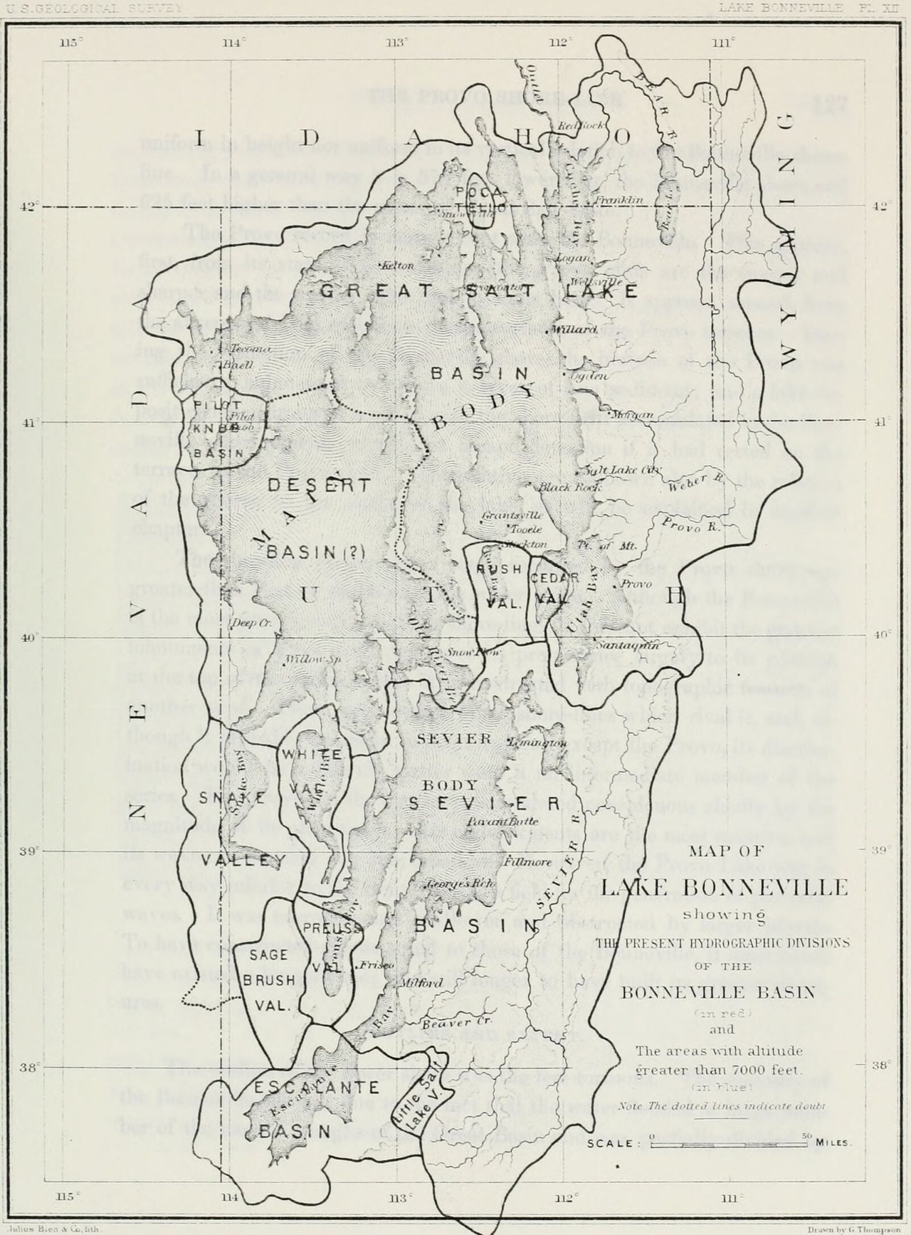
The heavy line on that map is the rim of a basin. The lighter lines inside it mark where the water drains now. The largest of those is Great Salt Lake’s. The map was printed in 1890, in the first of the Geological Survey’s monographs. Its author had first written on the shore-lines in 1874, for Wheeler’s survey west of the hundredth meridian. The book is about a lake that no one has seen.
Grove Karl Gilbert names it early. Padre Escalante had crossed the country in 1776. Indian traders came after him, men “who learned of the existence of undrained lakes and passed the account from mouth to mouth, but made no maps.” Captain Bonneville was an army officer on leave, “traveling in the interest of the fur trade but with the spirit of exploration.” He took notes in 1833. Washington Irving put them into print some years later, “and his map is probably the first which represents interior drainage.” Frémont followed, with “the first clear conception of the hydrography of the region.” Gilbert gave the captain the lake.
Frémont found a line of driftwood a few feet above the water of Great Salt Lake and “appears to have overlooked the ancient shore-lines terracing the mountains round about.” Stansbury saw them. He surveyed the lake in 1849 and the year after. On the plain where Lakeside station of the Central Pacific later stood he counted, on one ridge, “thirteen distinct successive benches, or water-marks.” The highest was about two hundred feet above the valley. There “must have been here at some former period a vast inland sea, extending for hundreds of miles.”
The highest bench runs around the whole basin. Gilbert leveled it. It is the Bonneville shore-line, and it stands about 1,000 feet above Great Salt Lake. At that stage the lake reached from Cache Bay to the south end of Escalante Bay. Its coast, not counting islands, ran 2,550 miles. The deepest water stood over the western part of what is now Great Salt Lake. “It is probable that the extent and form of no modern lake in an unsettled country is more accurately known.”
One shore-line, and it does not sit at one height. Table XIII lists it at thirty places, measured above the zero of the Lake Shore gauge. Santaquin, south of Utah Lake, is on it. So is Meadow Creek Canyon, in the Escalante Desert. “It appears by inspection that the range of altitude is about 350 feet.” Tecoma, Nevada, is number 10 on the list. Its figure is 981 feet. The water had been level when it cut the line. The old water line, he writes, “is no longer of uniform height,” and its variations “afford a means of measuring the recent differential movements of the earth’s crust within the basin.”
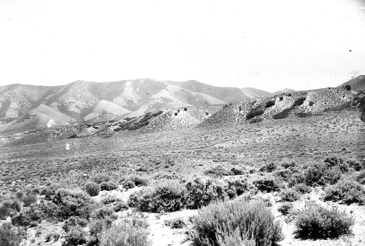
In the northwest corner of the basin the lake had an island. “The Ombe range, including Pilot Peak, was an island, sheltering behind it a bay or sound from which a narrow arm ran northward to Thousand Spring Valley, the extreme limit of the water in a northwest direction.” When the water fell to the next shore-line down, the island became a peninsula. Near Pilot Peak, between the two great terraces, “thirty-three separate terraces were counted, the average interspace being less than ten feet.” Plate XII letters the mountain PILOT KNOB. Southeast of it is a small closed valley. Stansbury found its floor covered with one or two inches of salt. When the lake dried it left that valley as a basin of its own, and Gilbert lists it, the Pilot Peak basin, in the same list as the basin of Great Salt Lake.
“Thirteen years ago I had the temerity to predict,” Gilbert writes, that the Bonneville shore-line had been set by overflow, and the Provo shore-line below it the same. The second prediction “proved to have full warrant.” A lake with no outlet rises and falls with the weather. A lake spilling over a sill holds its level and cuts a deep mark. The Provo shore-line is 375 feet below the Bonneville, and it is the strongest marked of them all. He went looking for a pass in the rim lower than the shore-lines around it. He examined the entire coast.
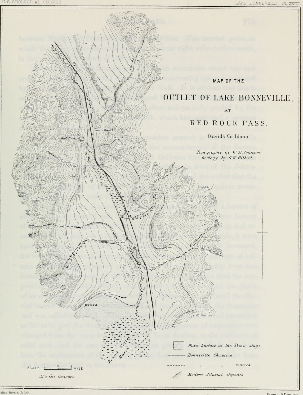
The pass is at the north end of Cache Valley, in Idaho. The Utah and Northern Railroad runs through it. “The ascent to Red Rock Pass from Cache Valley is so gentle as to be scarcely noticeable.” Bradley crossed the old channel some miles below the pass in 1872 and was the first to suggest it. Gilbert and Gilbert Thompson each went and confirmed it. The outflowing river went down Marsh Creek, took in the Portneuf, and reached the Snake.
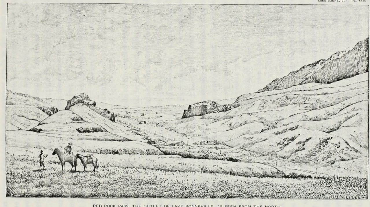
The sill was not rock. Marsh Creek had built an alluvial fan across the pass before the lake came, and the fan’s edge “was part of the ancient water-parting, and was the point at which the outflow was initiated.” Then he says what alluvium does. “Uncemented alluvium is easily and rapidly torn up and removed, and as soon as a current began to flow across the divide, it must have commenced the excavation of a channel. As the channel increased, the volume of the escaping water became greater, and this increase of volume reacted on the power of erosion. In a short time a mighty river was formed, and the lowering of the lake surface resulted. For a time the outpouring was a veritable débâcle.” The river cut down until it hit the limestone under the fan. There it stopped. The lake fell 375 feet and stood on the ledge. The Survey’s abstract has it in a sentence: “a prism of water about 375 feet deep went out by a debacle, lowering the lake to the level of the limestone ledge. This level coincides with the Provo shore-line.”
The Bear River had belonged to the Snake. Behnke, writing for the Bureau of Land Management in 1979, has it originally tributary to the upper Snake. Volcanic activity turned it south into the Bonneville basin. The added water raised Lake Bonneville “until it spilled over to connect to the Snake River at Red Rock Pass.” The trout native to the Bonneville basin “are not well differentiated from the Yellowstone trout native to the Snake River.” The chubs and suckers and whitefish of the basin are far older in it. The cutthroat came in with the river. Benson and nine others read the earth’s magnetic record in a lake-bottom core and set the clock by it. The lake reached its highstand and began to spill about 18,500 years ago. It overflowed at the Provo level, on and off, until 15,200.
The Lahontan basin lies west of this one. Hubbs and Miller, in 1948, citing Russell, wrote that the two “adjoin only to the northward, along a short common divide near the Utah-Nevada line. Here there is an abrupt faunal break.” Everywhere else, they wrote, the two systems are separated by a string of smaller mountain-rimmed basins “which show little physiographic evidence of Pluvial overflow connections with one another or with the watersheds of any of the three surrounding major systems.”
Pilot Peak stands on the Utah-Nevada line. Tecoma is a station on the Central Pacific. Plate XII draws it a few miles north of the Pilot Knob basin, on the Nevada side of the line. In the summer of 1977 a man named Hickman was collecting in the Bonneville basin for the Bureau of Land Management’s study of its native trout. He took an unusual trout from a small stream on the peak. Behnke identified it as a Lahontan cutthroat, “which undoubtedly was introduced since Pilot Peak is part of the Bonneville basin,” and found that it had been in the stream since before 1950. Later a paper read the fish’s DNA against museum specimens. It names the water: “the fishless Morrison Creek drainage in the Pilot Peak Mountains in the Bonneville hydrographic basin of Utah on the border with Nevada, where they have persisted to this day.”
The Bonneville shore-line at Tecoma is 981 feet above Great Salt Lake, number 10 in Table XIII. On Plate XII the mountain south of the station is lettered Pilot Knob, and the valley behind it is a basin of its own.