
The Great Basin
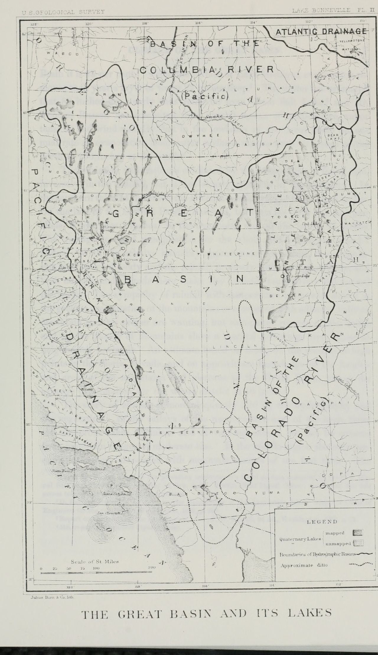
Every region on that map but one is named for where its water goes. Inside the heavy line the water goes nowhere. It comes off the mountains, crosses a valley floor, and stops in a lake or a sink. G. K. Gilbert of the Geological Survey drew the line in 1890. The name inside it is older, and the man who gave it was standing outside the line when he did.
On October 13, 1843, John Charles Frémont, brevet captain in the Corps of Topographical Engineers, was camped on the Snake River above the mouth of the Malheur, at latitude 44° 17′ 36″, longitude 116° 56′ 45″, 1,880 feet above the sea. He was about to leave the Columbia’s drainage. In that day’s entry he looked south, at country he had not been in, and named it: the Great Basin, “a term which I apply to” the region between the Rocky Mountains and the next range west, full of lakes with their own rivers and creeks “which have no connexion with the ocean.” He had it named before he had been in it, and said so in the next sentence. “This Great Basin is yet to be adequately explored.”
His way home ran across it. The route, he wrote on page 196 of his Report, was to go southeast to “a reported lake called Mary’s,” and on to the Buenaventura, “which has had a place in so many maps,” running on them from the Rocky Mountains to the bay of San Francisco. The river does not exist. I would have gone looking for it too.
By the middle of January the party was camped at the mouth of an inlet, latitude 39° 51′ 13″, on the lake we call Pyramid, and the camp was eating salmon trout boiled, fried, and roasted in the ashes; “every few minutes an Indian would be seen running off to spear a fresh one.” On January 16 they went up the river that fed the lake, past dams the Indians had built to catch fish, along “this beautiful stream, which we naturally called the Salmon Trout river.” It is the Truckee.
On the 17th they left it. Every stream now, Frémont wrote, he expected to be the Buenaventura. Christopher Carson, his buffalo hunter of 1842, hired again, rode to every stream they reached and looked for beaver cuttings, holding that beaver cut only on water that ran to the Pacific, “and the absence of such signs was to him a sure indication that the water had no outlet from the great basin.” The guide of the expedition was Thomas Fitzpatrick.
On January 29 the party came down a hollow under the mountains and met eight or ten Indians. When the party got near enough they “stretched out to us handfulls of pine nuts, which seemed an exercise of hospitality,” and went off to tell their village. That afternoon more of them stood on the hillside above the camp and looked it over. They were induced to come in. There was a council in the evening. Frémont wrote down what he was told.
The Indians immediately made it clear that the waters on which we were also belong to the Great Basin, in the edge of which we had been since the 17th of December.
Forty-three days, counted from the 17th of December. On the next page: “The Indians informed us that at certain seasons they have fish in their waters, which we supposed to be salmon trout.”
Charles Preuss drew the map that went out with the Report. He was Frémont’s assistant in the topographical part of the work. E. Weber & Co. of Baltimore lithographed it. The interior is empty. Across the emptiness runs a paragraph of lettering headed THE GREAT BASIN, giving its diameter in degrees of latitude and longitude, its elevation between 4 and 5,000 feet, and then this: “surrounded by lofty mountains: contents almost unknown, but believed to be filled with rivers and lakes which have no communication with the sea, deserts and oases which have never been explored…” Inside the blank, in capitals, PAH-UTAH INDIANS. At its edge, SNAKE INDIANS. Pyramid Lake is drawn. Mary’s Lake is not. Under it, in italic: “See Fremont’s Report, pages 275, 6.”
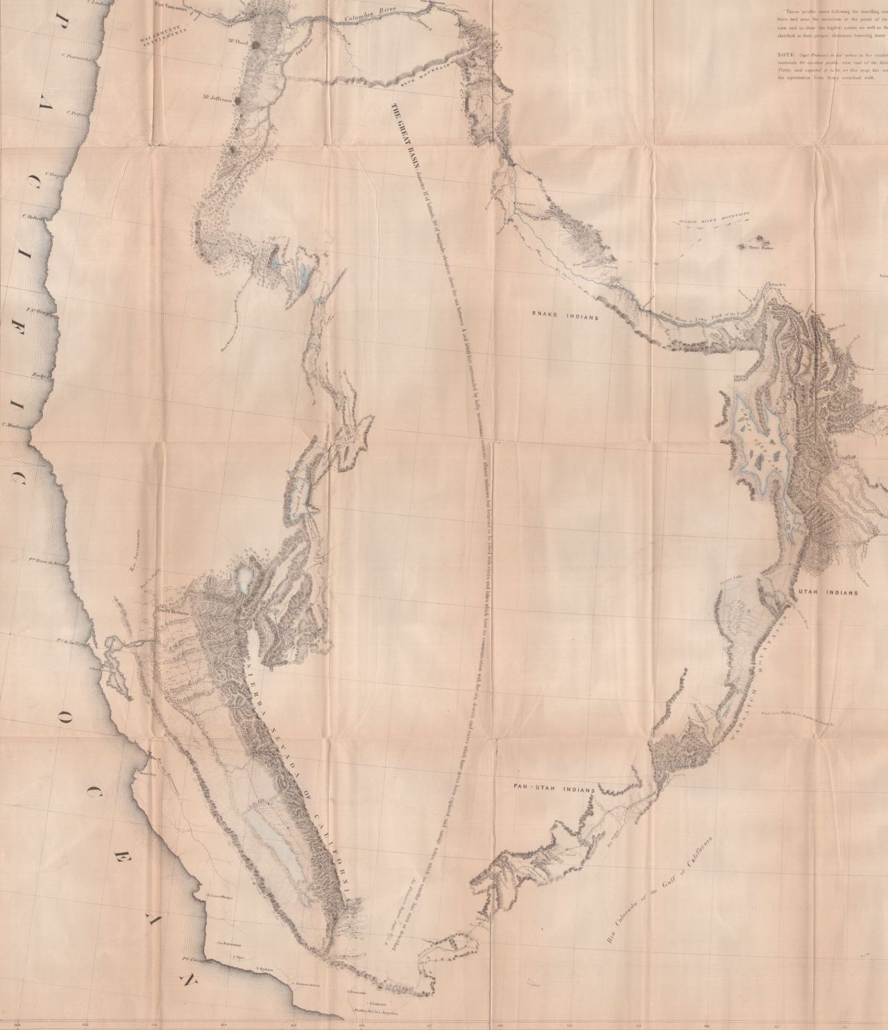
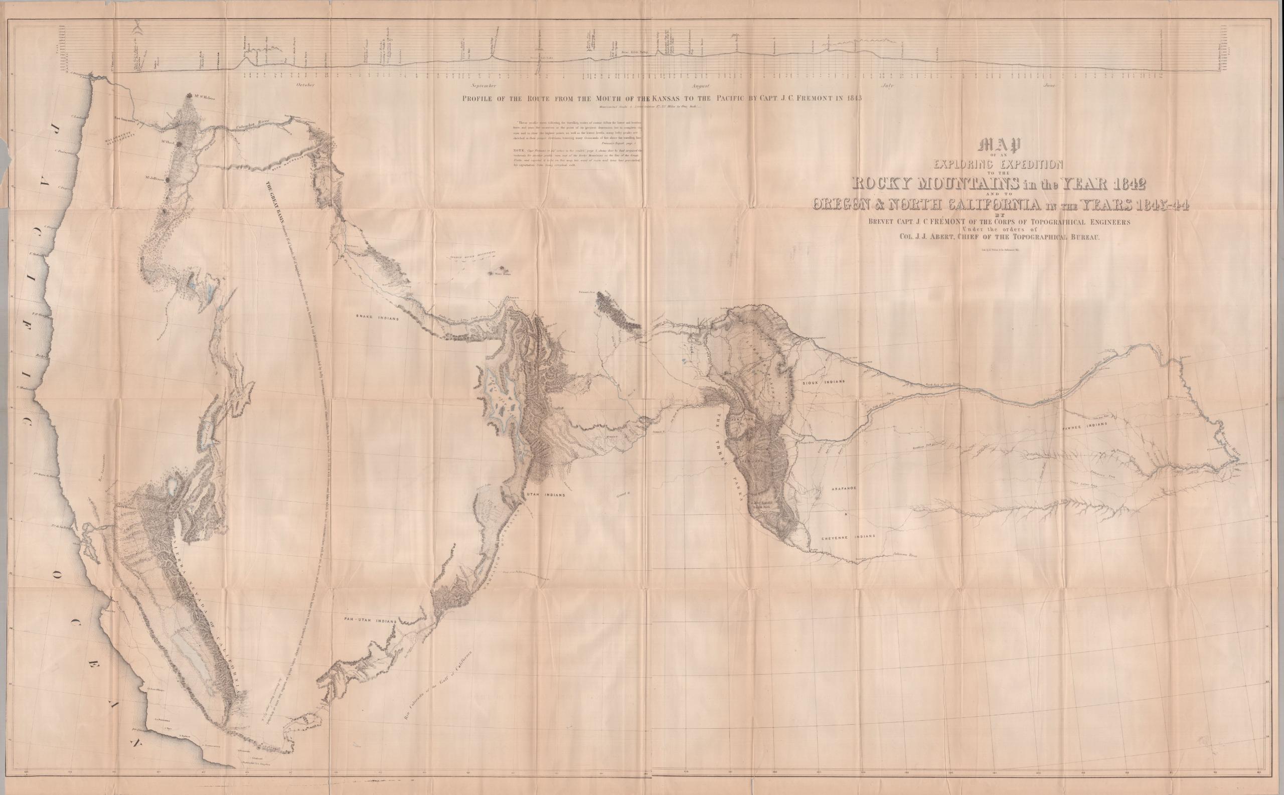
They went over the Sierra in February. On the 16th the camp was on the headwater of a little creek, and the water in it ran to the Pacific. On the 20th they stood on the summit of the pass, a thousand miles by their own road from the Dalles of the Columbia. They boiled water for the altitude. The thermometer put them 9,338 feet above the sea, on a range higher than the Rocky Mountains themselves, this near the coast. “This extraordinary fact accounts for the Great Basin,” he wrote: a flat country of small lakes and rivers, walled off from the ocean by the Sierra.
He went down into California. In April he came back over the mountains. He had entered the pass, he wrote on page 254, meaning to strike straight across toward the Great Salt Lake, “in the view of obtaining some acquaintance with the interior of the Great Basin.” He took advice and went around. The blank stayed blank.
By page 276 he could walk the rim. The Wah-satch and Bear River mountains on the east. The Sierra Nevada on the west, “where we travelled for forty-two days.” A rim on the north and a rim on the south. “We entered the Basin at that point, and have travelled in it ever since.” Its existence was “an established fact in my mind.” It could not be less than four or five hundred miles each way. And, on the water: “where there is no outlet, there must be lakes to hold the accumulated waters, or sands to swallow them up.”
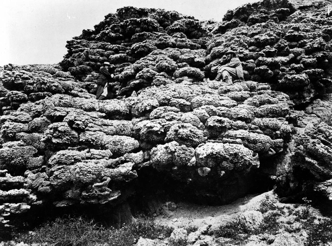
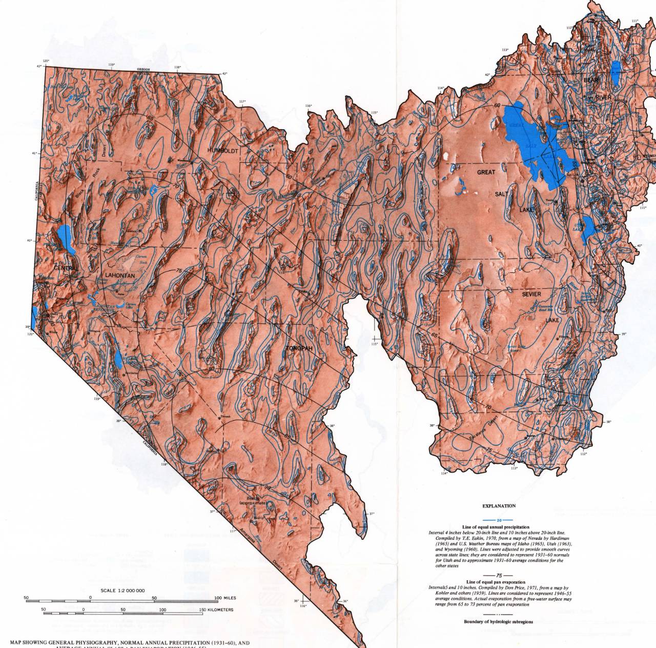
The Survey drew the line again in 1974 and lettered the compartments inside it: BEAR RIVER, GREAT SALT LAKE, SEVIER LAKE, HUMBOLDT, TONOPAH, CENTRAL LAHONTAN. Pyramid Lake is named on it. So is the Carson Sink. The atlas says: “Streams in the region end in lakes or sinks, or are absorbed.”
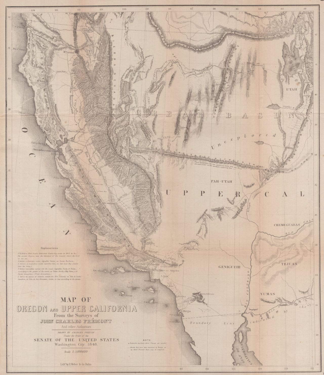
Preuss drew the country again in 1848, for the Senate, with the middle filled in. One word still stands on it. Unexplored.
The water that goes over Llewellyn Falls is Silver King Creek. Silver King Creek runs to the East Fork of the Carson, the East Fork to the Carson, and the Carson to the Carson Sink. There it stops.