How to read a medieval map - and exhibitions in Paris this summer
Thanks for reading my free newsletter! If you’d like to support my work, sharing this newsletter, or buying or gifting HUMANS: A MONSTROUS HISTORY, would be wonderful, as would borrowing one of my books from your library or recommending they buy them; reviewing HUMANS on, say, Amazon, Goodreads, or Storygraph; adding it to your wish list or TBR list; or telling friends, family, colleagues, or students about it.
Hallo friends, and welcome, new readers!
In today’s newsletter:
Despatches from the “Cartes imaginaires” exhibition in Paris
More shows I loved in Paris
HUMANS news and writings
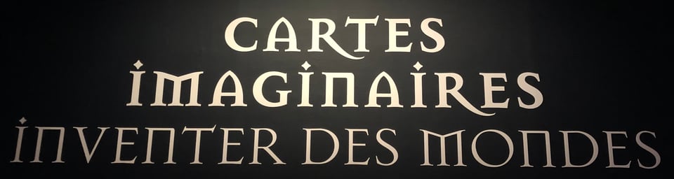
Despatches from the “Cartes imaginaries” exhibition
The late medieval Christian friar, chronicler-historian and sometime inquisitor Paolino Veneto (1272-1344) had this to say about the challenge of understanding past events without a world map, or what he called a “mapa mundi”:
‘it is not just difficult but impossible to make [oneself] an image of, or even for the mind to grasp, what is said of the children and grandchildren of Noah and of the Four Kingdoms and other nations and regions, both in divine and human writings.’1
I imagine Paolino sitting in a monastic library, pondering the story of Noah, his ark and his sons Shem, Cham, and Japeth to whom, in the Book of Genesis, Noah gave the three parts of the world: Asia, Africa, and Europe. Or perhaps Paulino was picking his way through histories of the ancient Babylonian, Median, Persian, and Seleucid Greek empires wondering, ‘so where did this happen?’, and went in search of a map of the world.
But what sort of world map?
In Paolino’s thinking, an effective history of the world was composed of both painting (visual images) and writing:
‘Nor will you deem one sufficient without the other, because painting without writing does not indicate regions or nations clearly, [and] writing without the support of painting truly does not mark the boundaries of the provinces of a region sufficiently clearly for them to be seen almost at a glance.”
For Paulino, maps were vital tools for understanding the relationship between stuff that happened and where it happened — between geography and history. Words and pictures braided together in a geographical diagram gave illustrated maps a particular explanatory power.
The fabulous but dodgily titled (more on that later) “Cartes imaginaires: inventer des mondes” or “Imaginary maps: inventing worlds” exhibition at the Bibliothèque Nationale de France (Mitterrand site) until July 19 has on show treasures of European cartography before 1700, a smaller selection of stunning maps made elsewhere, and “real” maps, map-inflected artworks, and maps from works of literature since 1700.
Here’s a map that monks like Paolino Veneto, princes, and scholars might have consulted in a medieval library:

This map (high-res here) reminded viewers that life on earth varied with climate and therefore with latitude. The central layer of this (to my food-obsessed brain) world hamburger was probably intolerably hot, with polar extremes too chilly for life, but each hemisphere had a temperate zone.
For ancient Mediterranean thinkers and their intellectual heirs, “civilized” peoples couldn’t live in places of extreme heat or cold: regions at climatic extremes supposedly engendered monstrous peoples. Versions of this theory would prop up European racism and colonialism for centuries.
Also in this exhibition is an early fourteenth-centry world map (high-res version) in a copy of the Compendium or Chronologia magna by Paolino Veneto (he of the “can’t think about history without a map” opinion):

The map is oriented with east (and thus the Earthly Paradise) at the top. At the bottom, you may be able to pick out islands titled Corsica and Sardinia (on the version online), and on the western mainland the Spanish place-name Galicia. At the bottom-left (or northwest) were the frigidly cold British Isles. As far as the cartographer Pietro Vesconte was concerned, who knew who — or what — dwelled in those climes.
(Sidebar: Medieval English cartographers were obsessed with mapping monsters, perhaps because they were acutely aware that the lived at the edge of what ancient thinkers considered to be lands with climates that didn’t suck. For the best nerdery on monsters on medieval English maps, check out my friend Asa Simon Mittman’s writing. His first book, Maps and Monsters in Medieval England, is coming out in a revised second edition in a few months.)
Moving from the ink-blottish diagrammatic style of world map to a more representational, encyclopedic style, a favourite Parisian treasure of mine is the Catalan Atlas made c. 1375 by Abraham and Jefuda Cresques, two Jewish cartographers in Majorca (now a Spanish Mediterranean island). Here’s a part of it, on a 50cm by 65cm double panel:

The atlas may have a gift from the crown prince of Aragon (later Juan I) to the newly crowned French king Charles VI, and first appeared in an inventory of the Louvre (which was a royal palace long before it became the museum) around 1378 or 1380.2
The atlas maps on vellum have been pasted onto six foldable wooden boards. Two double panels comprise astronomical and geographical information; the remaining four double panels cover the known parts of the world (large, partially-known-in-outline swathes of Asia, Africa, and Europe). The double panel in the exhibition covers East Asia from what is now the Pacific Ocean to India.
This displayed map is halfway between a mappamundi (a map of the world centered on Jerusalem and usually with Paradise depicted at the top/east) and what are known as marine or portolan charts: regional maps that conveyed topographical information about ports, cities, and geographical features at the coastlines of a much smaller area.
The geographical framing of the Catalan Atlas functions as a substrate and an encyclopedic container for information about peoples and places, even though the busy detail at the coastline is a feature it shares with portolan charts.
Illustrations, diagrams, and other non-topographical features on maps from the European Middle Ages and the Renaissance weren’t mere “decoration”, as old-fashioned map historians insist; they were part of what maps were for.
Understanding that way-finding and wallpaper weren’t the only reasons for having a map lies at the heart of understanding maps before the modern era; prestige-pricing and propaganda weren’t the only reasons mapmakers and their patrons included images on maps.
In that fifteenth-century squishy zone between the Middle Ages and the Renaissance in my brain sits Christopher Columbus. The exhibition includes a world map (high-res, unobstructed view here), that, in 1925, was attributed to Columbus, a possible attribution that’s cautiously reproduced on the map’s label (“carte dite de Christophe Colomb”)3:

Striking here is how the mapmaker (whoever they were) juxtaposed two maps made according to different mapping paradigms. One, the rectangular, main body of the map, is in the style of a portolan chart, with place names bristling along the coastlines:

This is a more mundane version of the bells-and-whistles, technicolor style of the Catalan Atlas introduced earlier in this essay.
To the left is a map of the cosmos: concentric celestial spheres centered on a world map:

The geographical information was the best available in Europe in the late fifteenth century. Africa’s coastlin includes the Cape of Good Hope at its southern tip, so we can date the map to after the Portuguese expedition on which Bartolomé Diaz navigated around the Cape in 1488. And since there are no lands depicted in the west Atlantic, the map pre-dates the circulation in Europe of knowledge about Columbus’s landfall in late 1492 (after which his letters began tumbling off printing presses around Europe from 1493).
Putting these two maps on one sheet — the regional, coastline-focused map covering the maximum extent of travel of late medieval European ships from Iceland to the Congo River in central Africa in the west, and to the Black Sea in its northeasternmost corner — with a hypothetical as in not-entirely-traversed map of the universe is an audacious piece of imaginative extrapolation.
A mariner used to northwestern Atlantic coastlines could use it envision longer, theoretically possible voyages. And on a round world, western sailing eventually led to lands in the east — an alternative route to the Spice Islands which, as a caption on the map explains, was a looonggg trip.
Subscribe for free to receive exclusive essays!I went around this show a couple of times with different friends. From Tolkien’s map of Middle Earth to a map of Guiana derived from Sir Walter Ralegh’s travel narrative about the region, it felt at times like the library had put this show on specially for me!
Raleigh and Guiana’s monsters are the subject of a chapter in Renaissance Ethnography and the Invention of the Human: New Worlds, Maps and Monsters and some later thoughts appear in a recent newsletter.
There were also plenty of sea monsters on show, a topic about which I seem to have a book’s worth of unpublished thoughts and scribblings (TLDR: I disagree with what lots of people have said about sea monsters!). For the moment, here’s a preview in an essay published in Aeon Magazine a few years ago, in which I show that black holes and sea monsters have something in common.
I have perhaps one beef with the show, and that’s the first half of its title, “Cartes imaginaires” or “imaginary maps.” To call them imaginary implies that their content isn’t real — and that’s not true. It’s too easy to look at something with an unfamiliar style or diagrammatic convention and say it’s just “decoration,” “myth,” or “fantasy.” Those words are value judgements.
Use “fantasy “ if you wish when you’re talking about a novel, or about Tolkien’s map of Middle Earth. But it’s sloppy to throw that word around geographical maps or around premodern illustrations of spectacularly strange marine life — as I discuss in my Aeon essay.
More shows I loved in Paris
I’ll write about a few things I saw in future newsletters, so requests are welcome!
The birds of paradise exhibition — birds and their encounters with people over millennia — at the Musée du Quai Branly. HUGE and incredible! On until November 8.
A cultural history of unicorns in the West, at the Musée de Cluny. Until July 12.
A major show of surrealist Leonora Carrington’s works: in my view she’s perhaps the best of the surrealists! Her paintings actually seem to mean things (ducks). This is on at the Musée du Luxembourg until July 19.
HUMANS news
I finally got my virtual hands on a copy of The Hedgehog 2025, the newsletter of the Linda Hall Library in which there’s an except from the “Animals” chapter of Humans: A Monstrous History. I love the flashy design and layout of the magazine and the excerpt! Essay begins on p. 28.
I signed copies of the paperback at Smith and Son, the English bookshop just north of the Tuileries gardens, a 15-minute walk from the Louvre (or 7 minutes from the Orangerie). If you’re book-buying in Paris, it’s a wonderful store!
ICYMI: I wrote about the Frankenstein spinoff movie, Bride! and wrote an essay using an early sixteenth-century world map to talk about Bad Bunny’s Superbowl halftime show. More essays, book excerpts, podcasts, and videos of events are available on my website.
The various quotes comprise this passage: Paolino Veneto, Vat. Lat. 1960, f.13 (Biblioteca Apostolica Vaticana): ‘que dicuntur de filiis ac filiis filiorum Noe et que IIIIor monarchis ceterisque regnis atque provincias tam in divinis quam in humanis scripturis, non tam difficile quam impossibile dixerim ymaginari aut mente posse concipere….Nec unum sin altero putes sufficere, quia pictura sine scriptura provincias seu regna confuse demonstrat, scriptura vero non tamen sufficienter sine adminiculo picture provinciarum confinia per varias partes celi sic determinat, ut quasi ad oculum conspici valeant’, transcribed and translated in Juergen Schulz, ‘Jacopo de’ Barbari's View of Venice: Map Making, City Views, and Moralized Geography before the Year 1500’, The Art Bulletin, 60 (1978), 425–74, at 452. I have made minor amendments to the translation. I also discuss this quotation in Renaissance Ethnography and the Invention of the Human: New Worlds, Maps and Monsters (Cambridge University Press, 2016), 1. ↩
Evelyn Edson, The World Map, 1300-1492: The Persistence of Tradition and Transformation (Baltimore, MD: Johns Hopkins University Press, 2007), 74.; and Catherine Hofmann, Hélene Richard and Emmanuel Vagnon, eds, L’Àge d’or des cartes marines: quand l’Europe découvrait le monde (Paris: Seuil/Bibliothèque nationale de France, 2012), 42. ↩
For a discussion of why Columbus or someone with similar interests and knowledge is likely to have made the map, see Edson, World Map, 211-214. ↩
Add a comment: