Have your say on SES29 and SES30 by 28 October
The Further Main Modifications consultation closes at 5pm on Wednesday 28 October.
If you have already written in, thank you. Please forward this to a neighbour who has not.
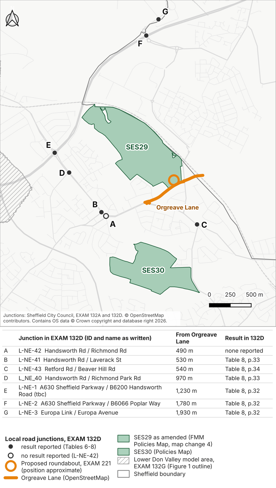
Below, we look at the proposed access to Handsworth Hall Farm (SES29) and the Council’s traffic testing, which did not include any junctions on Orgreave Lane.
We also explain how you can respond to the current consultation.
What the Council’s traffic testing leaves out
The latest documents for Handsworth Hall Farm (SES29) propose access via a new roundabout reached entirely from Orgreave Lane.
Yet the Council’s assessment of the Plan’s traffic effects does not test a single junction on Orgreave Lane to establish whether the local road network can cope with the traffic generated by the Plan.
The report identifies 56 junctions for detailed testing (EXAM 132D). Its traffic model is based on travel in 2016 - before many of the houses at Waverley were finished, and nine years before the new Lidl on Rotherham Road opened.
None of those 56 junctions is on Orgreave Lane. Neither its junction with Handsworth Road nor its junction with Rotherham Road is included.
The nearest tested junction to the proposed roundabout is Retford Road / Beaver Hill Road, about 700 metres away (junction C on the map below).
That junction shows what is at stake. For the evening peak in 2039, the report forecasts it operating at 95% of capacity without the Plan, and over 150% with it (Table 8, page 34).
The report proposes traffic lights to increase the junction’s capacity. With the Plan and the lights in place, it forecasts the junction operating at 97% of capacity - still close to its limit. It also says “there is insufficient space to construct a roundabout”, illustrating the limited space for improvements at this junction.
Our transport consultant, Aprica Ltd, warned in its April 2026 report that queues would back up between the proposed lights and the new Lidl lights. The two junctions are only about 200 metres apart, yet the Council’s own modelling forecasts a maximum evening queue of roughly 300 metres, which would block traffic exiting Rotherham Road. In other words, gridlock on Handsworth Road.
Handsworth Road / Richmond Road (junction A on the map), about 490 metres west of Orgreave Lane, is listed for testing and marked as modelled for 2039. But none of the results tables includes figures for it. We have not found a result for it in the Council’s other traffic reports either.
Remember: the sites were proposed for allocation in late April 2025, and Full Council agreed the updated proposals on 14 May. The Council’s updated transport report is dated 23 May - nine days after that vote. The Council should explain what transport evidence councillors had available to scrutinise before making that decision.
The proposed roundabout is described in EXAM 221, dated 11 August 2026, more than a year after the updated transport report. EXAM 221 says the design was “informed by detailed analysis including traffic surveys”, but we have not found those surveys in the published evidence.
That leaves a question for the Inspectors: what evidence shows that Orgreave Lane and the nearby junctions can cope with traffic from 870 homes and 20 hectares of employment land?
That traffic would come on top of the traffic generated by over 1,000 homes still to be built at Waverley, just across from SES29 in Rotherham, and the 827 homes proposed at Bramley Common, about 600 metres away.
The Plan is forecast to push the nearest tested junction over capacity. Even with the Council’s proposed traffic lights, that junction is forecast to operate at 97% of capacity, with a maximum evening queue that would block Rotherham Road. The junctions on Orgreave Lane were not tested, and we have not found a published result for Handsworth Road / Richmond Road.
If the Council has results for these junctions, it should publish them now, while the Inspectors can still consider them. If it does not, it is asking the Inspectors, and then councillors, to accept the Plan for Handsworth without those results, leaving the consequences for local traffic unclear.
Read more about Orgreave Lane and the Council’s traffic testing on our website.
If you use these roads, tell the Inspectors what you see, where and when. You can do this through the current consultation; details are below.
Have your say: choose a topic
Our guide to responding to the Further Main Modifications (FMM) consultation has a suggested comment for each topic, with the reference you need to quote.
- Traffic (SES29): what happens on Orgreave Lane and the roads around it. Reference: EXAM 221.
- Wildlife (SES29 and SES30): what you have seen in the fields, hedgerows, beck and brook. References: FMM5 and FMM16.
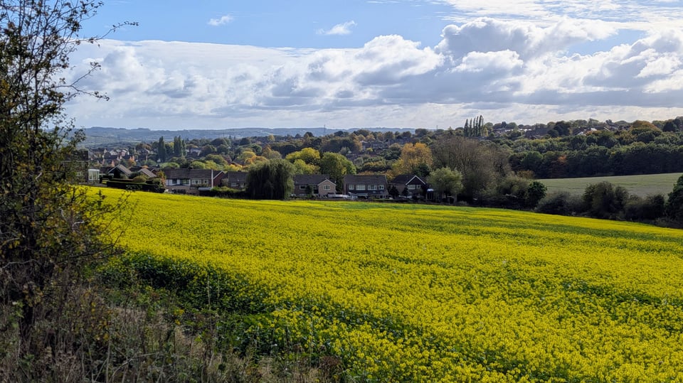
- Farmland (SES29 and SES30): what crops you have seen growing or being harvested. Reference: EXAM 219.
- The Quaker burial ground (SES30): what you know about the burial ground at Cinder Hill Green. Reference: EXAM 222.
If you are not sure where to start, start with traffic. The Inspectors asked for the new access evidence for SES29 to be open to public comment (EXAM 217C, paragraph 10).
How to respond
- Choose a topic you know and copy the suggested comment from the guide.
- Replace the words in square brackets with what you have seen, where and when. Three or four sentences of your own are enough.
- Email your comment to [email protected], with the reference number in the subject line and your full name at the end.
Send one email per topic. Your name will be published with your comment.
If you would like help, email us at [email protected].
We will send one last short reminder on Tuesday 27 October. After the deadline, we will report on what the campaign and the Sheffield Green Belt Alliance have submitted.
What you can do
Send your comment by 5pm on Wednesday 28 October.
If you have already responded, please forward this email to a neighbour who knows the land or uses these roads.
-The Save S13 Green Belt Campaign