Sarek Sarek Sarek
Hiking in Sarek National Park was sure an exciting adventure. Rivers! Willows! Knee pain! Wolverine!
I have survived my trip to Sarek National Park in Northern Sweden. Before the trip I wrote:
If I run into trouble in the middle of the park, it’s going to take 50 km out of there.
You will never guess where I was when my knee started hurting so much that I almost cried! Read on to find out.
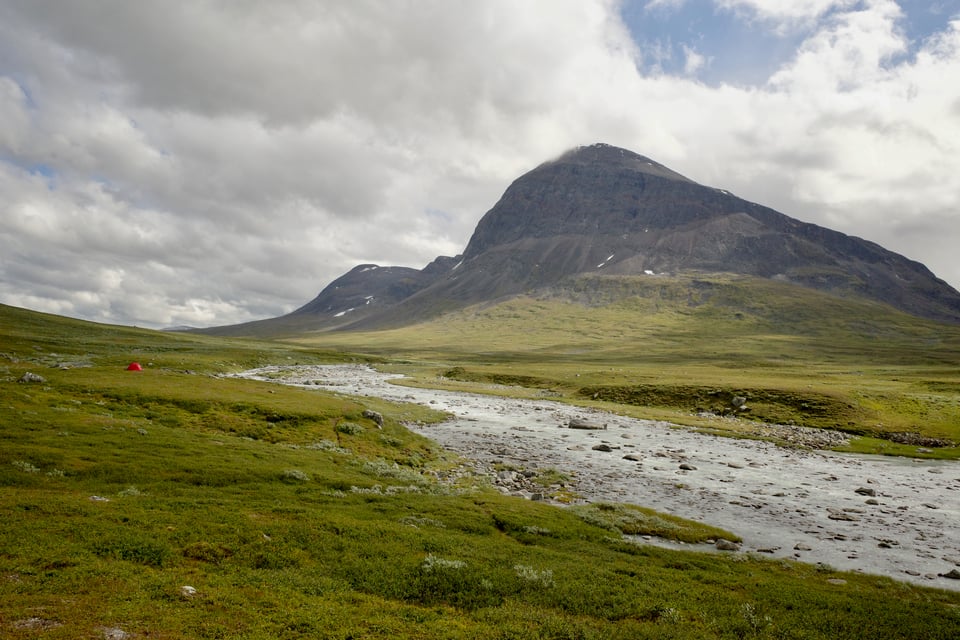
So how did it go?
If you want to see my route on a map, check this out. The red path is what I planned and the purple path is what I actually hiked.
Sarek is surrounded by other national parks, so getting there is slightly involved.1
I took the Road to Ritsem bus from Gällivare to Ritsem. Then you have to cross Akkajaure, the reservoir lake south of Ritsem. You could take a boat, but I took the Fiskflyg helicopter to Akkastugor. The price difference was small: about 45€ for the helicopter, 35€ for the boat. It was efficient - the ten-kilometer flight took less than 15 minutes.
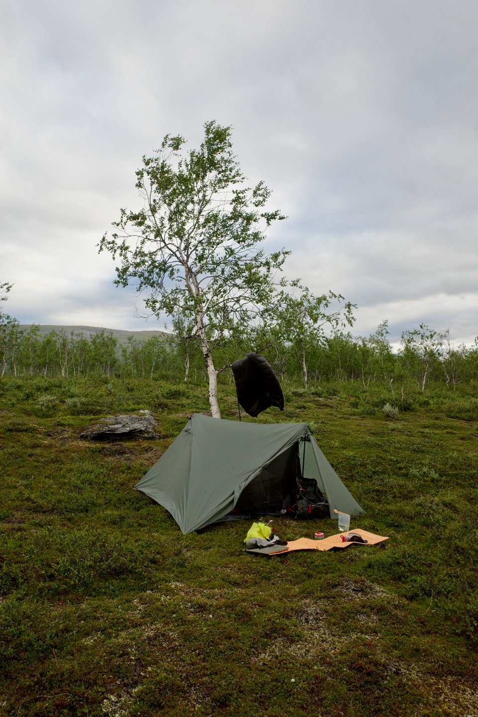
On the first night, I just walked a few kilometers on the easy-to-walk Padjelantaleden and set up my tent.
The next morning, I entered Sarek for real.
There was a nice-looking trail going the right way so I started to follow it. After 50 meters, the trail led me to a pretty wet mire. This would be a recurring experience.
I was wondering about why the mire was not marked in the map. Turns out wetland is everywhere in Sarek and none of it is marked on the maps.
The first day made it clear to me already that this is going to be more difficult than I expected. The guide book Fjällvandra i Sarek described the route as “medium difficulty” but it was hard work to navigate the mires, the hills, and the vegetation.
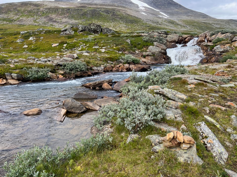
The rivers, fed by melting glaciers, are a defining feature of Sarek’s landscape. The big question is whether you can cross them. There’s one bridge in the park, but otherwise you will have to wade them.
Wading is… exciting. It’s not a skill that I would have practiced. The water from the glaciers is cold. If the current is strong, it does not take much water to sweep your feet under you.
My first big river crossing was Suottasjjåhkå.
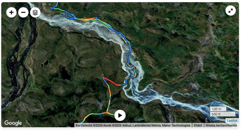
At the delta where the river joins Nijákjågåsj, there’s a small archipelago of islets and sand banks. By hopping around them, I managed to find a route where there was water only up to my knee, and I was able to cross over.
Later on the trip I encountered an experienced Sarek hiker. We exchanged intel on the river crossings (it’s the default topic) and he told me that Suottasjåhkkå is such a difficult one that he always avoids it. I guess I got lucky.
Next there was the Ruohtesvágge valley. It’s a long, flat beautiful valley with a stream at the bottom. Easy and fun to walk. The water level was so low that the streams were trivial to wade.
Eventually I got to Skárjá. It’s a cliff at the crossroads of Ruohtesvágge, Guohpervágge, and Rapadalen valleys.
While taking a break there, I saw more people than anywhere else in the park. People were going to all directions.
There’s a tiny hut there. You could take a break inside in bad weather, and there’s an emergency phone. The aforementioned bridge is there, too, although only in the summer. They lift it away for the winter with a helicopter.
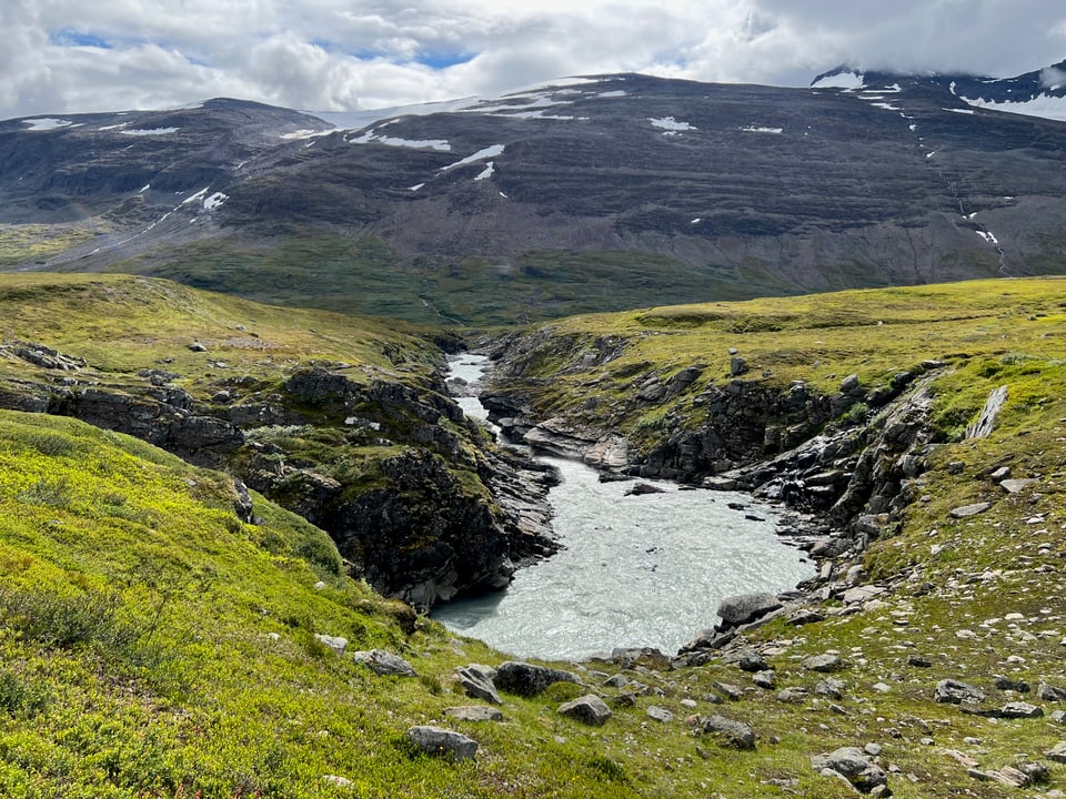
After spending a night near Bielajåhkå, I headed towards Rapadalen. I had heard many stories about the area - how beautiful it is and how challenging it is to traverse - and I was excited to finally see it in person.
I took the trail that goes around the north side of Låddebákte. The trail was tough, crawling up the side of Bielatjåhkkå. It was the steepest and most physically demanding section of my hike.
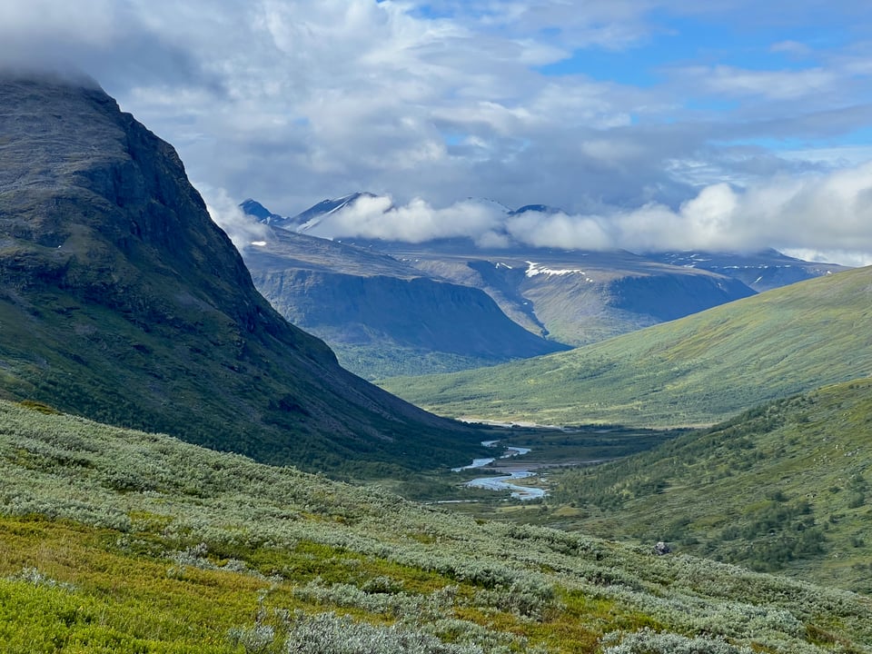
My plan was to descend into Rapadalen near Skårkistugan and then head west to Tielmavadet. Tielmavadet is the usual point for wading Ráhpaädno, the Rapadalen river. The river is strong and there aren’t many places where it could be crossed.
While I descended into Rapadalen, my knee started to feel funny. No matter, battling through the birches and the willows and the stone blocks, I did get to Tielmavadet.
On the first try, I couldn’t even cross to the island in the middle of the two main streams. The water came over my knee and the current was strong enough that I felt like I’m going to lose control. I got scared and backed out.
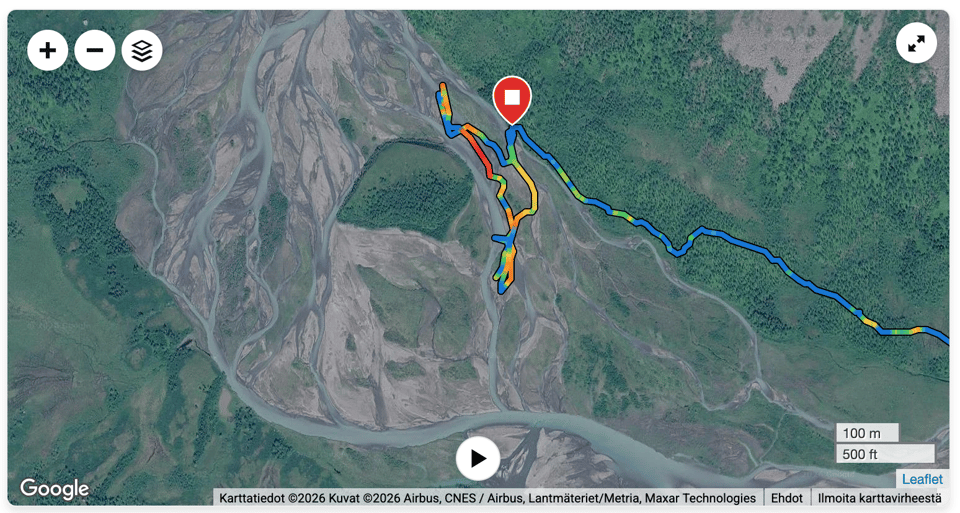
Had I had a second go, I think I would have had made it to the island in the middle. Would have I been able to cross the rest? Who knows. The flow was low so probably yes. Maybe, in the worst case, I could have hazarded a swim.
However, I didn’t have a second go. While I was scouting the river on the shore, my knee started hurting so much that I could barely walk. It was clear that even if I was able to cross the river, I should think about my plan carefully.
I rested for a while and then limped to the first suitable spot I could find for my tent. The tent being X-Mid 2, it was not easy to find a large enough spot.
There are no great camping spots on near Tielmavadet the north side of Rapadalen but I found a passable spot and set up a camp.
I considered my options:
I could continue with my original plan and cross Tielmavadet. However, that would mean taking on Rapadalen’s south side and its thickset vegetation, or opting for the steep high route over Pårte.
I could stay on the north side of Rapadalen. If I managed to cross a few rivers described as difficult to wade by the guidebook, I could make it to Aktse. From Aktse, you could get a private helicopter ride (€€€) or walk Kungsleden to Kvikkjokk.
I could turn back and reach one of the northern exit points with bus connections: Ritsem, Suorva, Saltoluokta.
The route to Saltoluokta looked to be the one with the easiest terrain. As a bonus, there’s the Saltoluokta Mountain Station whose dinner has a good reputation. That’s where I decided to go.
The next morning my knee felt much better. The first six kilometers were the toughest: I had to climb out of Rapadalen. More of the mires, more of the willows, the blocks, and the birches, and finally a steep slope.
Once I was back to my previous camping spot near Bielajåhkå, I knew that I would get out by myself. Only 45 km to go!
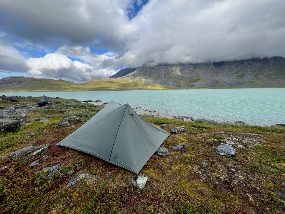
The rest of the route was easy. I camped next to Bierikjávrre. It’s a beautful mountain lake with rocky shores.
The night was so windy that I was scared that the wind would shred my tent. It wasn’t a storm or anything, but it was my first night with this tent in strong winds and the noise it made was terrible.
In the evening, there was a gust so strong that one of the hiking poles I was using as tent poles slipped 5 cm. Luckily that was the only problem I had the whole night.
After the lake, I was soon out of Sarek and in Nienndo in Stora Sjöfallet National Parko. It’s a long valley full of large stone blocks and willows.
It’s beautiful but in a monotonic way. You can see the ten-kilometer stretch and it’s all the same. I got so bored with it that I listened to podcasts while walking.
Pro tip for Nienndo: if you walk higher on the slopes, there are trails that let you avoid fighting the willows.
After a night in the valley, it was only a short way to Saltoluokta. After a week without even meeting anyone every day, it was an overwhelming experience to enter a mountain station full of Kungsleden throughikers. Sauna felt really good and the dinner with moose stew and mashed potatoes was delicious. Would recommend.
What if you weren’t able to walk out by yourself?
I would have had to call for help. I had a Garmin InReach satellite communicator with me. Eventually I would’ve pressed the SOS button and initiated the communication with the rescue authorities.
What is Sarek like?
Sarek is wet. I did not realize it beforehand, but it’s basically one big mire. The snow and glaciers up the mountains keep melting and that water has go somewhere. A lot of it goes to the rivers, but there’s also plenty to keep the ground wet.
By the way: I visited Sarek at a time when it’s relatively dry and the flow of the rivers was low!
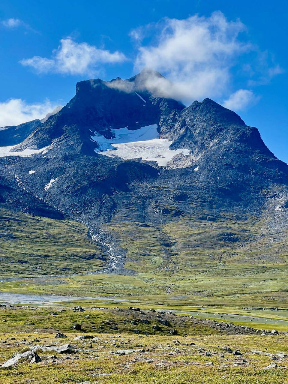
It’s also full of jagged mountains and the scale is difficult to understand. Everything is so big. I’m not used to mountains, so it feels weird when you walk and walk and the mountains just stay there while you pass rivers and lakes and other small landmarks.
Sarek is also big in the vertical sense. The mountaintops scrape the clouds. It was funny to stand on a slope and see a helicopter fly past below me.
The mountains have fun effects on the weather. Often when it’s raining, you can see that the sun is shining in the next valley over. It makes the rain less miserable when you know that sun is just around the corner.
What about willows?
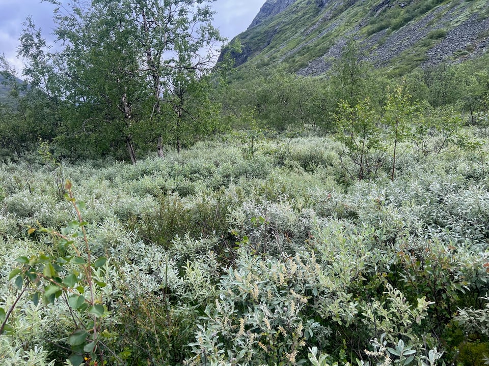
An important feature of Sarek are the willows that grow on wetland. Sometimes, they're just knee-height, but often they go up to the waist. Sometimes they are even taller.
The wetland was wet indeed: five-ten centimeters of water on top of mud. You have to take big steps to get over the willows and it's hard to see what you're stepping on, solid ground or mud.
You’ll quickly learn that willows are not fun and then you’ll try to find a route that avoids them. It does not always succeed. Once I ended up in a willow bush taller than myself and I didn't want to turn back. The only way forward was by charging ahead. Poor willows, poor me.
What about the wildlife?
Golden plovers were everywhere. They are one of my favorite birds because they don’t hide. In contrary, they like standing tall among the shrubs: heather, blueberry, etc. Sometimes they stand on a stone. They’ll beep and run a short distance and beep again. If you get too close, they’ll fly away and beep more.
I startled a bunch of willow ptarmigans. Where, you ask? Among the willows of course.
A reindeer herd came to check me out. Maybe they thought I’d have something for them. I didn’t, and they ran away again.
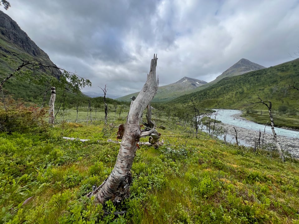
One morning I saw a dark brown mammal loping on the sandbanks of Rapadalen’s rivers. At the time I thought that it’s a beaver or badger or something, but turns out there are no beavers or badgers in Sarek (and badgers aren’t brown anyway). It must’ve been a wolverine! Wow, what a rare sighting.
I didn’t see any of Rapadalen’s moose, but I saw tufts of their hair stuck on branches and spots where they had rested.
Basic tips
The rivers are the crux. Can you cross them? Who knows. Check the flow information beforehand. You need to have a backup plan.
The guide book Fjällvandra i Sarek is valuable source of information, both the description of the routes and the well-known wading locations. Use Google Translate if you don’t know Swedish.
There’s no mobile network coverage. Have a Garmin InReach device or similar.
The ground is wet and there are the crossings. Your shoes will get wet and, most likely, your feet will get wet. How are you going to deal with it?
Gear talk
According to the scale, my backpack weighed 15.2 kg at the start of the trip. About half of it was food and water. Unfortunately I don’t have an itemized gear list to share this time.
My biggest gear mistake was taking only two pairs of undersocks, one for hiking and one for sleeping. The hiking pair got really wet and when I tried to put the socks on, the heel on one of them was torn in two. I wore the sleeping socks for the rest of the trip.
I got a bunch of new gear. Here are mini reviews:
Durston Gear X-Mid 2: an hiking pole tent. It’s marketed as a two-person tent but in practice it’s good for one large person. It offers a lot of space for the weight. The details like the magnetic door toggles are thoughtful. The price is good. No wonder it’s already a classic. The only flaw is that you need a lot of space, ideally flat, to pitch it.
Altra Timp 6: trail running shoes. They were comfortable on my feet and the sole had good traction on the wet rocks of Sarek. I used them with Sealskinz waterproof socks and that was an excellent combination to keep my feet relatively dry.2
Xtelink X4 e-book reader (with CrossPoint firmware). It’s tiny, but I figured out it’d be good for hiking. Only 76 grams - a paper book can easily weigh hundreds of grams. Turns out I like it so much that it has replaced my Kobo as the everyday e-reader. Maybe I should have gone for the even-smaller X3! There are two flaws, though. First: it does not support DRM so acquiring books can be a bit of hassle. Second: in direct sun light, the screen can become dim.
In conclusion
Will I go to Sarek again? Absolutely. Next time I want to summit something, too.
The problem with the places in the middle of nowhere is that it is difficult to get to the middle of nowhere. ↩
The problem with the Sealskinz socks, and with Gore-Tex shoes and rubber boots, is that while they’re good at keeping water out, they’re also good at keeping the sweat in. There’s no way around it, you’ll feet will get wet. ↩