|
Iran is often discussed as a potential target for regime change, but rarely as a country that would be exceptionally difficult to occupy. Geography explains why. The Iranian Plateau is enclosed by mountains and deserts that impose severe constraints on mechanised movement and sustained logistics. Air power can strike Iran. It cannot hold it.
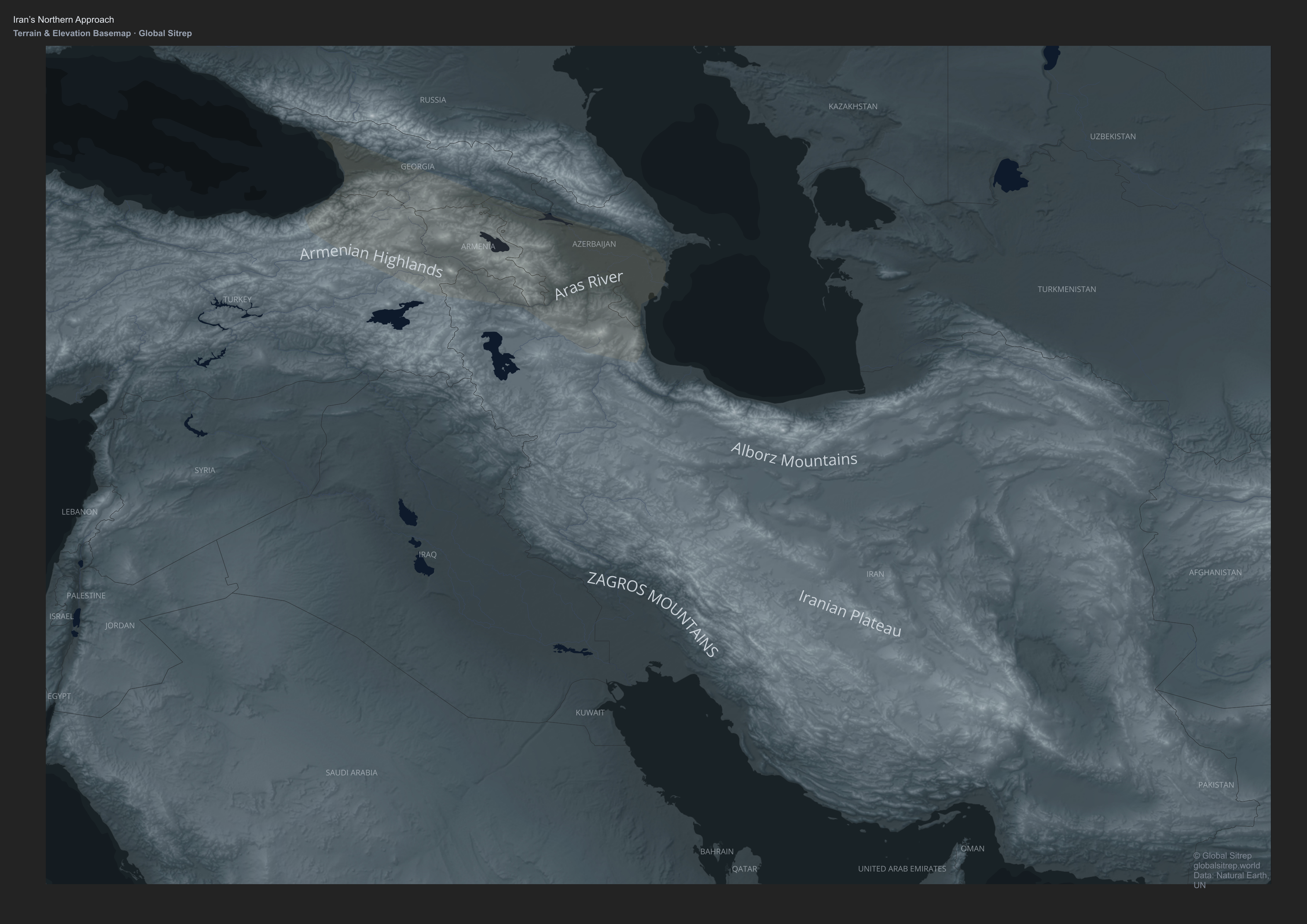
Any ground occupation would require a viable overland approach capable of supporting fuel, maintenance, and reinforcement at scale. From a purely physical perspective, the least restrictive terrain lies in Iran’s northwest, where the Armenian Highlands and South Caucasus meet the Iranian Plateau.
Here, elevated but broken terrain, river basins, and valleys connect Anatolia and the Caucasus to Iran without crossing the deepest Zagros barriers. The Aras River basin marks this interface, forming a zone where movement into Iran’s periphery is historically and geographically more feasible than elsewhere.
This does not constitute a defined invasion corridor. It represents a relative weakness in an otherwise formidable geography. Crucially, this physical possibility is constrained by politics. Any force seeking to exploit it would require secure staging areas, bases, and logistics north of Iran, within the South Caucasus.
That region is among the most geopolitically complex in Eurasia, shaped by overlapping Russian, Turkish, Iranian, and Western influence, and increasingly by east–west trade routes linking China and Europe.
Iran’s defensibility therefore rests on more than terrain alone. The only realistic land approach is also the least politically permissive. Geography opens a door. Geopolitics keeps it closed.
|