Things that caught my attention
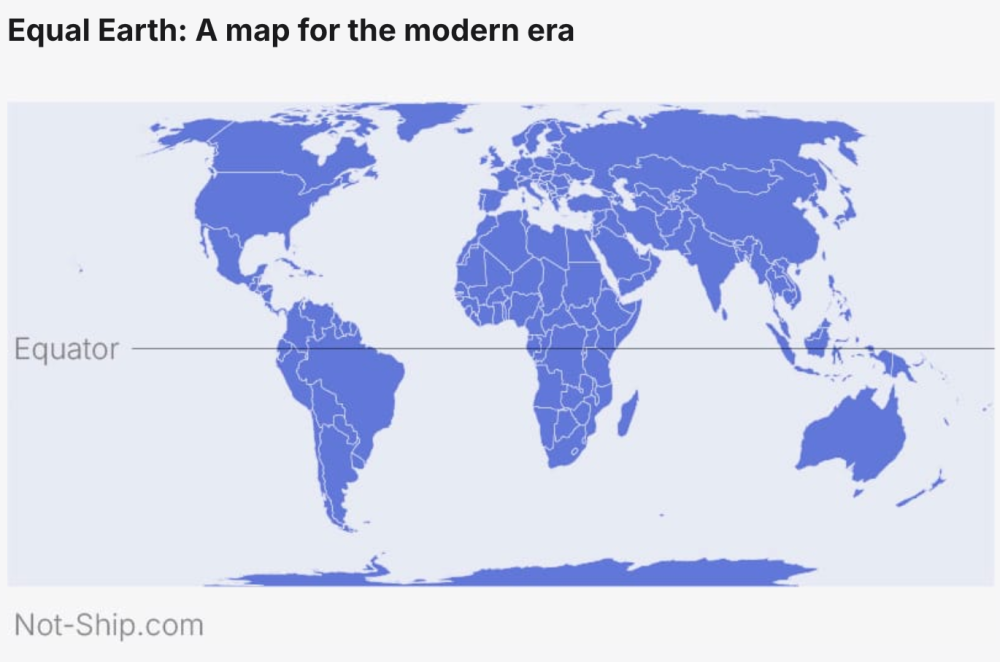
Ah, the good old controversy over the Mercator projection just took an interesting turn. As reported by Amanda Shendruk (see "Topical"), the UN General Assembly voted 164–1 (I'll leave you to check who the 1 was, for exercise) to encourage the use of equal-area projections such as Equal Earth. The instinct is right: Mercator's intrinsic distortions inflate landmasses the further you move from the equator, which is why Greenland ends up looking roughly the size of Africa, which in reality is about fourteen times larger.
The media are discussing this in purely political terms, with the usual polarisation, mostly around the idea that Mercator devalues developing countries. There is truth in that, and above all in the unconscious bias it produces. But part of me keeps thinking about data, maps, and user needs. Maps are made for a purpose, and projections should be chosen to serve that purpose. Mercator is not wrong if you're a sailor: it was devised (in the 1500s) precisely for navigation, because it renders a line of constant compass bearing as a straight line on the chart. That property is also why it survives in web mapping, where local shape and angle matter more than continental area at street-level zoom.
The resolution's sponsors, Togo, agree, with its foreign ministry noting that the resolution "in no way challenges the use of the Mercator projection for maritime and aerial navigation, for which it remains fully suited" (see Al Jazeera). So the real challenge isn't what's "better" between Mercator versus Equal Earth, but that a tool built for one job spent about four centuries doing another, and nobody asked whether it was fit for it.
Check out Amanda's article below, and enjoy the rest of Quantum #675.
·Quantum #674 had an open rate of 47% and a click rate of 15%, and the most clicked link was Julius Fintelmann article about male violence for The European Correspondent.
·'till next week,
Giuseppe @puntofisso.bsky.social