Week 7: It Grows As It Goes
Thanks for joining me on my trip along the Great Divide Mountain Bike Route from Whitefish, MT, to Antelope Wells, NM. I'll be sending this newsletter about once a week. It will be in a narrative journal format with a few pictures. To see more pics, please check out my Instagram account.
Day 43 & 44: Abiquiu rest day and to FR-70 Campsite
I spent one final day in Abiquiu relaxing, in part, so I could align my arrival in Cuba closer to when my Dad and Denise would get there. On Tuesday I headed out early in the morning because I knew I had a big day ahead of me.
Although the overall elevation isn't as high as Indiana Pass, the climb from Abiquiu up Polvadera Mesa is still about 4,000 feet of elevation gain. Fortunately it is not a steep climb and the road surface was just challenging enough to keep my mind distracted from the climb anyway. It was a combination of slabs of slickrock, sand, and loose cobbles.
It took me the whole morning to reach the high point at which there was many miles of rolling roads along the rim of an ancient volcano known as Valles Caldera. The surrounding Santa Fe National Forest, the mostly cloudy skies, and the high elevation kept the air nice and cool, so I kept riding and feeling good.
After 11 hours in the saddle I started to feel some sprinkles, so I found a nice campsite by the side of the road and made camp for the night. I had only seen two people in cars the entire day and nobody passed by my site by the time I left in the morning.
Day 45: FR-70 Campsite to Cuba
The remaining 15 miles into Cuba were downhill, mostly on pavement, so I rolled into town and immediately found a cafe for breakfast.
Cuba is a fairly small town with just a few restaurants, a grocery store, a couple gas stations, and motels. In the early afternoon I checked into the motel where Dad and Denise had made reservations and waited for their arrival the following day.
Day 46 & 47: Cuba rest day and car trip to Chaco Canyon
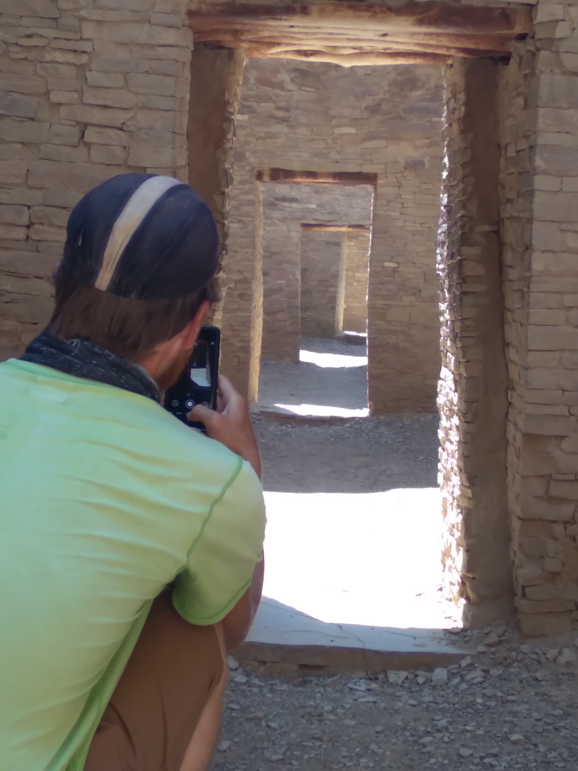
On schedule, they arrived on Thursday and we spent the day catching up and eating out. Our plans for the next day were to drive to the Chaco Culture National Historic Park. The distance wasn't too far, but the last 13 miles were on some washboarded gravel, so the going was slow. At least it kept the crowds down.
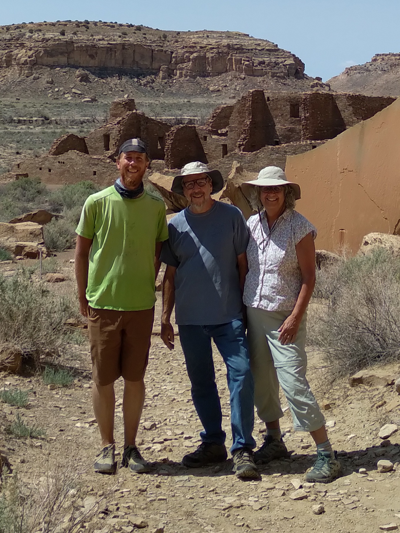
The Ancestral Puebloans occupied the area where the park is located from A.D. 900 to 1,150. Several of their Great Houses are still partially intact where they had cultural hubs for trading, ceremonial purposes, and even archaeoastronomy. We also saw some of their petroglyphs on the canyon walls.
Day 48: Cuba to Mesa Sarcio
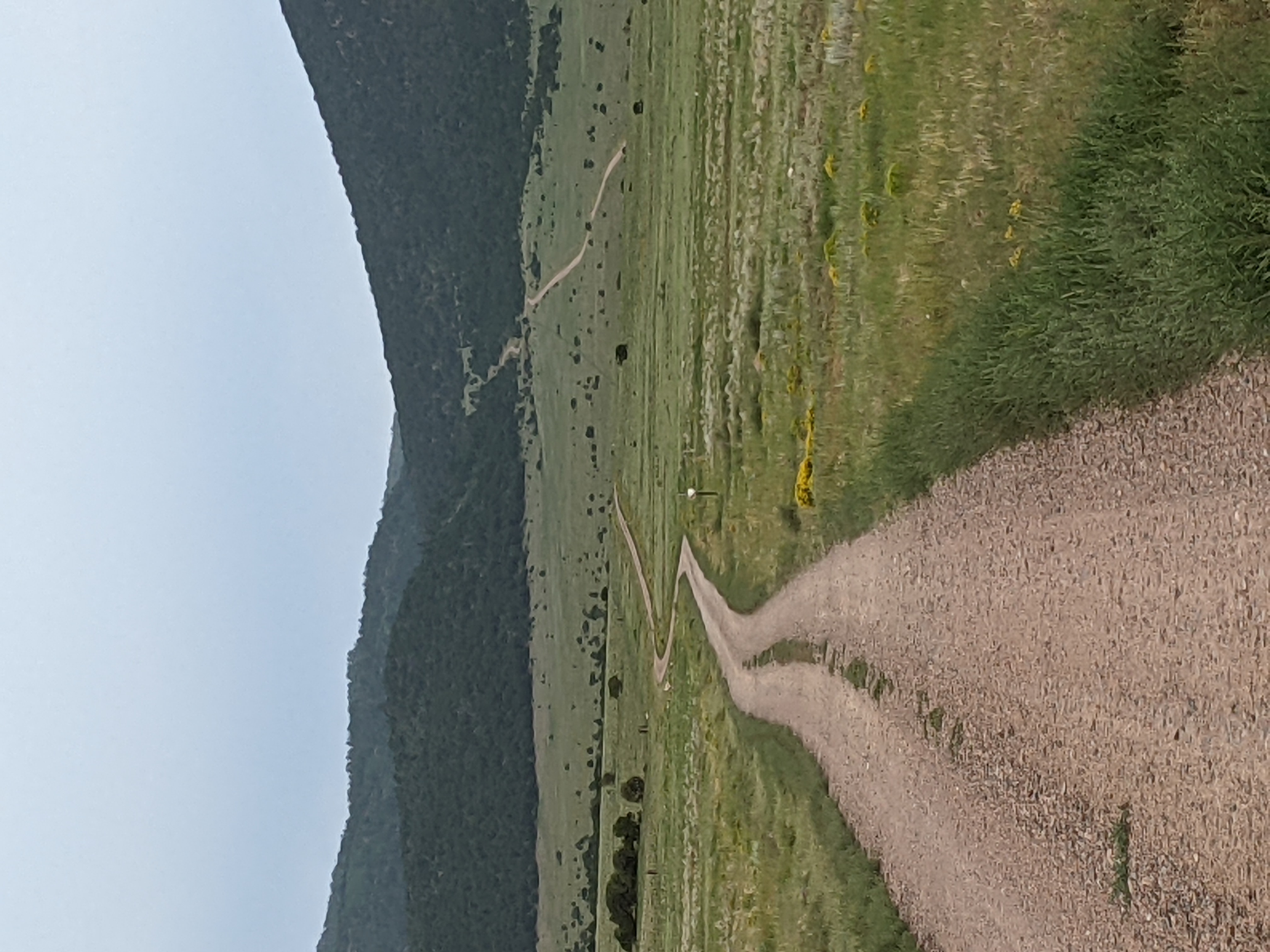
On Saturday I was back on my bike and ready to go. The stretch between Cuba and Grants is compared to the Great Basin of Wyoming since there are very few water sources and the area is quite remote. I stocked up on plenty of water, carrying about nine liters.
The day's terrain was familiar from yesterday's trip to Chaco Canyon—dry, sandy soil supporting thorny shrubs, cacti, piñon pine, and juniper with many rocky mesas protruding here and there. The road was also quite sandy and wound around the mesas and down through the dry arroyos for a relatively flat day of riding. The main danger to watch for was rattlesnakes, of which I saw one very large one that rattled and spit at me as I rode quickly by.
The land is a patchwork of public BLM land and private ranches. This made it tricky to find dispersed camping, but I finally set up my tent near Mesa Sarcio under a juniper tree in the late afternoon.
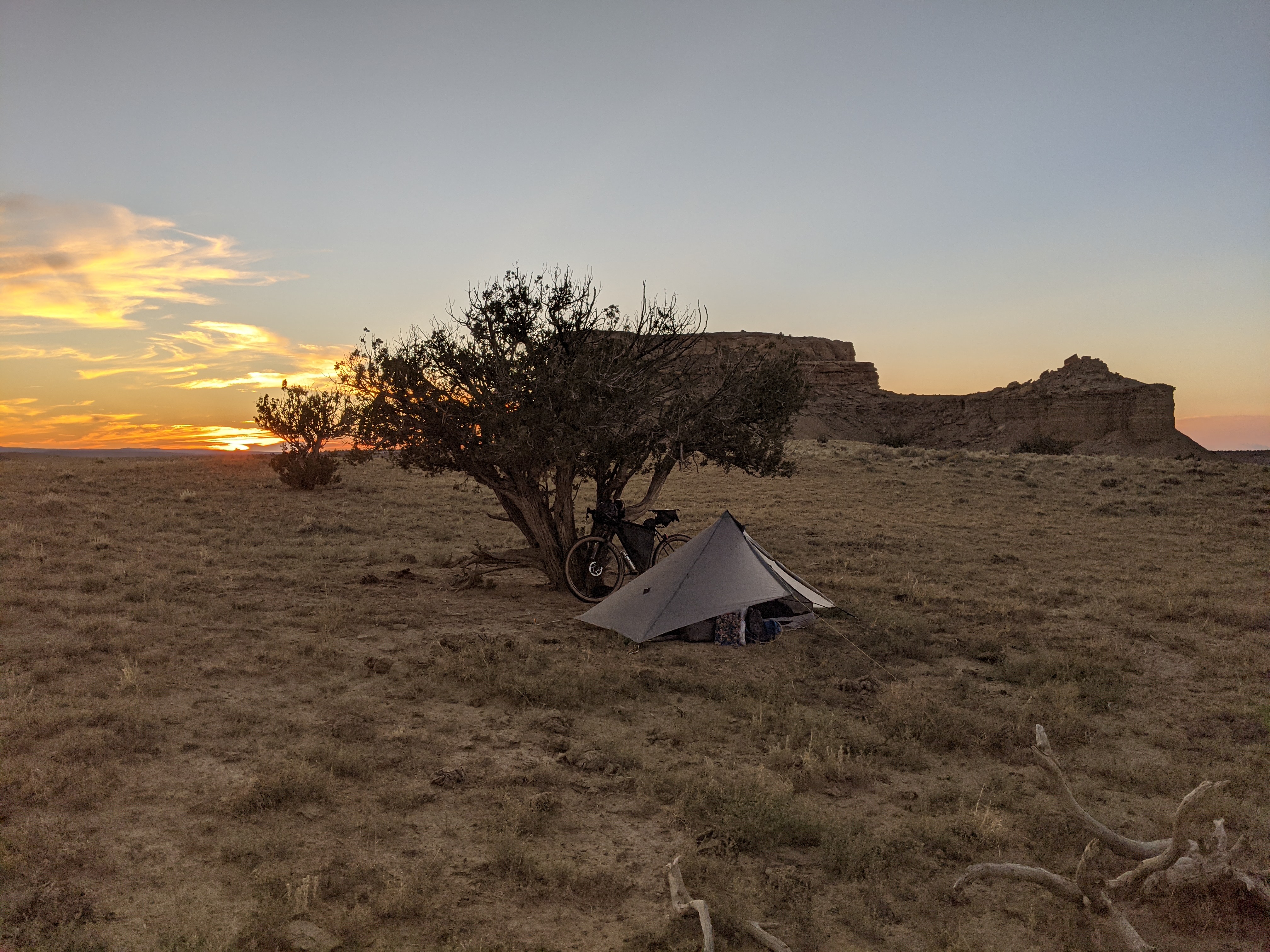
Day 49: Mesa Sarcio to Bandero Volcano and Ice Cave
The road surface improved immediately upon leaving camp the next morning as I left behind the desert surroundings and climbed into the Cibola National Forest with pines and junipers of larger sizes finally providing some shade to the road. The summit was at San Mateo Spring followed by a nice downhill into Grants, NM. Grants is the largest town by population that I've been to since Rawlins, WY, but somehow it felt empty. The famous Route 66 goes through its heart, but its heyday is probably behind it.
After a quick lunch I was led out of town by Zuni Canyon Road for the final 25 miles to meet back up with Dad and Denise at the Bandero Volcano and Ice Cave campground. The road was a gentle grade uphill the whole way to a crossing of the Continental Divide. It was hot and the gravel was freshly laid, thus loose and dusty. It made for slow travel, but I rolled into camp around dinner time.
That evening around dusk we were welcomed by a real New Mexican monsoonal thunderstorm. The rain poured in bucketfuls and streams quickly formed under our tents. Luckily there were empty cabins on site and the generous owners let us take shelter in one for the night.
I want to spend some time hiking to the ice cave and volcano rim in this strange volcanic rock landscape known as El Malpais, so I'm going to stay here at least one more night, especially since I'm still ahead of my schedule.
The numbers so far:
- 2,089 miles
- 19 Continental Divide crossings
- 1 rattlesnake encountered