Week 6: High Elevations
Thanks for joining me on my trip along the Great Divide Mountain Bike Route from Whitefish, MT, to Antelope Wells, NM. I'll be sending this newsletter about once a week. It will be in a narrative journal format with a few pictures. To see more pics, please check out my Instagram account.
Day 36: Salida to Sargents
With my wallet a little lighter, Howard and I headed out from Salida's hotels and bike shops to conquer Marshall Pass, the first of many high elevation passes this week. Marshall, like Boreas, is a former railroad grade which kept the steepness down. Much of the climb was through aspen forests and the temperature steadily decreased as we neared the summit. We also watched the skies carefully, because the forecast had a chance of rain.
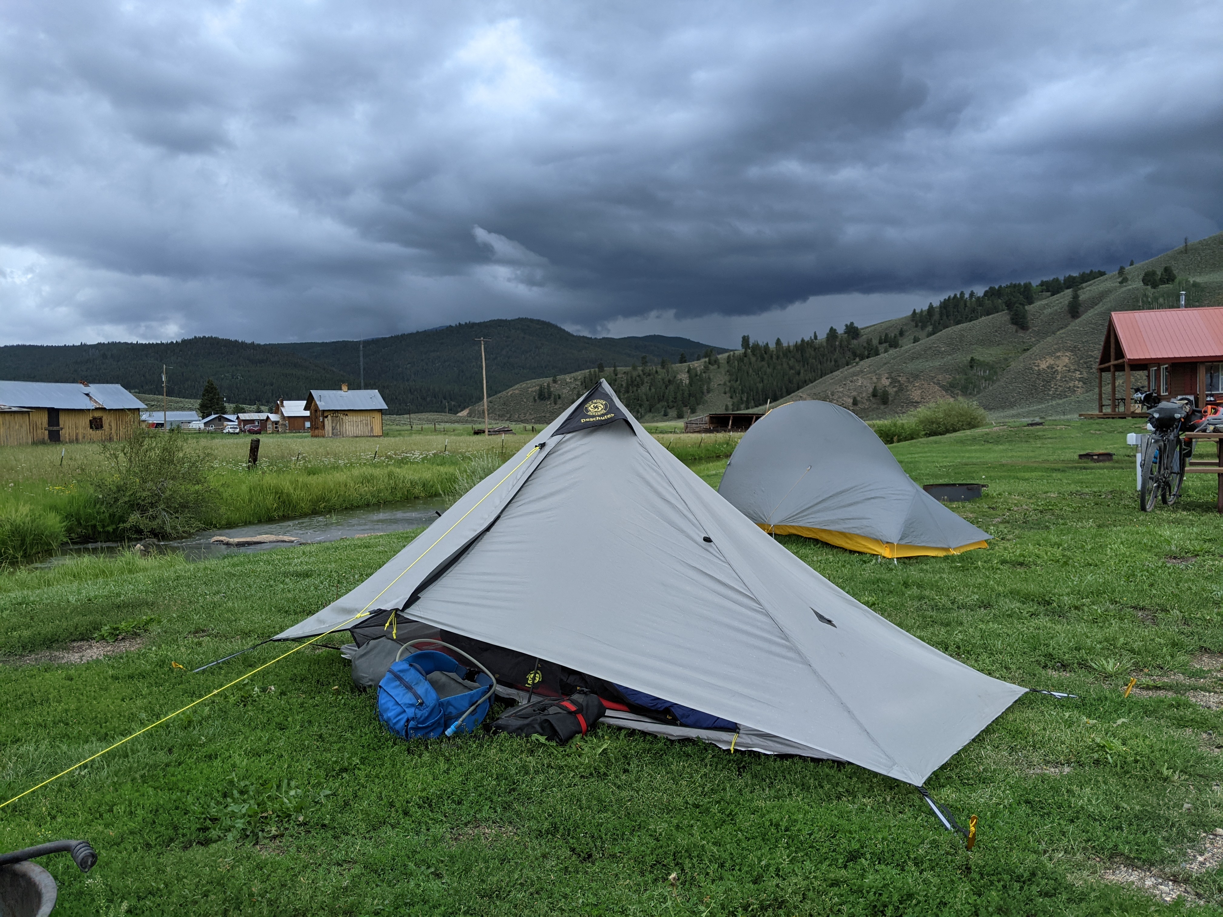
We descended to the small town of Sargents where the Tomichi Trading Post is the only business. It has a restaurant, store, and campground. By this time the clouds were getting darker, so we called it a day and set up our tents. That evening the wind picked up and it poured for several hours.
Day 37: Sargents to Luders Creek CG
The next morning we set our sights on the next pass. The roads were still wet and a little muddy, but not impassable. Cochetopa Pass was relatively easy considering it crossed the Continental Divide. The hiking trail also crosses near the top and we found a trail angel named Apple had set up a tent with snacks and drinks for hikers and bikers passing by. We stopped for a short time and met several hikers, one of which named Pipes, was carrying a small set of bagpipes which he pulled out and played for the group.
Just over the pass we stopped at Luders Creek Campground with the intention of having lunch and trying to tackle one more pass. Mother Nature had other plans. Thunder rumbled in the distance and raindrops began to fall. We scrambled to set up our tents. It rained on and off until after dark. Another couple cyclists and some hikers arrived as well. The cyclists were northbound and told tales of how rainy and muddy the roads to our south had been. Luckily our forecast showed things mostly drying out for a while.
Day 38: Luders Creek CG to Del Norte
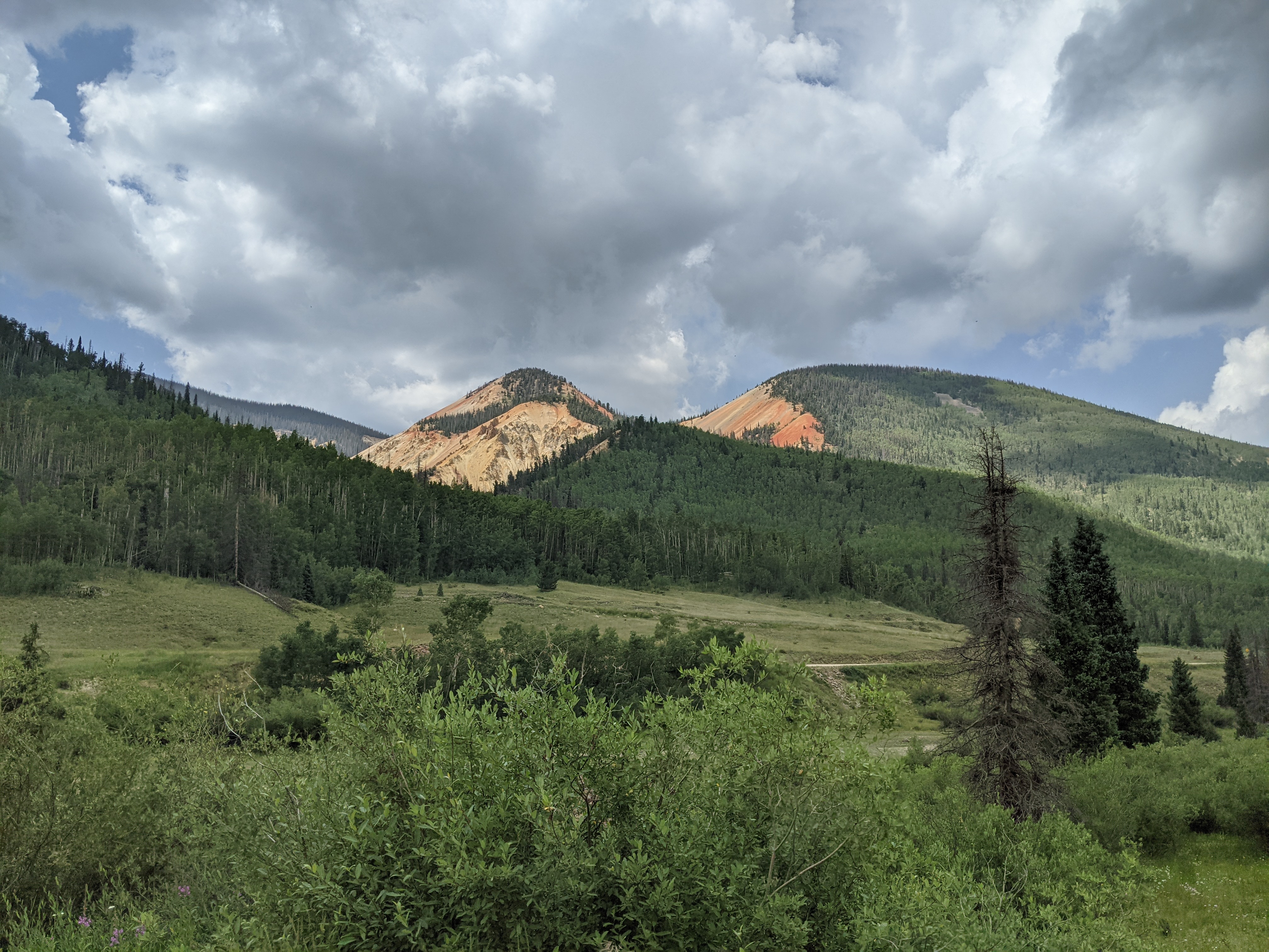
Another day, another pass. First we descended the rest of Cochetopa and were surprised to find the landscape begin the change drastically to the sharp exposed reddish rocks I always associate with the southwest. New Mexico was getting closer. Carnero Pass was only challenging in sections, but I was happily distracted by the mushrooms I was seeing in the forests along the road. I've been told the recent rains have brought out more mushrooms in the area than locals have seen in years. Lucky me!
The summit came and went as we made our way down to a little town called La Garita for lunch. Afterwards it was a quick 20 miles around the edge of the San Luis Valley to our target of Del Norte. The San Luis is a high elevation desert which made the surroundings once again appear as though we'd left the Rockies behind, but that was only temporary.
Day 39: Del Norte to Platoro
Four thousand feet of elevation gain over 25 miles faced us the next morning, most of it in the final 12 miles leading up to Indiana Pass. The summit was our highest point on the entire route at 11,910 feet above sea level. It took me over two and a half hours of pure climbing to reach the top and I felt every inch of it. The air was cool and thin up there and I felt light headed from the exertion. It was not my favorite pass, particularly because there was not a downhill reward, but rather a string of ups and downs leading through an EPA superfund site at the old Summitville Mine and over to Stunner Pass, which was the prettier of the two, even though it was smaller.
By the time we were descending from Stunner, I was ready to find camping in Platoro. The rumbling thunder which came out of nowhere confirmed my feelings. We rolled into Platoro, which is mostly a town made of cabin rentals, just as the rain began to fall. We grabbed a bite at the cafe and watched as it continued to pour and then hail and then pour some more. Almost two hours passed before we attempted to ride down the flooded road a short distance to the campground. To our surprise they had a basic cabin which was built just for cyclists and was reasonably priced. Neither of us wanted to set up tents on the sodden ground, so we gladly accepted the cabin.
Day 40: Platoro to Lower Lagunitas CG
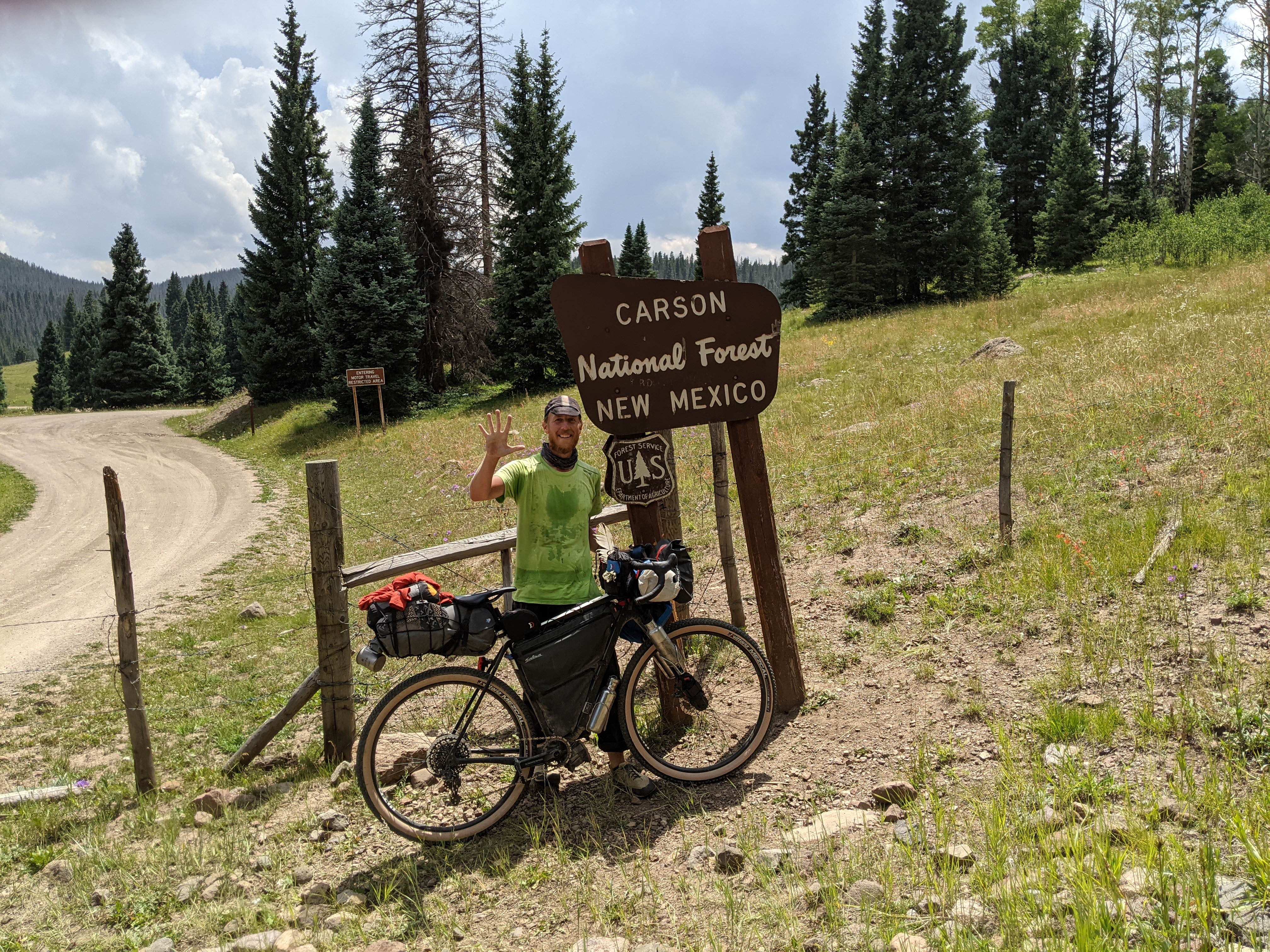
Once again the roads were wet and covered in puddles, but they soon dried out as we continued descending the Conejos River valley down to Horca. After Horca, you guessed it, another mountain pass. La Manga Pass was on pavement which makes things a little easier, but the days were accumulating in my legs. I didn't feel great as we crested the pass and turned onto dirt roads which led to New Mexico. It was exciting to reach a new state, the final state, but I was ready to find a campsite. Howard was eager to push on since his schedule for finishing is tighter than mine, so we said our goodbyes and he moved along.
I ended up riding quite a few more miles into New Mexico anyway. The roads became very rocky and the scenery on Brazos Ridge was beautiful. I was spotting more mushrooms on the sides of the road too. All of this helped distract me from my exhaustion until I pulled into Lower Lagunitas Campground. My site neighbors invited me over to sit around the campfire for a while. They were a father and son from North Dakota that were in the area for a youth muzzle loader hunt for pronghorn. We chatted about various outdoor subjects for a while and then I slept solidly the whole night through.
Day 41: Lower Lagunitas CG to Hopewell Lake
I felt better the next morning and was thrilled to find that, although there was climbing in the next section of road, there were no passes. I was still starting at about 10,000 feet in elevation, so the air was chilly. The landscape alternated between forests and open rangeland. The wind picked up strongly from the west. By midday I was climbing a 5 mile paved hill against the wind toward Hopewell Lake.
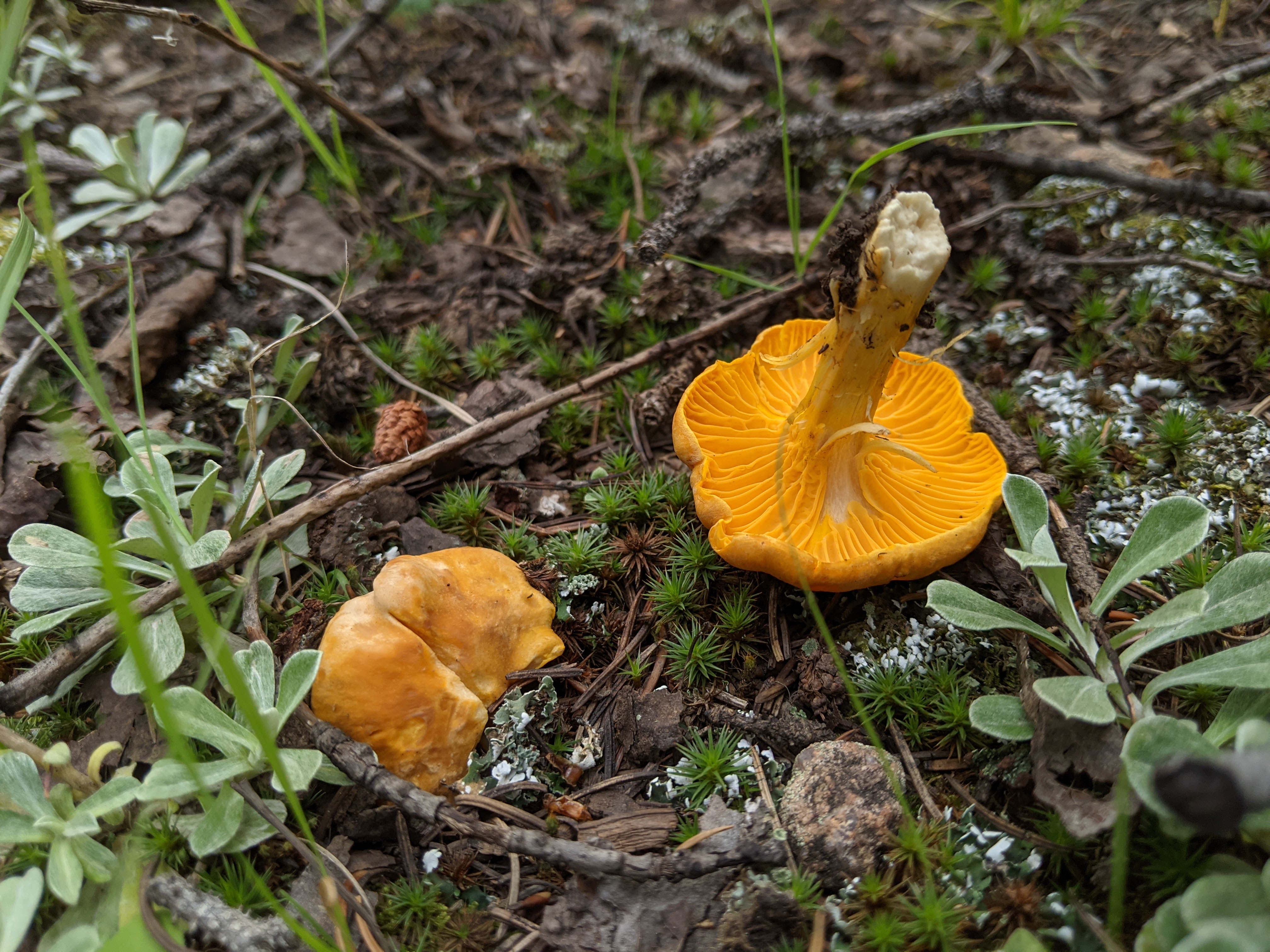
It was early yet, but the next good place to stop was over 50 miles farther, so I decided to camp at Hopewell. The camp host pointed out a shelter in the day use area which is available for hikers and bikers to use free of charge. My tent isn't free standing, so I set it up outside. I spent the afternoon lounging in the shelter, pampering my bike a little bit, and walking through the woods. I overheard some campers talking about chanterelles and it only took me about five minutes to find some. Sadly I had no way to cook them, so I left them for the next person or animal.
Day 42: Hopewell Lake to Abiquiu
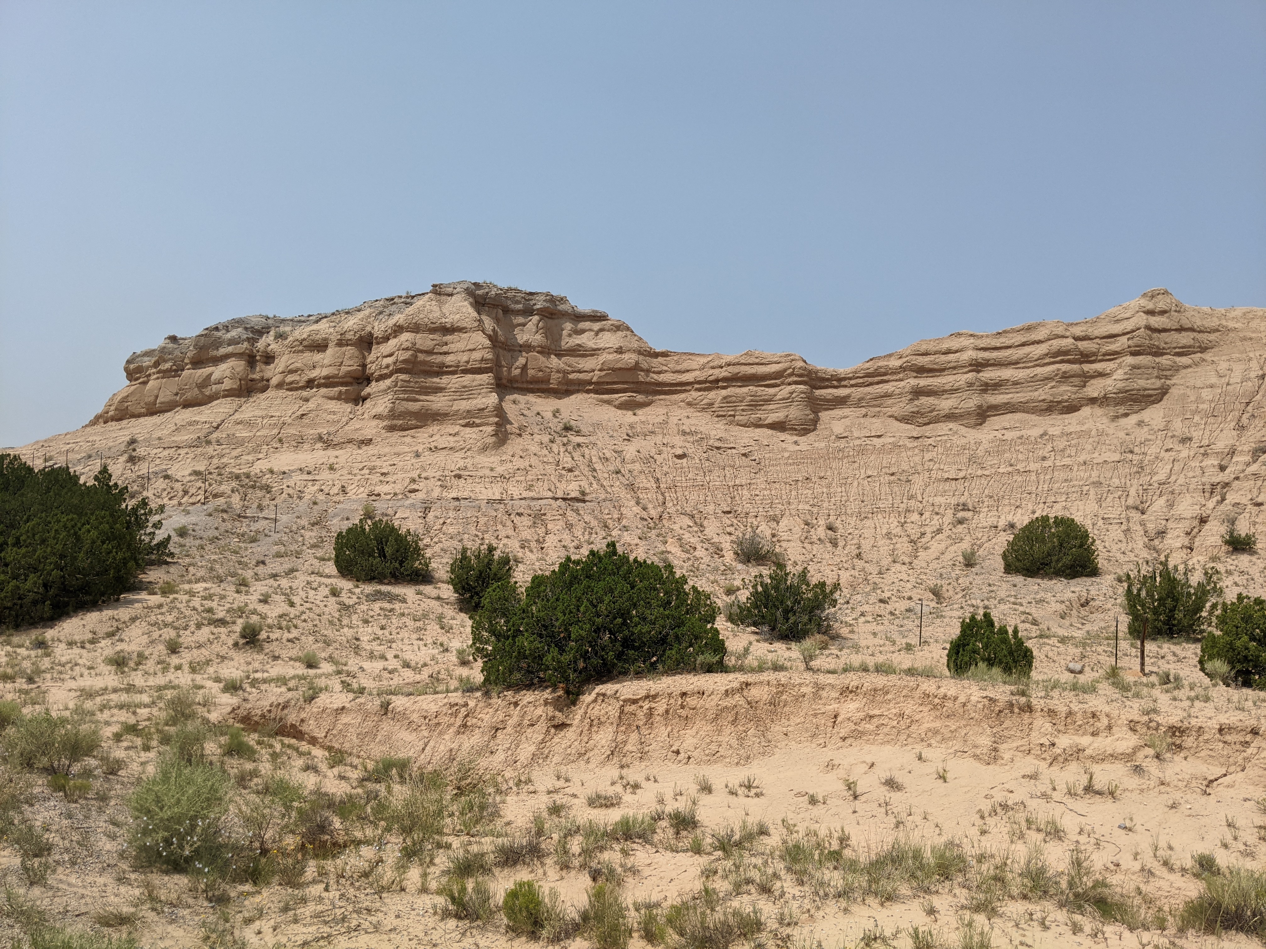
This morning was chilly at 10,000', so I made my way down to Abiquiu, NM, where it is 90°. The landscape transitioned from dense aspen and pine forests to open ponderosa pine woodlands to shrubs and cacti in the matter of 55 miles. Unfortunately a heavy blanket of smoke has blown in from California, so the views aren't what they could be.
I'm most likely going to spend an extra day in Abiquiu before the big climb up to Polvadera Mesa and over to Cuba, NM. I'm excited to see Dad and Denise who will be traveling out from Michigan to meet me there and follow along by car for a few days. A side trip to Chaco Canyon is also planned.
The numbers so far:
- 1,868.3 miles
- 5 states
- 17 Continental Divide crossings
- 11,910' highest elevation