The Hills Are Alive With Local History
This issue of Left Coast Dispatch is free to all subscribers. Please consider upgrading to a paid subscription - just $5/month.
The landscape of Greater Victoria is peppered with rocky hills and bluffs, once scraped by glaciers and now home to a varying mix of native and invasive plants. The tallest of these is Pkols (also known as Mt. Douglas), but there’s also Mt. Tolmie, Christmas Hill, Moss Rock, Gonzales Hill, Peacock Hill, and Summit Park – to name a few.
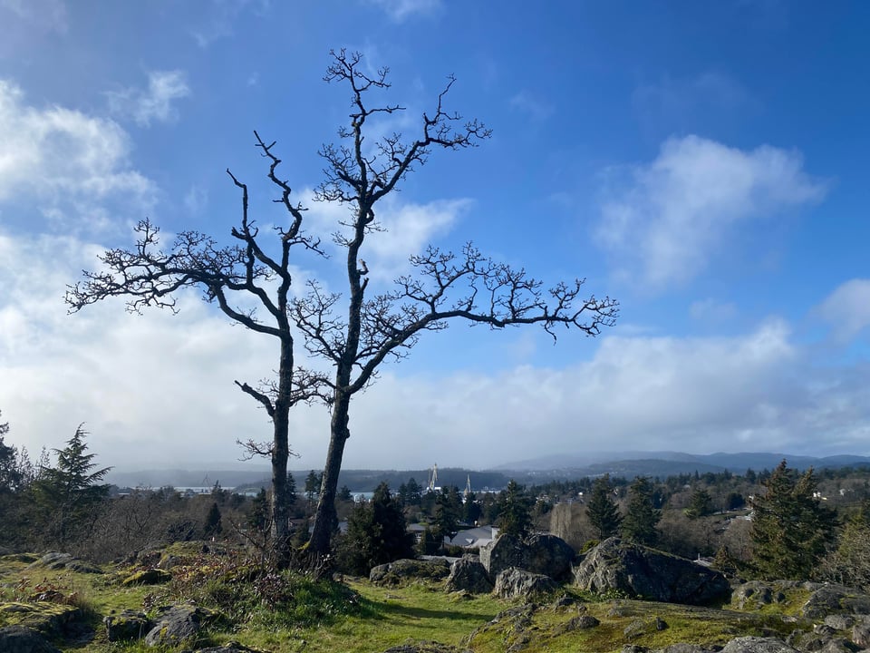
On a recent sunny day, I found myself exploring Highrock Cairn Park in Esquimalt. As the name implies, this is the highest point of land in Esquimalt at 71 metres.
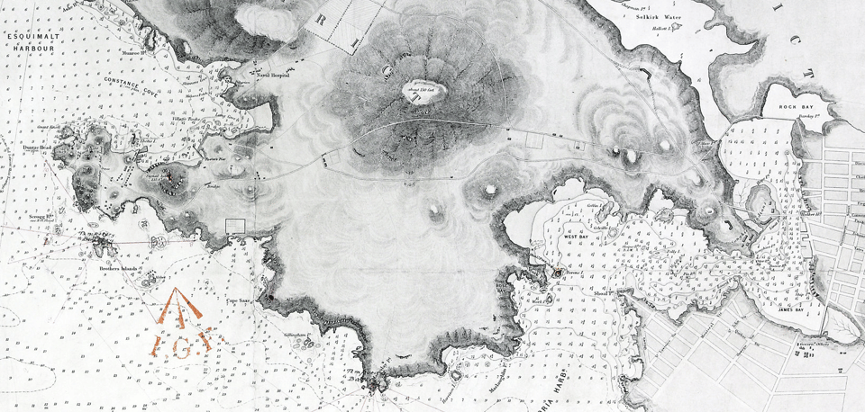
Esquimalt, like neighbouring Victoria, is the territory of the Lekwungen speaking peoples, and Highrock park is close to several ancient Xʷsépsəm village sites. The Royal Navy made Esquimalt Harbour a stop in the 1840s and by 1853 the Puget Sound Agricultural Company (a subsidiary of the Hudson’s Bay Company) established three large farms in the area – Constance Cove, Craigflower, and Viewfield. The historical border between Constance Cove Farm and Viewfield Farm passes through Highrock Cairn Park.
As the naval base and farms developed, so too did the village of Esquimalt and its connections to Victoria. A trail over land to Victoria was built in the 1850s and this later became Old Esquimalt Road; today the road takes you past the entrance to Highrock Cairn Park.
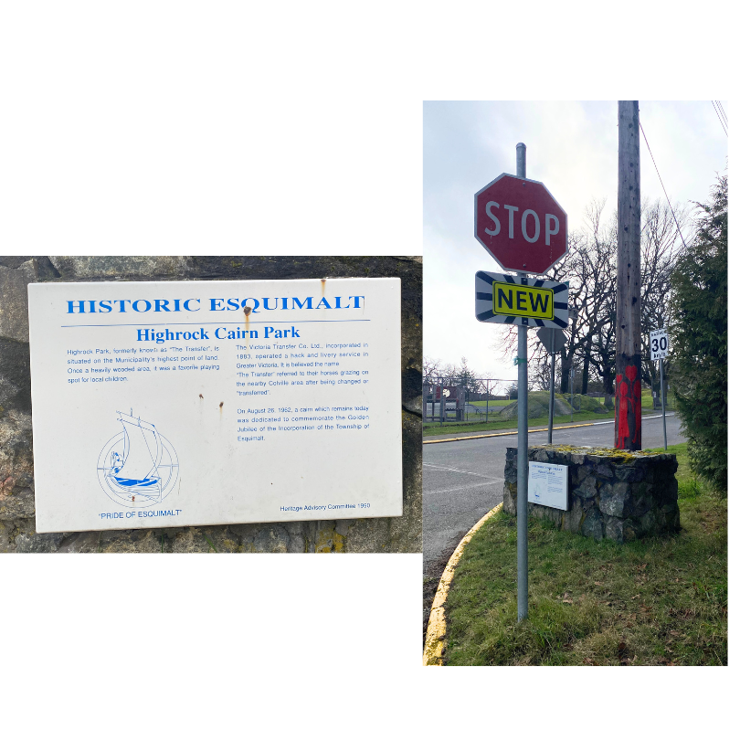
Highrock Cairn Park is a name that comes from the installation of stone cairn at the top of the park in 1962 to commemorate 50 years of the Township of Esquimalt. Before the 1960s, the wooded hilltop and surrounding field were referred to by locals as “Transfer Woods”, “Transfer Trail”, “Transfer Field”, and “The Transfer.”
So who, or what, was being transferred around this location?
People and horses.
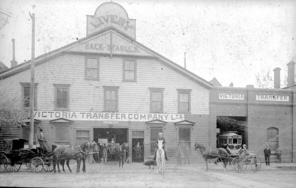
The Victoria Transfer Company
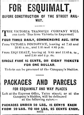
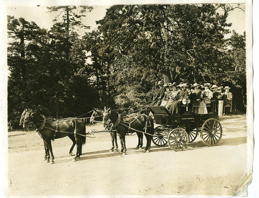
The horses belonged to the Victoria Transfer Company Ltd., movers of people and goods. The company’s headquarters were located in downtown at Broughton Street and Gordon Street Victoria and the company president was Frank S. Barnard, transportation magnate, politician, and later Lieutenant Governor for BC (1914-1919). In 1883, the first year of the company’s operation, a horse-drawn bus left Victoria for Esquimalt four times each day.
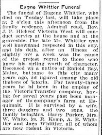
In the book Esquimalt Streets and Roads (1995), historian Sherri Robinson attributes use of the “Transfer” place name to Eugene Whittier who managed the Victoria Transfer Company farm bordering what is now Colville Road. When the company’s horses were done with their work in the city, they would be taken to spend time in these pastures leased from the Hudson’s Bay Company (HBC). The trail for this movement — or transfer — of horses ran from Old Esquimalt Road through the woods and down to the field near the bottom of the hill.
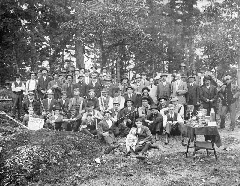
The various “Transfer” names for this area reflect its different uses – as a trail and pasture for horses, but also as a place for hunting, sports, and even as a site for the dumping of municipal garbage.
The HBC subdivided its lands around Esquimalt through the 1930s and housing quickly overtook much of the historical Transfer Woods.
Yes, There’s a Plaque!
There is a historical marker that explains a little about the origins of Highrock Cairn Park. Placed in 1990 at the corner of Cairn Road and Esquimalt Road, I’m not sure how many people actually see this – it is located at a stop sign and there is no sidewalk next to it. You certainly can’t read it from your car and I only noticed it because I was on my bike.
Even if you miss the plaque, this rocky high point is a fantastic spot to enjoy scenic views and contemplate the rich history of Esquimalt.
Left Coast Dispatch
Liked this dispatch? Please share with your family and friends!