Thames Path: Kingston to Woolwich
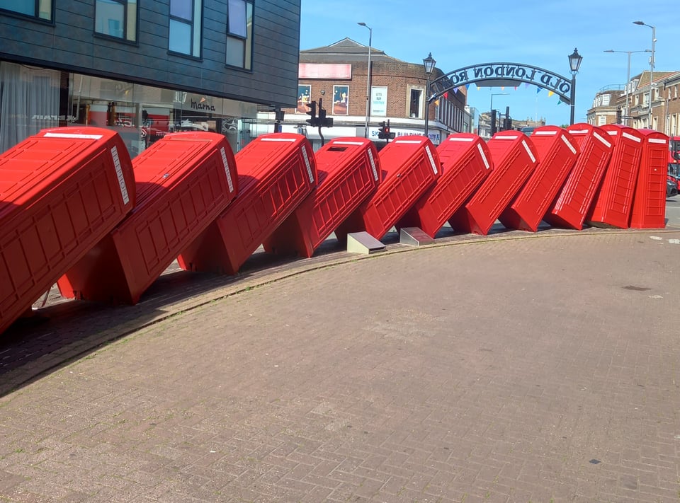
Kingston was familiar ground for me. When Scunthorpe used to have London matches, I would always make a quick detour to visit the fabric shop there. Even if the London match was in Leyton, such was my confidence in London's transport options. It was lovely to go back and see the fabric shop still trading, next to the artwork whose official title is Out of Order, but which my kid and I will always think of as "the telephone boxes".
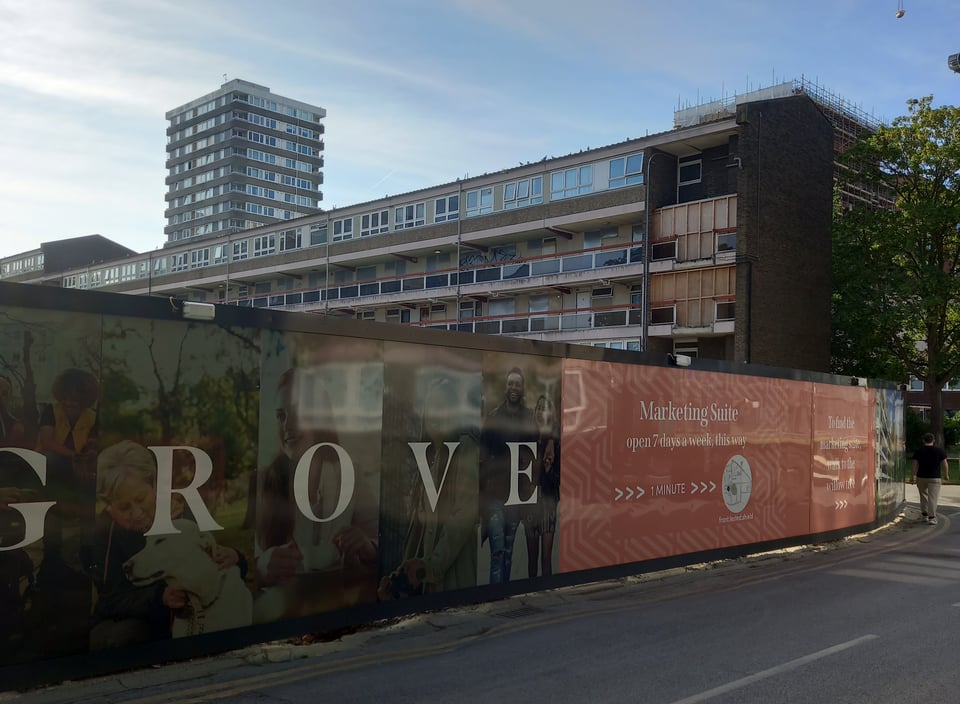
I spent the night in one of those contrasts that London seems to be made of: grimy concrete jungle slowly giving way to new builds with aspirational hoardings. Fortunately the kebab and pizza hadn't given way to more expensive restaurants, so I was able to enjoy a cheap, tasty, and filling chicken shish.
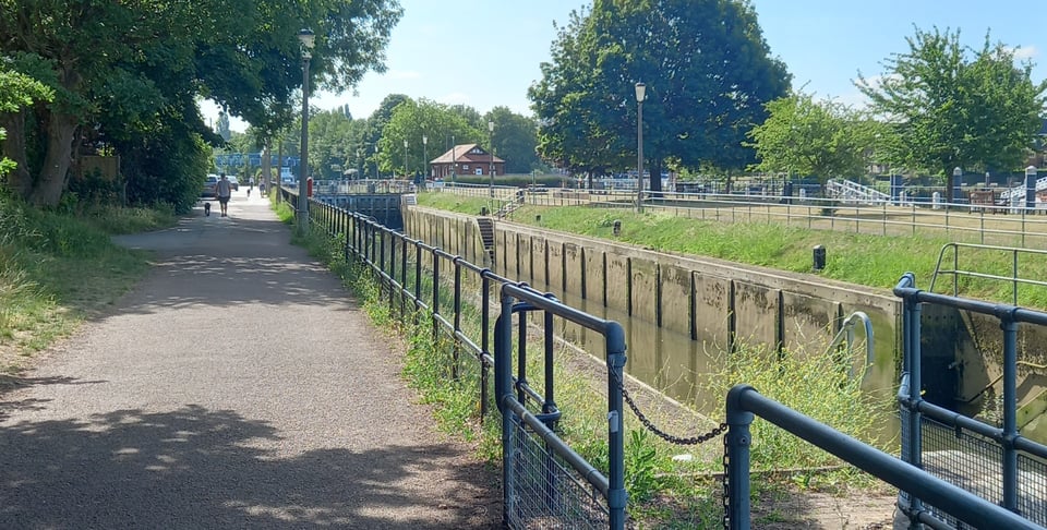
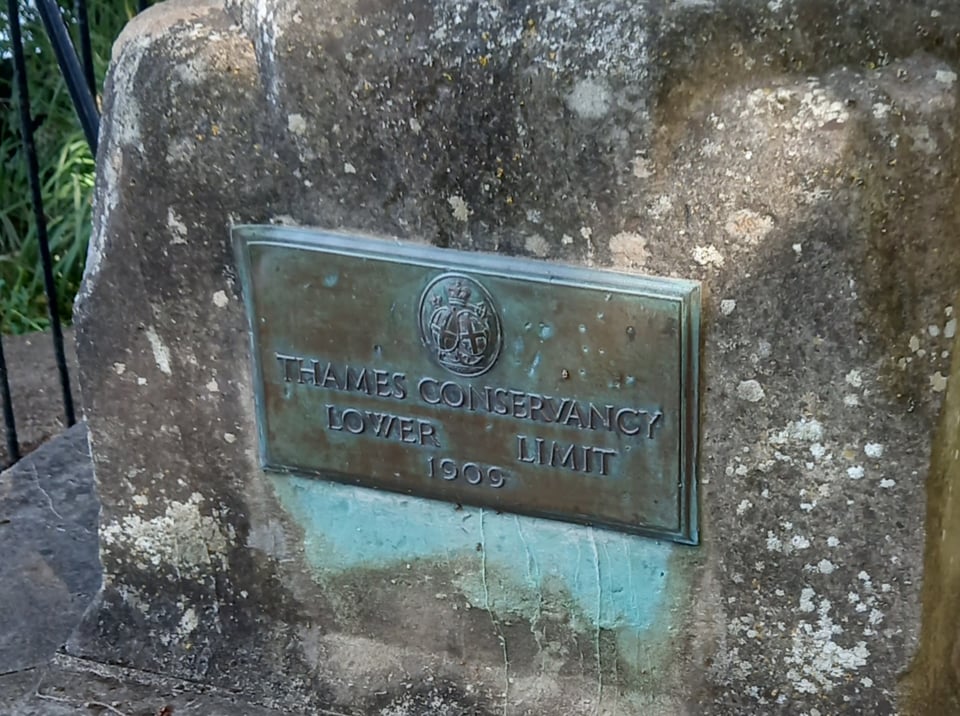
The first hour of my journey the next day brought another farewell. The Environment Agency locks had punctuated my journey since I left Lechlade, giving me somewhere to rest, refill my water bottle, use the toilet, learn about the local area, and even be offered a Buddhist chant. But Teddington lock, as well as marking the point where the Thames becomes tidal, is the last of them. There is one more lock downstream at Richmond, but it only operates at low tide and is managed by the Port of London Authority.
An obelisk just below the lock marks the point where the Environment Agency, who have looked after the river since it was first a river, hand the baton on to the Port of London.
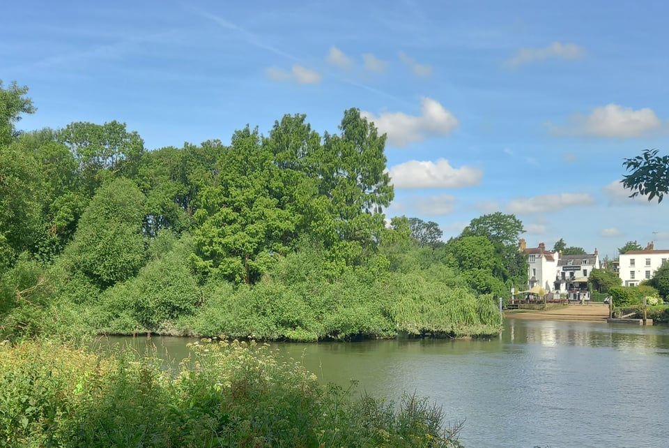
At Teddington, the trail also splits: you can choose to take the "northern" or the "southern" bank - although due to the Thames's many meanders, those compass directions are purely nominal to begin with. Following the guidebook's suggestion, I stuck to the southern bank, and was rewarded with a pleasant walk through a nature reserve where I could hear plenty of birds, even if I couldn't see them. I also got a view of Eel Pie Island, mentioned by Charles Dickens as a place of entertainment in Nicholas Nickleby but now apparently just a place of trees.
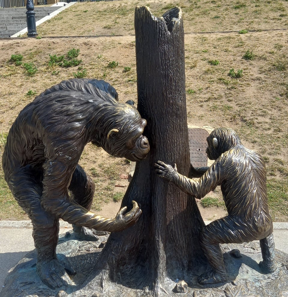
After a well-timed stop to refill my water bottle, I came into Richmond. I was delighted to see a Gillie and Marc animal sculpture, having passed up the chance to photograph many of them in Kingston. But a little further down, a young woman was singing I Can't Help Falling in Love With You. Whether it was the melancholy of the end of the trail or the griefs I brought from home with me, I was reduced for a moment to tears.
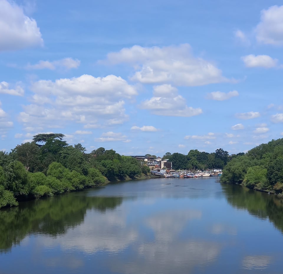
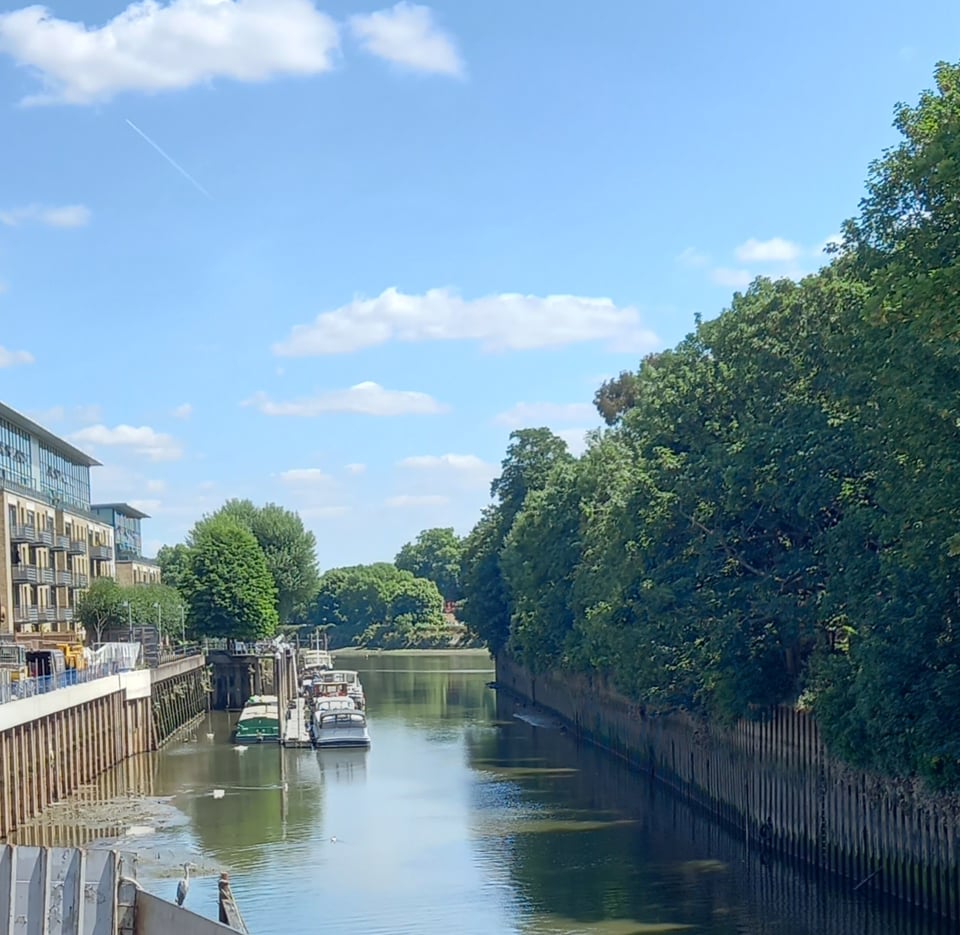
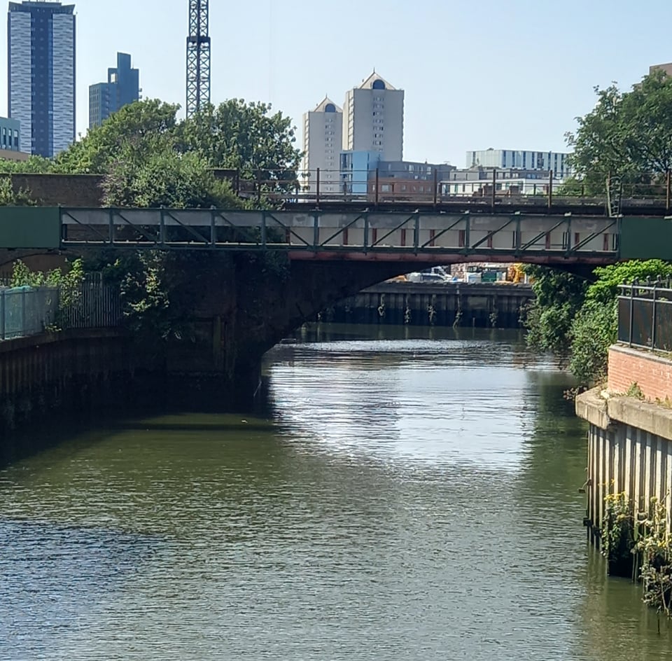
At Richmond lock, a little further downstream, melancholy gave way to irritation. Some kind of construction work was blocking the southern path, so I had no choice but to cross to the northern side. Instead of a stroll under trees, I found myself picking my way through the streets of Isleworth and struggling to keep track of all the trail markers. There was an amazing view from the footbridge, which was a partial compensation.
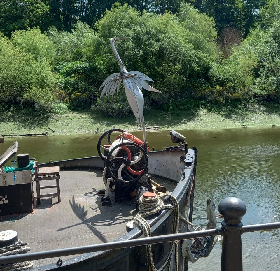
I passed a boat with an intriguing sculpture that looked like a heron. Later I spotted its living counterpart, not motionless on the bank like all the others I had passed but dramatically taking wing.
On the way into Brentford, the path followed the river Brent for a while before rejoining the Thames where the rivers meet. In spite of the irritating twists and turns, there was something special about seeing this little tributary, which was presumably forded somewhere to give the town its name.
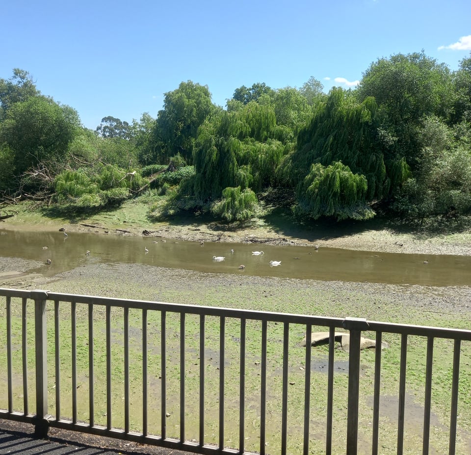
The next stretch to Kew Bridge was somewhere I briefly visited in April during my wanderings round London. I'd photographed the river from the road, and now I tried to photograph the same approximate spot from the path. There seemed to be a lot less water this time, although I don't know whether that was because of drought or simply low tide.
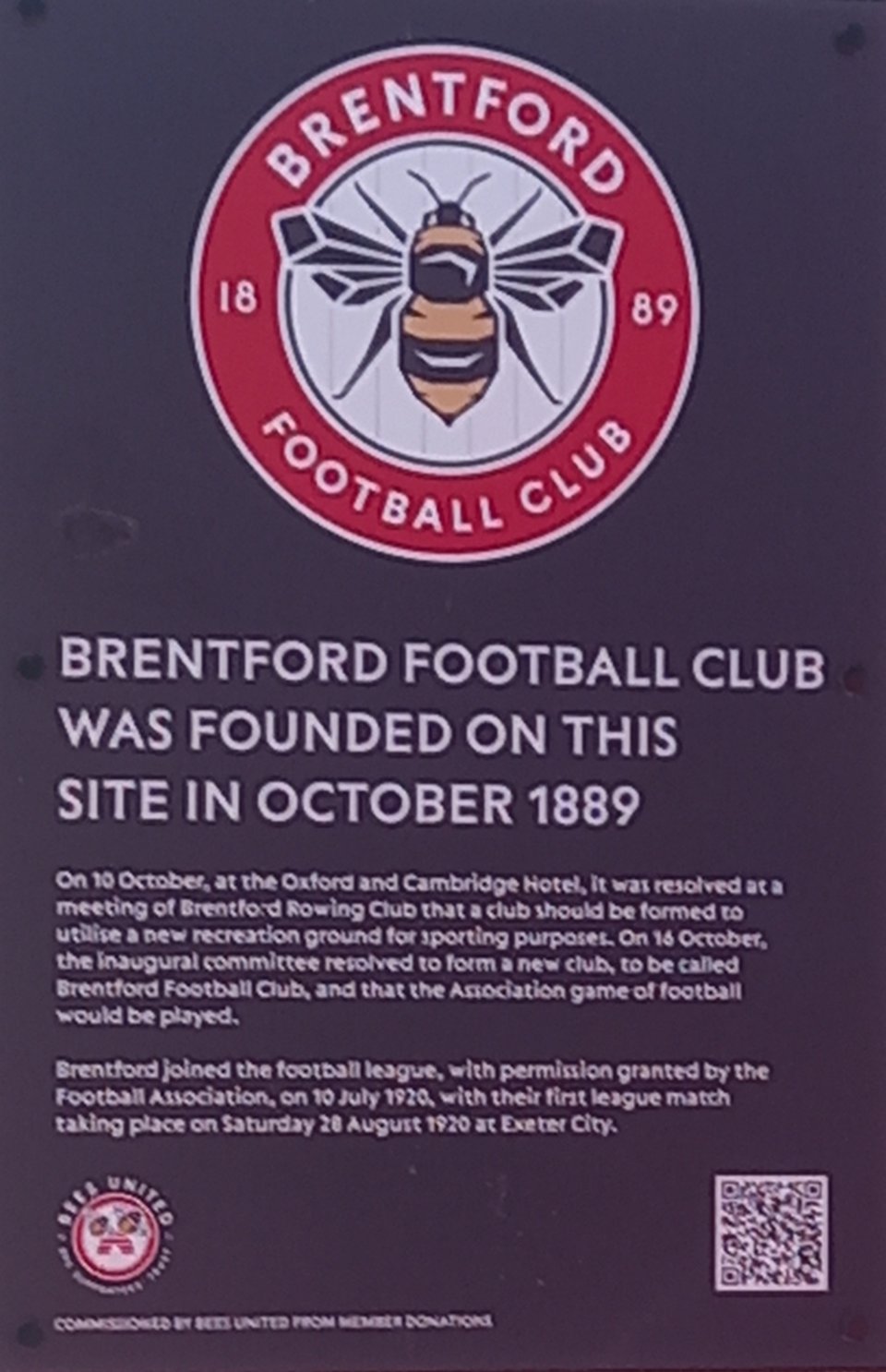
I'd intended to cross to the northern bank at Kew Bridge anyway, to take in the village of Strand-on-the-Green, where David Umber in Sight Unseen found a Mr Griffin and heard an interesting but ultimately irrelevant story. The path continued to be inconsistently signposted, so I ended up approaching the bridge from an odd direction, which let me see a plaque marking the place where Brentford FC were formed. I also spotted a blue plaque marking a house where Donald Pleasance lived - within easy reach of water that I'm sure is often dark and lonely.
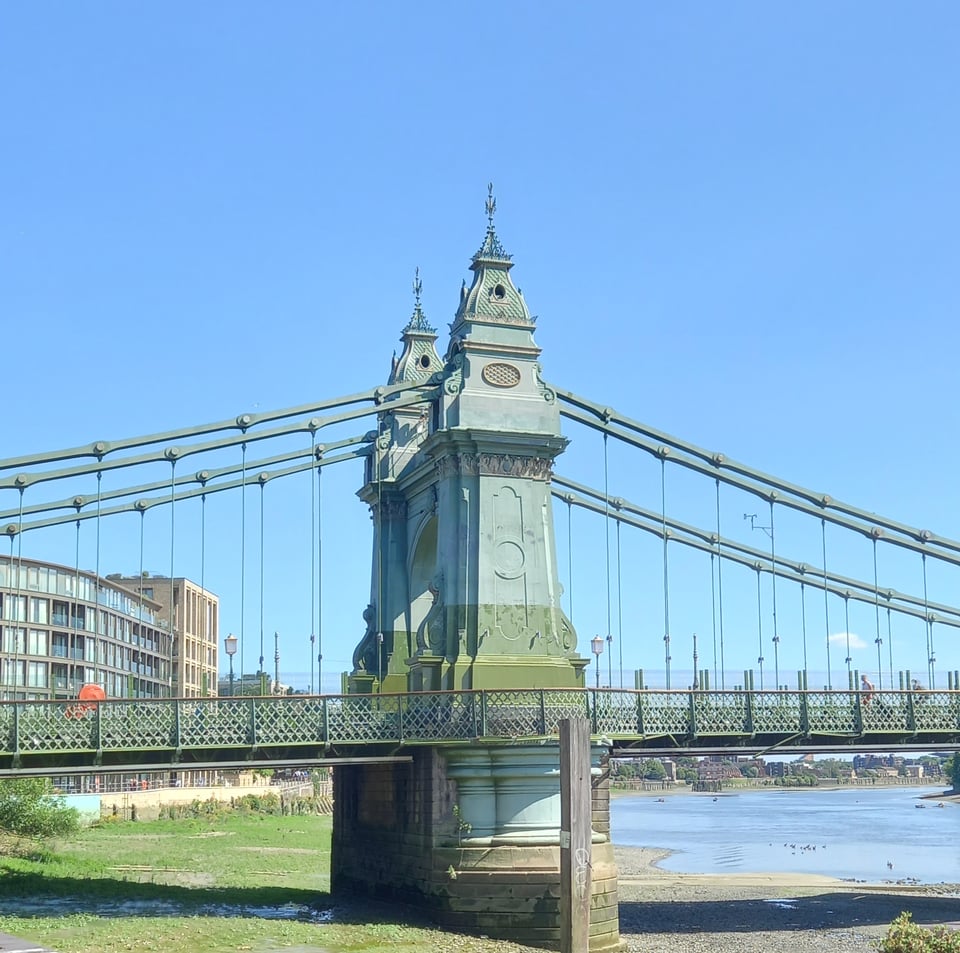
My original plan had been to walk to Putney and then double back, either on foot or by bus, to my hostel in Hammersmith. But by the time I reached Chiswick Bridge, I knew that wouldn't be an option. I was exhausted, and despite judicious use of water fountains, my bottle was almost empty. So I made Hammersmith Bridge my new goal, and once I reached its odd little pillars, I headed straight for the hostel.
I'd stayed in Hammersmith before, on a brief trip with my kid in 2016. So after drinks and pizza with a London based friend, I went for a short stroll to try to find the place where we stayed. I found the street, but the hotel itself is either very well hidden or has gone out of business during the intervening years.
After a night spent almost directly above the tube station - I had definitely reached the heart of London - I started the next day by crossing Hammersmith Bridge. I walked along the pleasantly tree-lined southern bank, mostly in the hopes of getting a good photo of Craven Cottage. The side closest to the river doesn't necessarily look like a football ground.
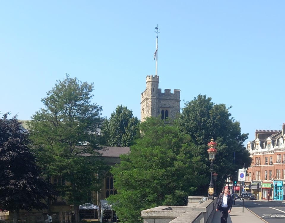
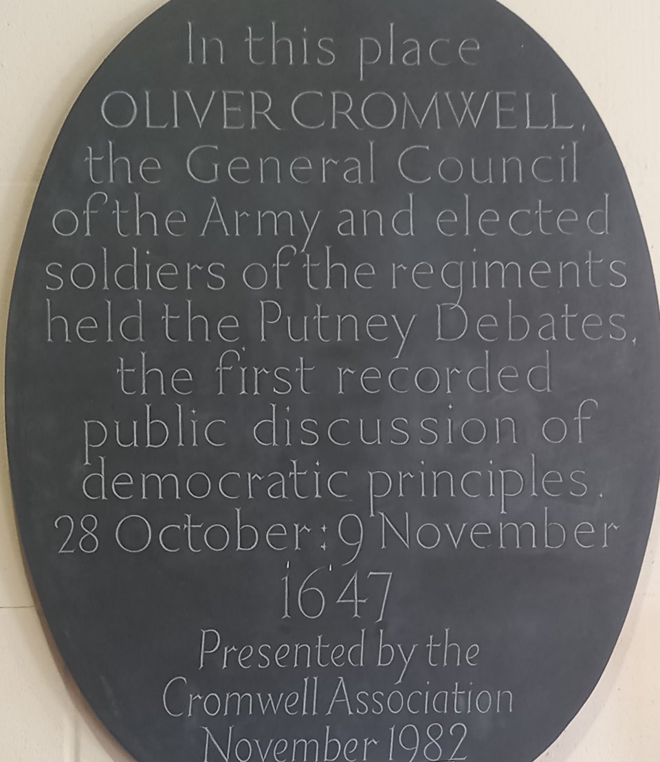
I crossed again at Putney Bridge in the hopes of seeing the University Boat Race mosaic, which marks the start of the modern course. Unfortunately, construction blocked the way and I headed back across the bridge disappointed. I was slightly cheered by St Mary's Church, site of the Putney debates where Oliver Cromwell's army first floated the idea of "one man, one vote".
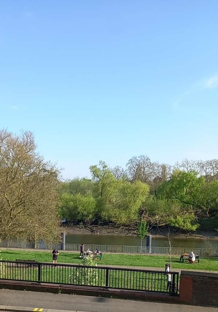
Wandsworth, the next landmark, was another familiar area. I had been fascinated by the Wandle, the largest Thames tributary in London, ever since I read The Borribles as a teenager. On another London trip, I diverted to look at it with my kid, who couldn't believe we'd walked all that way just to look at some muddy water. This time I was alone, and could look to my heart's content.
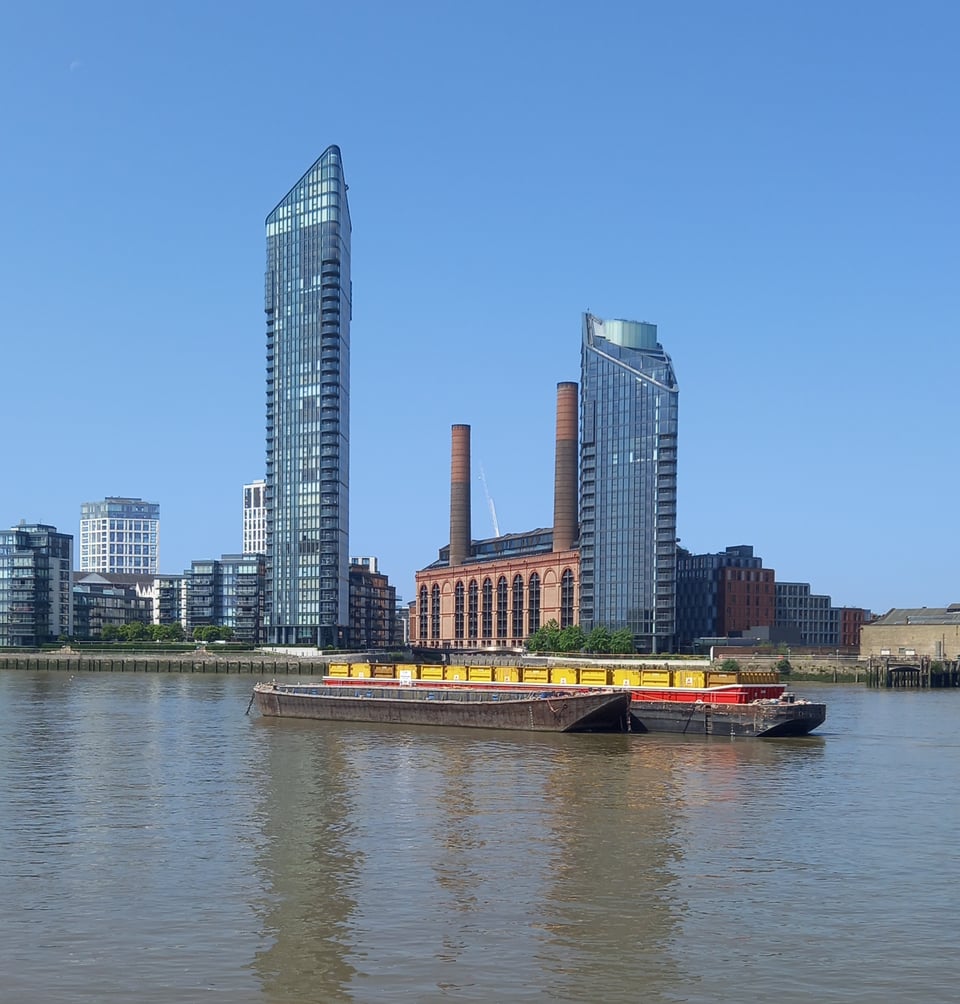
The London Thames feels like a different river to the one I followed for so many days. The tide means it doesn't always fill its banks, often leaving wide expanses of mud exposed. And apart from a few parks, with the trees carefully arranged, I was mostly walking between fancy housing. That did throw up an interesting contrast with the river's use for unglamorous transport.
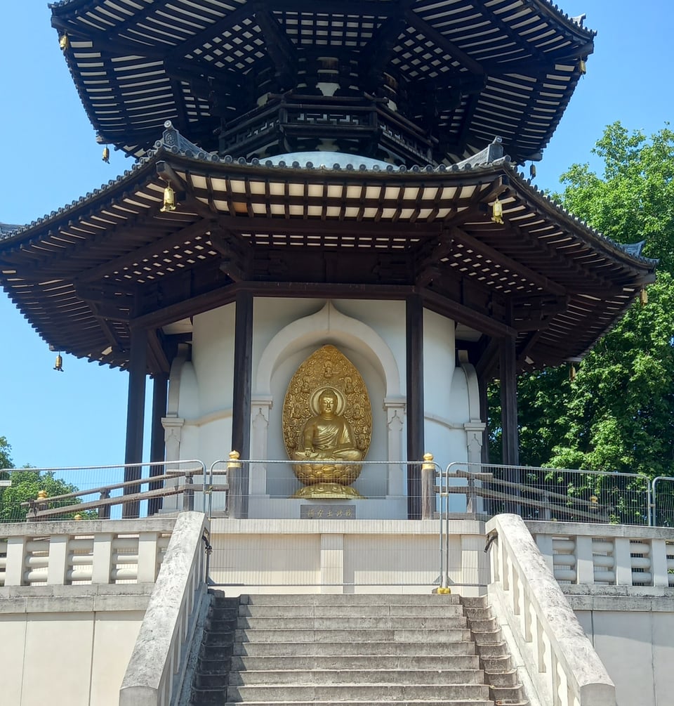
There were a few interesting sights along the way, like the London Peace Pagoda in Battersea. It depicts the Buddha in various states, which reminded me of the Northmoor lockkeeper. Strange to think that he must have let through his weir the water now flowing past the pagoda.
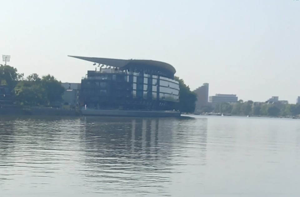
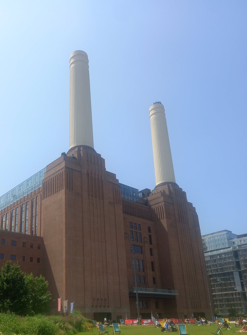
I stopped for lunch in the Battersea Power Station complex. I've seen so many images of the building that it was hard to believe I was now passing it in reality.
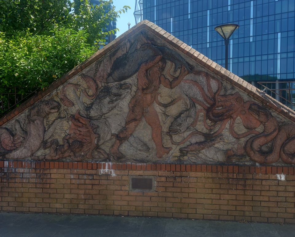
At the guidebook's suggestion, I picked my way through the complex rather than following the recommended route around the outside. That did cause a few problems picking up the trail on the other side, but I rejoined it in time to see an odd little mural of Father Thames apparently wrestling various sea creatures. It stood in front of the US Embassy, which meant it was also host to a Palestinian solidarity encampment.
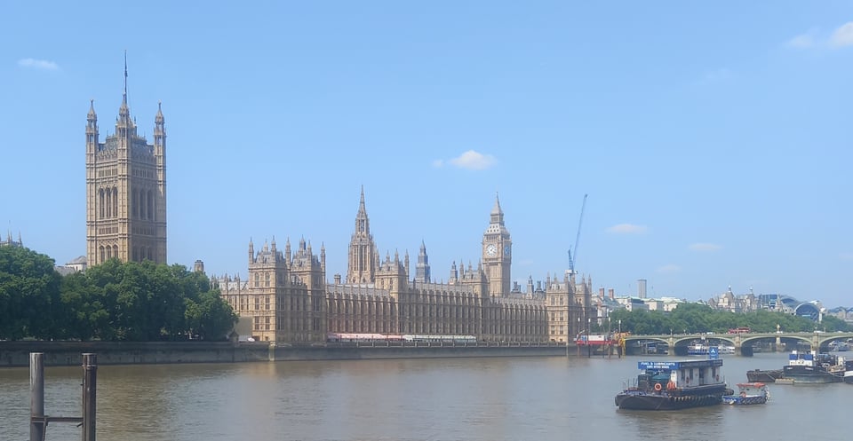
I had come to Central London, and the next landmark was the Houses of Parliament, another building so iconic it was odd to see it for real.
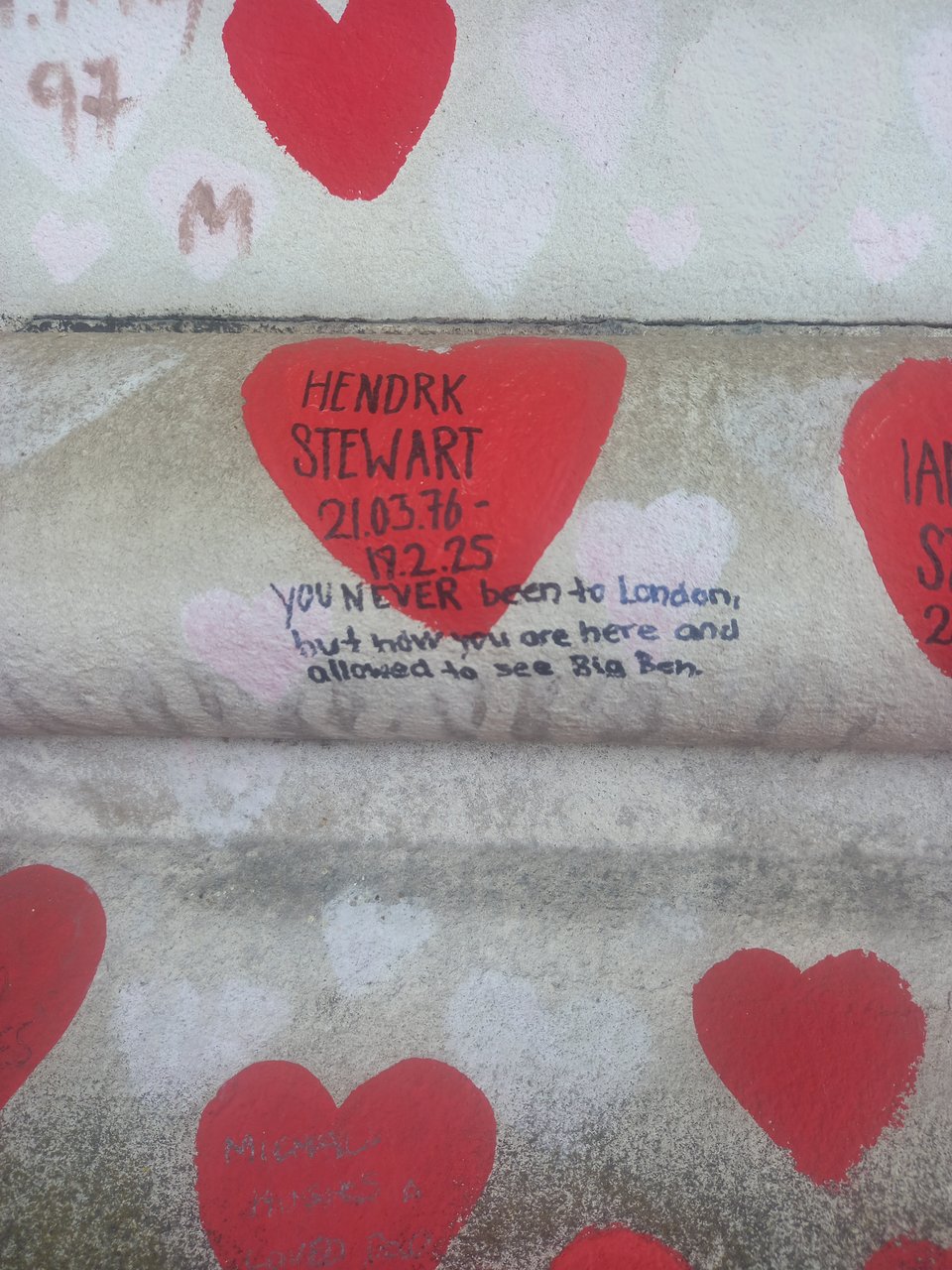
Facing it across the river, as if to challenge the government, is the Covid memorial wall, painted with little hearts that can be dedicated to a loved one who has died of Covid. The effect of all those hearts, all those lost lives, was deeply moving, and I walked slowly past, taking in a message here and there and reeling from the scale of the loss.
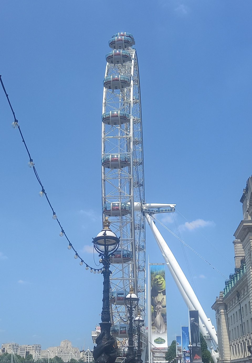
The mood shifted as I passed under Westminster Bridge and was plunged into the tourist chaos around the London Eye. With no money to spend, it held little attraction for me, although the staff of a cafe in the National Theatre were good enough to refill my water bottle.
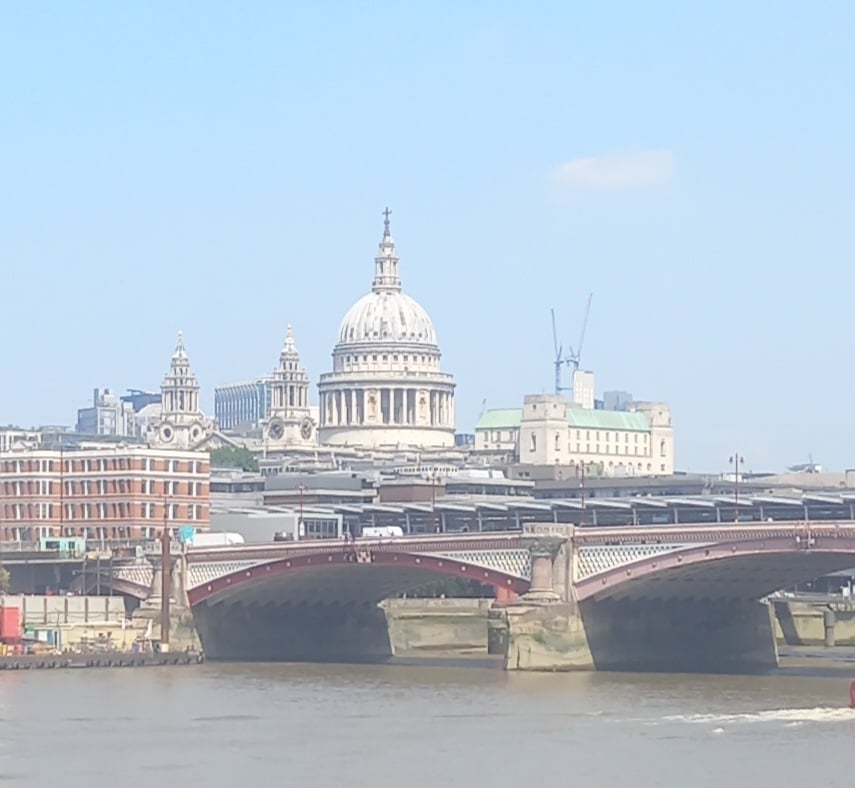
Blackfriars Bridge came next, with St Paul's towering above it like a real life recreation of the old Thames Television logo. Then the Tate Modern, which I doubled back to visit later in the hopes of seeing pictures which, it turns out, are actually in the Tate Britain.
The trail was still inconsistently signposted, which wasn't a problem when it exactly followed the river. But at London Bridge, various bars blocked the way, and I lost sight of the path. I found it after a few minutes of wandering, but since my hostel was near London Bridge anyway, I took that as a sign to leave the trail and make my way there.
In an attempt to beat the heat, I set off before half past seven the next day. The trail was easy enough to find downstream from London Bridge; seeing the buildings on the opposite bank softened by the early light, I could understand why William Wordsworth, several bridges upstream, said that "earth has not anything to show more fair."
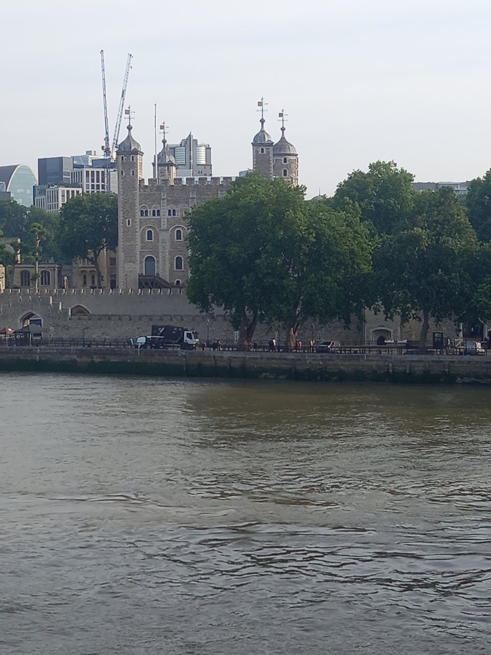
The stretch to Tower Bridge was easy enough, and I crossed to the northern bank because that route sounded more interesting. I got a picture of the Tower of London, which in spite of its grim reputation was simply the royal residence in London. All those fortifications were just the mediaeval equivalent of the signs I saw near Windsor Castle.
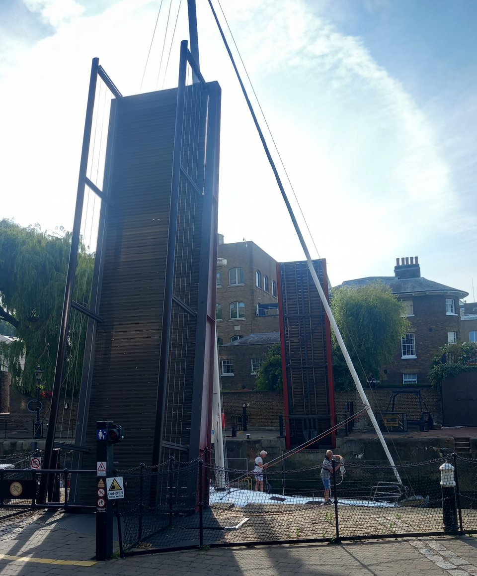
I was a little disappointed to learn that raising Tower Bridge now requires 24 hours notice, so that I could hardly hope to see it happen. However, at nearby St Katherine's Dock, a much smaller bridge over a lock was lifting to allow a sailing boat to pass, so I didn't miss out entirely.
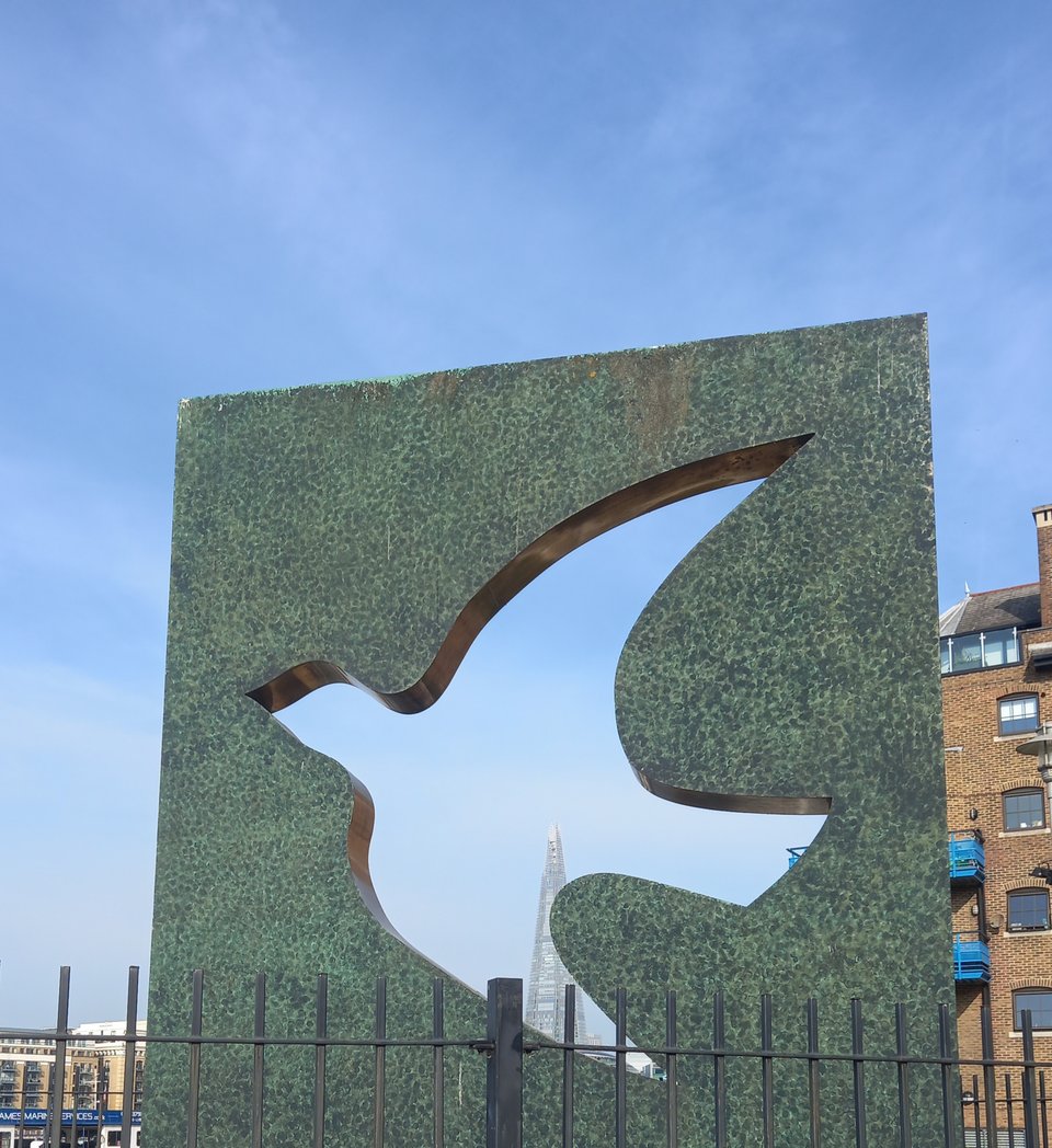
St Katharine Dock also houses a memorial garden dedicated to the citizens of the East End killed during the Second World War, with a dove sculpture to hint at hopes for peace in the future.
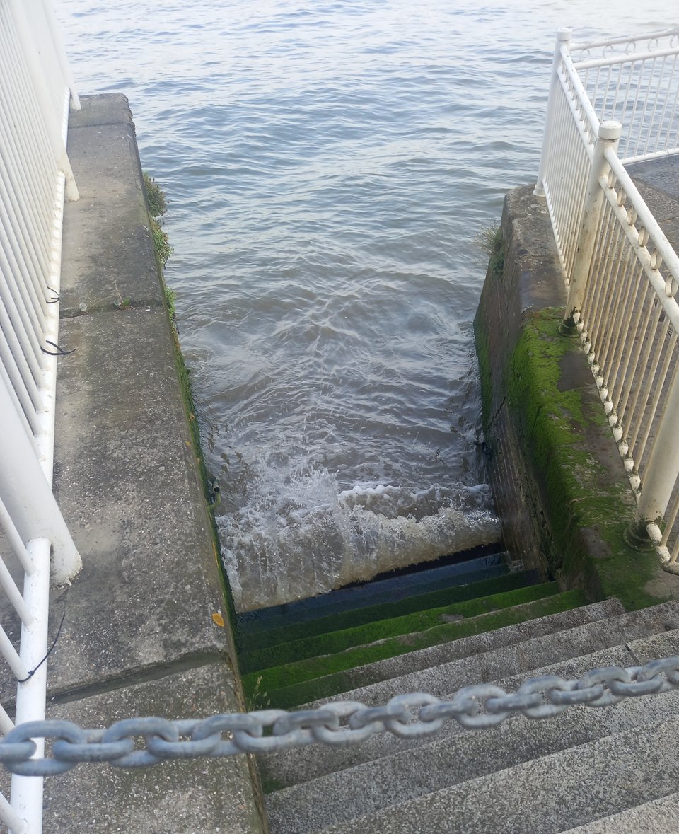
A tedious stretch of road walking with the river just out of sight took me through Wapping to reach Limehouse. Regent's Canal joins the Thames at Limehouse, and there are also weed encrusted steps that leave no doubt that these are definitely tidal waters.
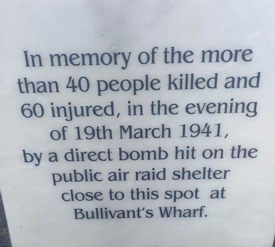
The Docklands area has been very attractive to housing developers since the 1980s, but so much fancy housing lining the riverside made for a rather dull walk. Only occasionally I stumbled on something that reminded me of the area's former incarnation, not just as a bustling port, but as a prime target for the Luftwaffe.
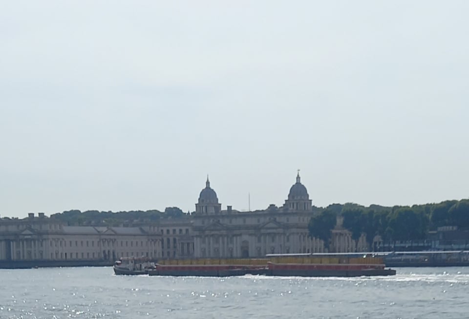
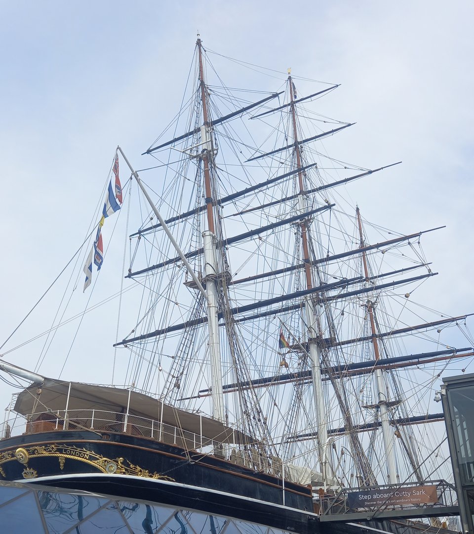
Long before I expected, I saw the distinctive sights of Greenwich - the Naval College and the Cutty Sark - on the opposite bank. And here, on my penultimate day, a novelty: having crossed over the Thames by bridge and on it by ferry, now I used the Greenwich foot tunnel to pass under it for the first time.
Arriving in Greenwich directly beside the Cutty Sark, I realised my attempt to beat the heat had worked a little too well. The early start, and the fact that this was a short stretch compared to some days' travel, meant I had arrived several hours before the hostel opened to guests. If I hadn't paid upfront for my stay, I might have considered pushing on to the end of the trail, but I decided it made more sense to find ways to pass the time in Greenwich.
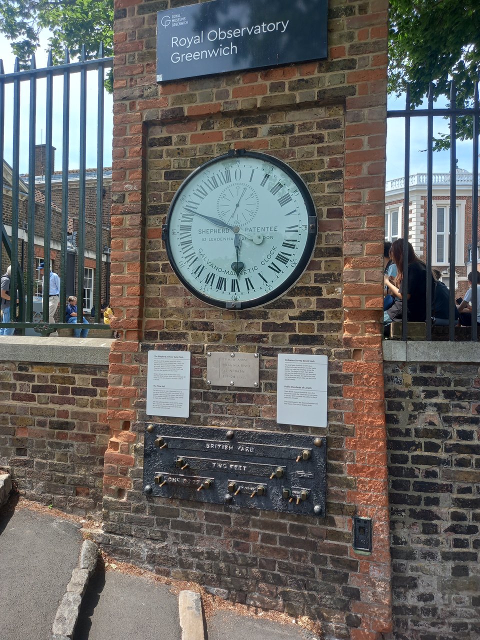
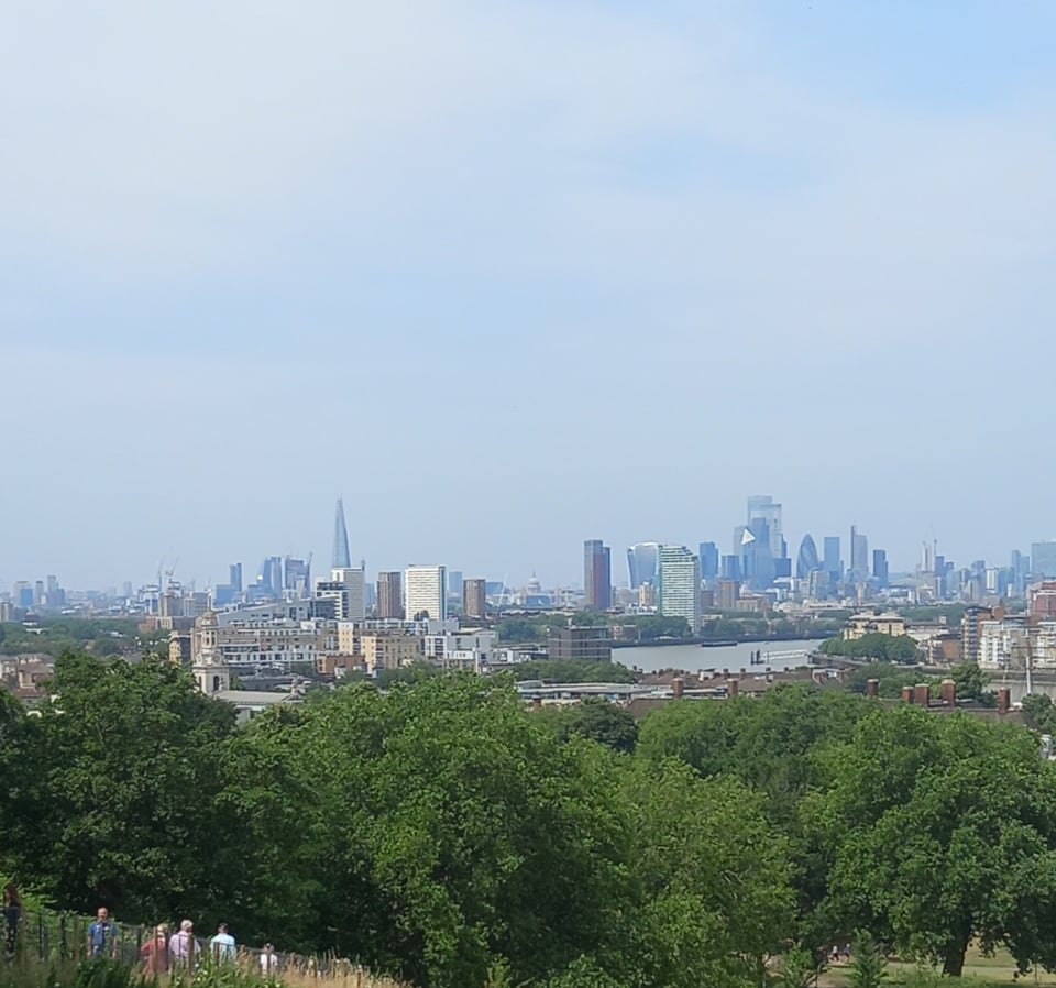
I had visited Greenwich with my kid twice, and half knew my way around, but a detour in search of a coffee shop gave me the chance to walk a little stretch of the southern bank that I'd missed. After a lengthy coffee break, I decided to walk up to the Observatory, a short walk, but mostly uphill. I was rewarded for my efforts with an intriguing 24-hour clock, as well as a stunning view from the lookout point.
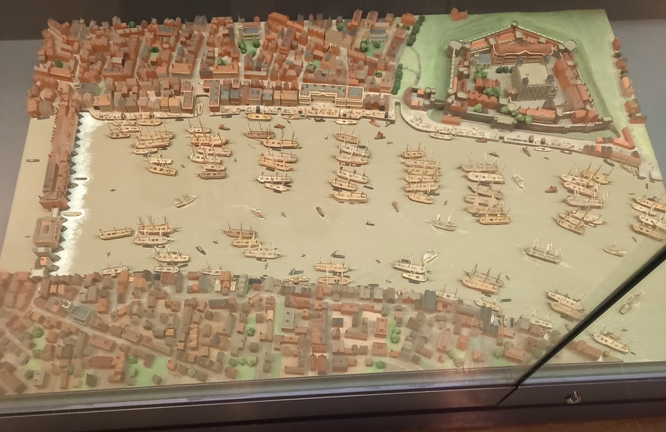
With time still to spare, I had a look round the National Maritime Museum, which had a fascinating exhibit on Maritime London. Then it was time to head to the hostel, relax in the bar, and try to plan some kind of celebration for the end of the trail.
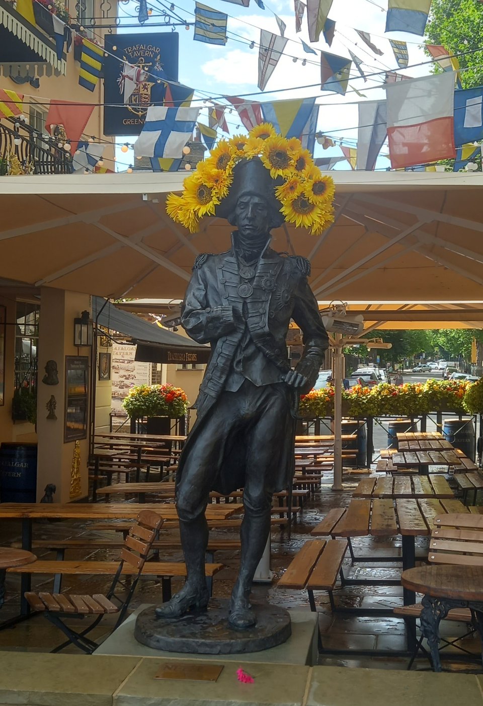
I dawdled on the final morning because I didn't want to finish too soon. But before nine o'clock, I was heading out of Greenwich, past the Trafalgar Tavern, where someone had improved a statue of Nelson by crowning him with sunflowers.
There weren't many miles to get through, but there were lots of bends - so many that I couldn't always tell which side of the river a particular landmark was. I had to walk around three sides of the O2 Arena, but I saw it across water long before I reached it.
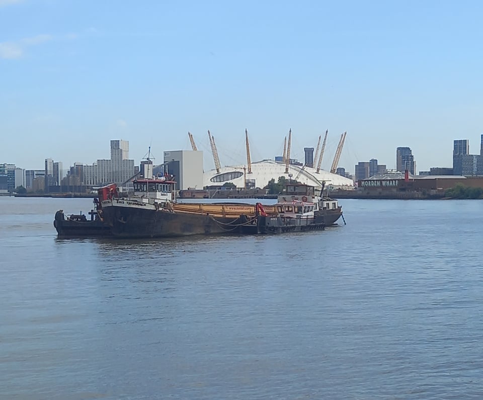
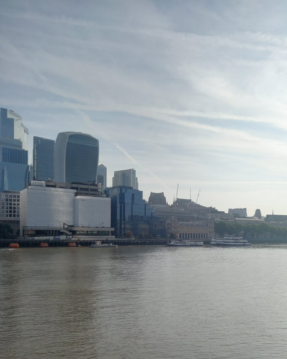
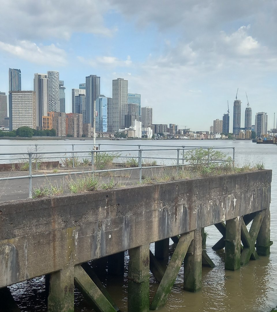
The river hadn't finished showing me its contrasts. While the northern bank was filled with glittering towers hosting big financial institutions, the southern bank had crumbling concrete wharves, presumably left without a purpose now that most shipping docks at Tilbury, and in the process of being reclaimed by nature.
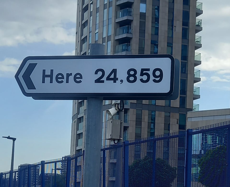
There are many intriguing pieces of art along that stretch, the first of which confused me until I found the explanatory note. It seemed to be a sign to "here", pointing out across the river. The explanation was simple: the distance was 24,859 miles, the Earth's circumference, which would indeed bring you back to your starting point. For added geographical significance, it was located on the Prime Meridian, the meanders having brought us back into line with Greenwich.
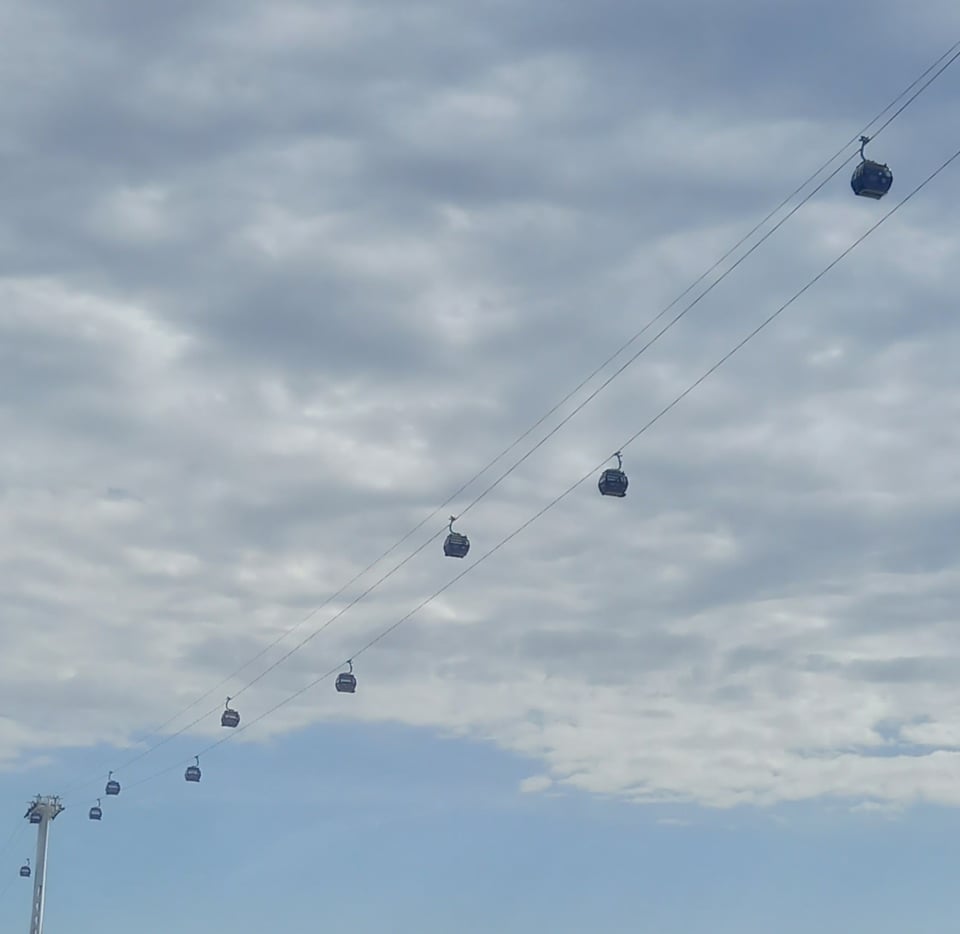
Just beyond the Arena, I passed under the most mocked Thames crossing, the "Dangleway" cable car. I rode it with my kid during the 2016 trip, when crossing the Thames was just an amusing diversion. As a practical way to cross the river, it leaves a lot to be desired, but as a novelty for tourists it can't be faulted. And it is a unique crossing, so I can't bring myself to condemn it.
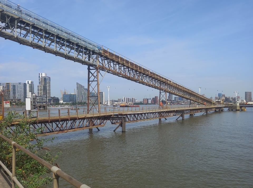
Another housing development gave way to more industry, this time a working wharf. A helpful sign explained that it was used to offload marine aggregate - sand dredged from the seabed for use in the construction industry - which was processed at the facility beside it.
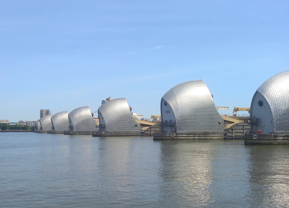
The trail used to end at the Thames Barrier, and the curved steel gleaming in the sun would have made a fitting endpoint. It even had a large logo from my old friends the Environment Agency on one of the administrative buildings. But now the trail officially goes a mile further, to the pedestrian tunnel in Woolwich, and I continued along the route.
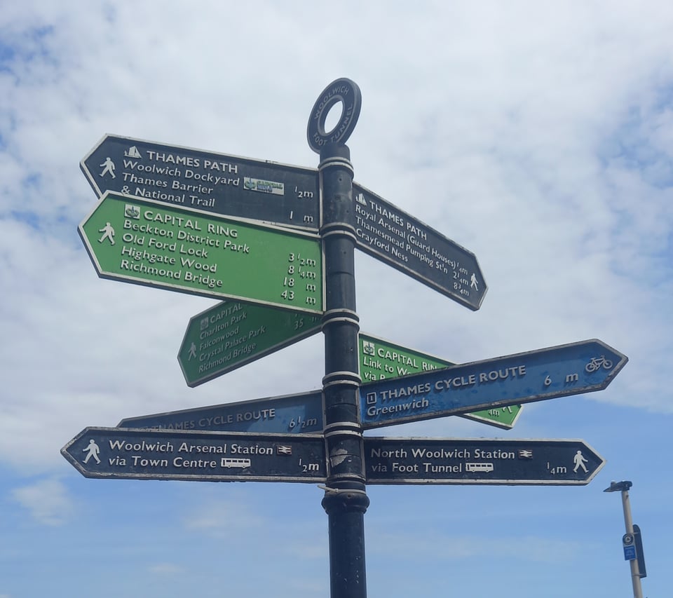
The signs became unclear at this point because there's a coastal extension, not part of the trail proper, that follows the Thames all the way to the North Sea. Officially the stretch between the Thames Barrier and the tunnel is part of the trail now, but the signs don't seem to have caught up. So it was rather disappointing to arrive at the tunnel entrance and find only a sign saying the trail started a mile behind me.
I headed north through the tunnel, hoping for some kind of sign to tell me the journey was at an end. But I began to realise that it was up to me to make my own ending. So at the northern tunnel portal, I took a picture, toasted my achievement with prosecco, and declared the journey complete. Then I headed up to the Docklands Light Railway station to catch what turned out to be a replacement bus into London.
An anticlimax? Perhaps. But perhaps after a journey like this, no climax could have done it justice. After all those quiet and lonely miles, perhaps a quiet and understated ending fitted better than any fanfare.
Miles walked: 223
Trail completed: 100%