Thames Path: Henley to Kingston
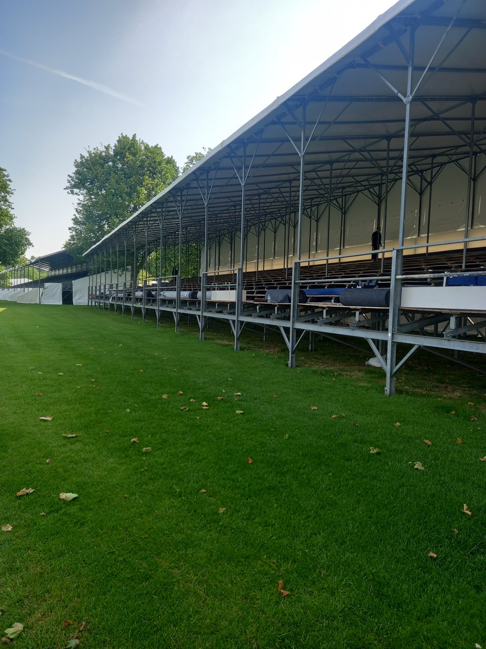
Apart from my kid's term dates, my other constraint was around Henley-on-Thames: I needed to pass through before the famous regatta brought in so many tourists it became impossible to find accommodation. It's still several weeks in the future, although they were already hard at work installing temporary stands in preparation when I passed through.
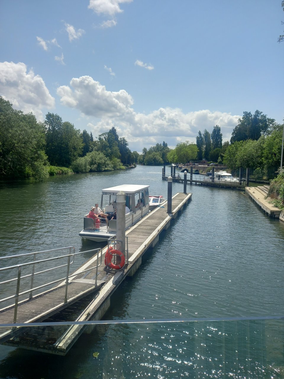
My campsite was two miles outside town, and on the opposite side of the river so I couldn't walk those miles as part of the trail. I opted to get a bus instead, which gave me time to linger in Henley, taking pictures of the ancient weight limit of the bridge and admiring the sculpture of Isis - some kind of spirit of the upper Thames - on its upstream face.

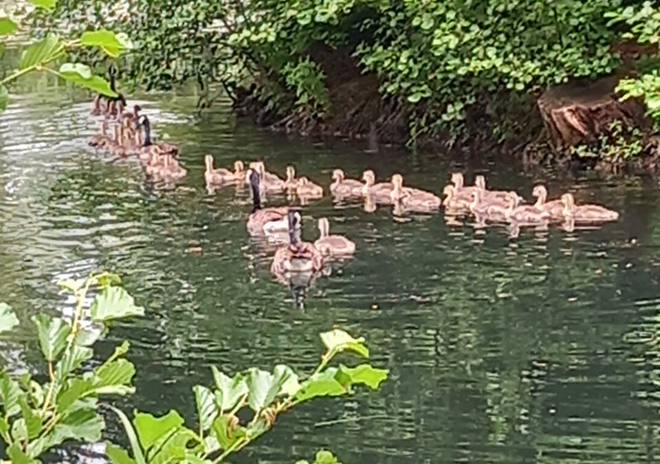
The campsite promised to make camping magical, and while I can't say it completely overcame the everyday irritations of the trail, it did offer a pond with a veritable flock of goslings.
My phone went on the blink, forcing me to walk back into Henley to find a pub with WiFi. It was a pleasant enough stroll in the golden hour, although I had to cross dozens of muddy little streams eager to join the Thames, and the bridges were annoyingly narrow at best and disturbingly rickety at worst.
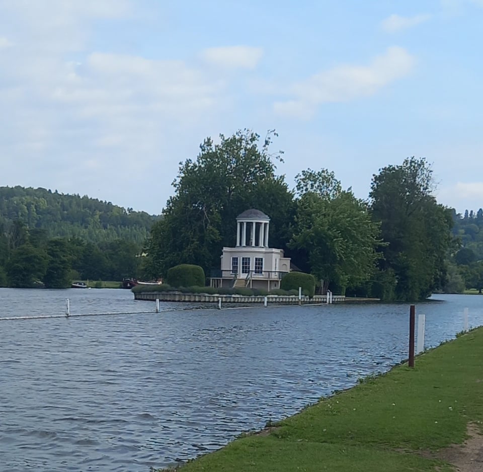
I made an early start the next morning, catching the bus back into Henley to pick up the trail. I passed the Regatta preparations as I headed up towards Temple Island, location of an odd little ornamental temple, and the starting point of the Regatta course.
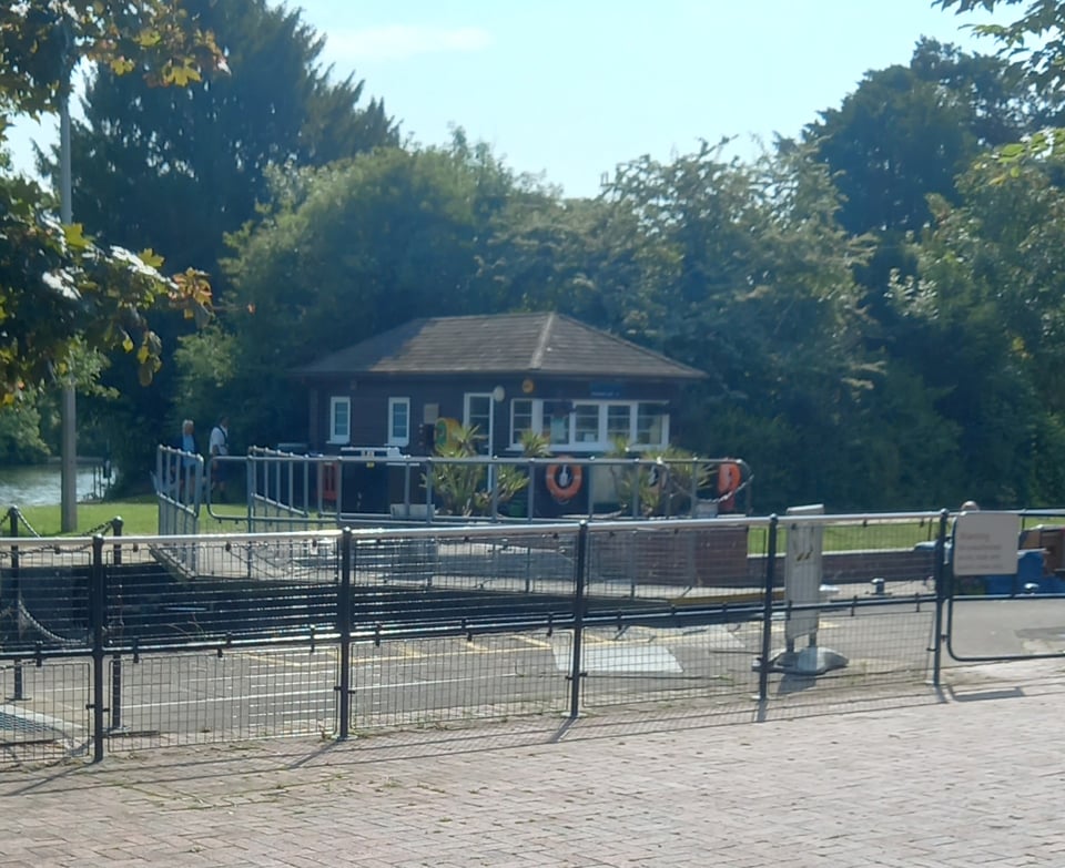
A little further upstream, I came to Hambedon lock, notable for being the starting point of the first ever Oxford and Cambridge boat race. There didn't seem to be anything at the lock to mark that fact, leaving just an unremarkable Thames lock.
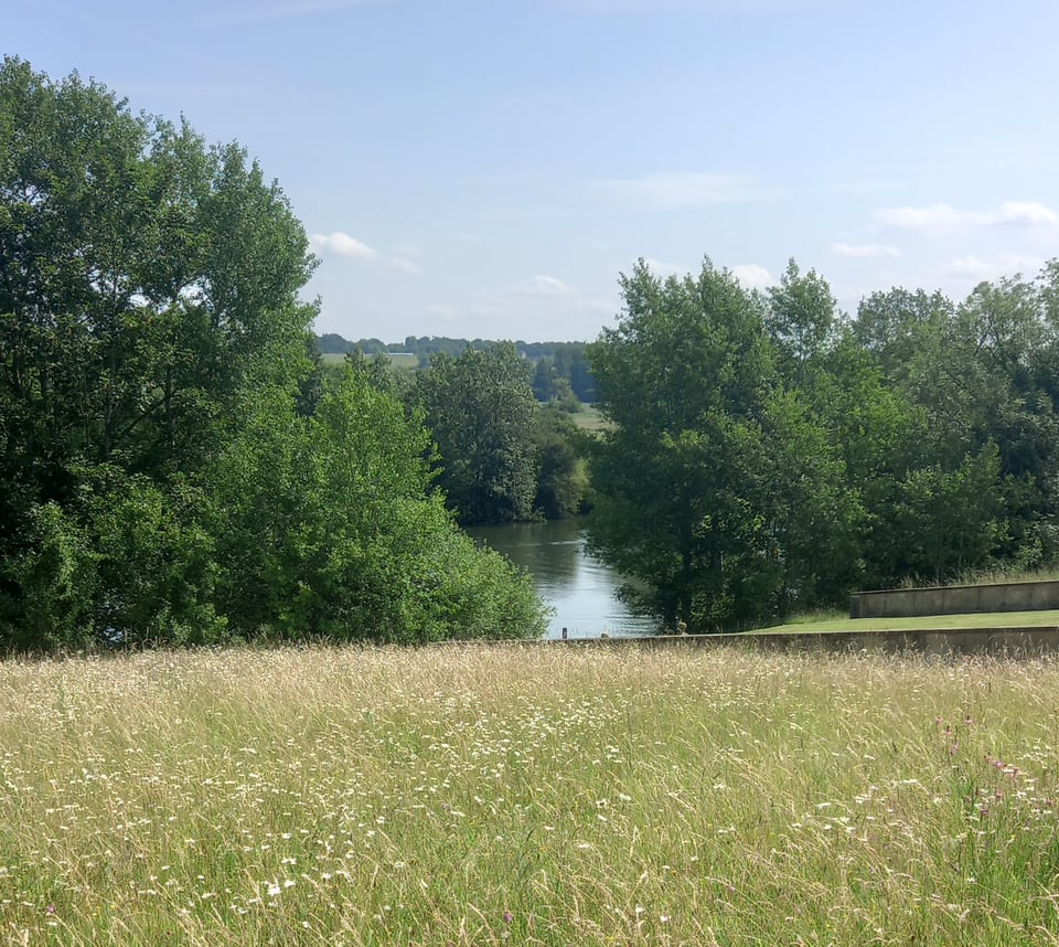
The path left the river at Aston and crossed some kind of sprawling country estate. It offered me some different views of the river, but not a great deal in the way of shade, and the heat quickly became oppressive. I'd booked into a campsite near Hurley, well short of the next suggested stopping point in Marlow, but even though it wasn't quite noon when I arrived, I didn't think I could walk any further.
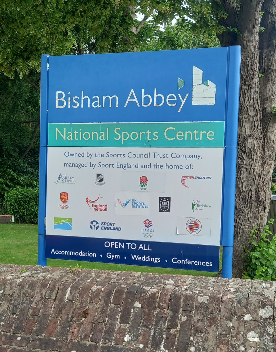
The next campsite was at Dorney Reach, just upstream of Windsor and a daunting 16 miles away. In the hopes of getting through the miles before the sun became oppressive, I packed up and left before half past seven, only to be hit with yet another bridge closure and a diversion through the streets of Bisham. This did let me pass the gates of the National Sports Centre at Bisham Abbey, but it also added miles, and I missed out on the Marlow Regatta, which seems to be a low-intensity alternative to the one in the neighbouring town.
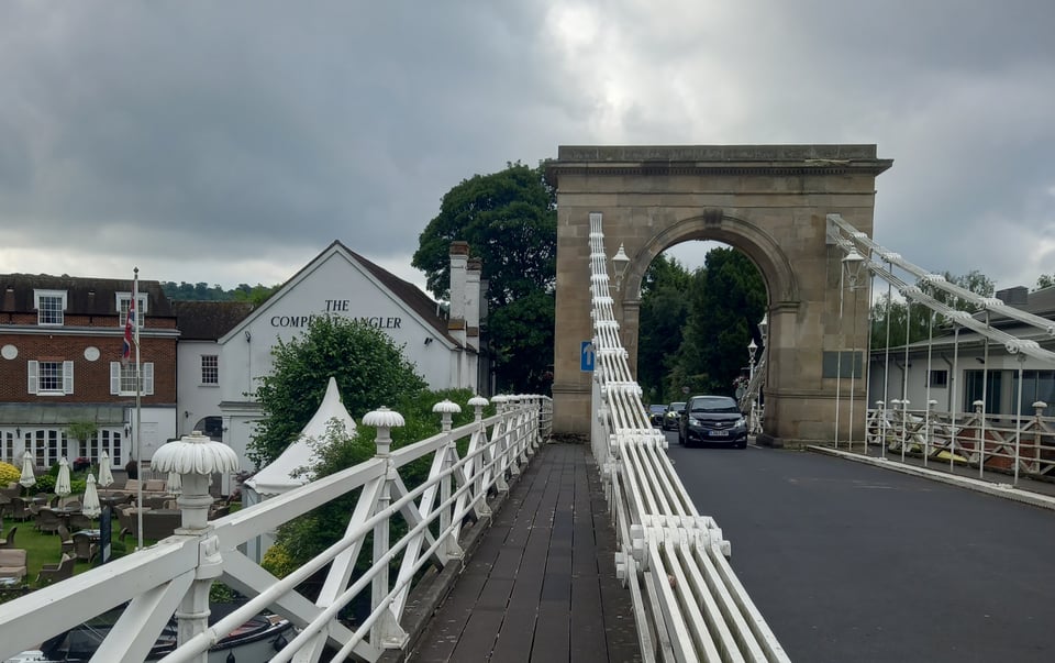
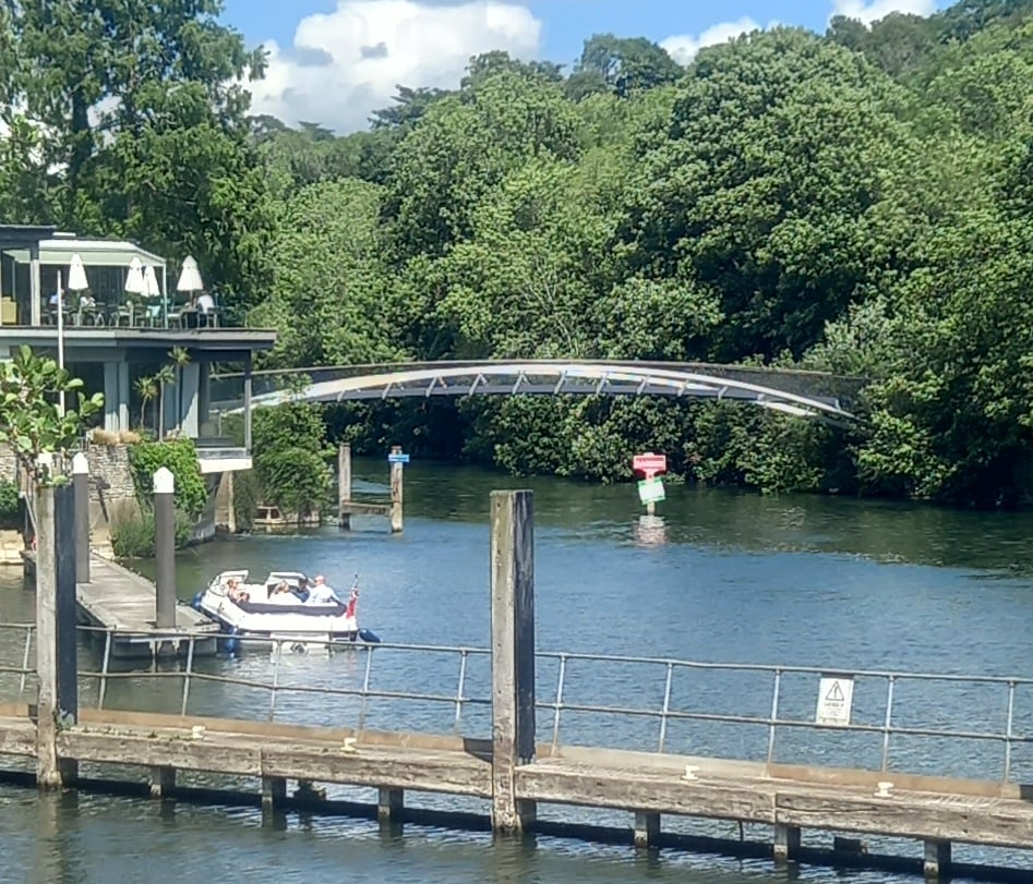
At a little before nine o'clock, I came into Marlow by the oddly miniature suspension bridge and immediately headed to Sainsburys to get the food I needed for the day. After a leisurely breakfast on a handy bench, I was ready to hit the trail once more.
I had definitely left behind the isolation of the upper Thames, and commuter villages and towns come thick and fast. The next place I passed was Bourne End, which if my memory serves is where Bernie Chadwick in The Franchise Affair took Betty Kane to his cottage on the river. I hope she enjoyed some of the river's beauty before Frances Chadwick gave her that richly deserved beating.
From Bourne End, I passed through Cookham, regretting that my budget wouldn't let me take in the Stanley Spencer Gallery as he sounds like a fascinating artist. From there, a stroll down a wooded path brought me to Boulters Lock. I ate lunch on a bench just above the lock and was ready to head into Maidenhead when I realised that my phone, despite the best efforts of my solar charger, was at critically low battery. So I stopped at the Boathouse at Boulters Lock, an extremely classy restaurant that still managed to be deeply gracious to a trail-stained hiker who just wanted to drink tea and charge his phone.
Having missed my chance to photograph the oldest bridge across the Thames, I made sure to capture the newest: a 2018 footbridge linking Ray Mills Island - where the Boathouse stands - with the eastern bank.
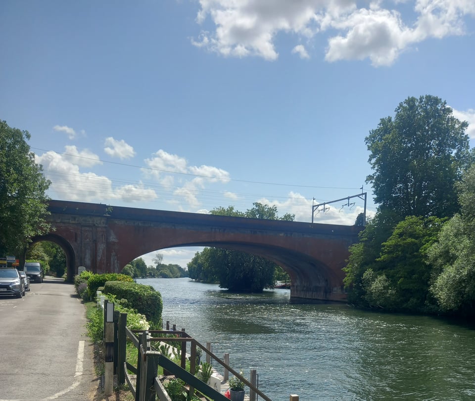
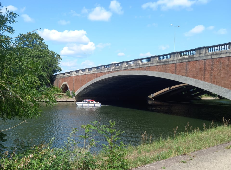
From there it was a straightforward walk into Maidenhead, the town Nick Hornby famously tried to pretend "had its own Tube station". The station is now served by Transport for London in the form of the Elizabeth Line, so perhaps he's finally technically accurate. Just before I passed under another beautiful Brunel viaduct, I had an amusing encounter with a young lady on a skateboard, who tried to avoid a collision by getting off, only to see her skateboard roll down the bank towards the river. Fortunately she was able to retrieve it before it went in.
My campsite lay just beyond Bray lock, almost literally in the shadow of the M4. The owners warned me about noise when I booked, but I actually find the hum of traffic almost soothing. Besides, after another 16-mile day, I was too tired to mind little things like that.
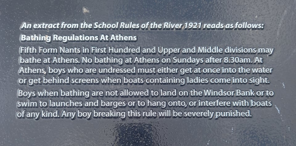
The next day started with an approach to Eton and Windsor. The one home to the boarding school of choice for future Prime Ministers, the other home to literal royalty. I passed the spot where Eton boys apparently bathed in the river, subject to stringent rules, of course.
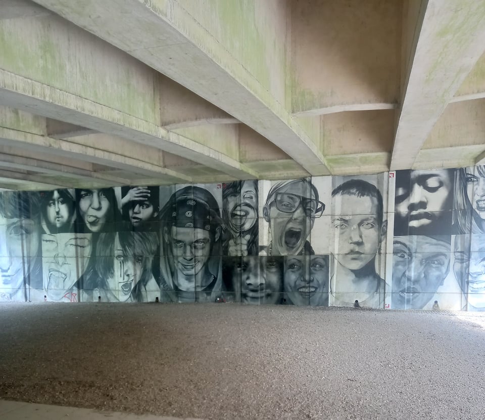
But there was still plenty to see that had nothing to do with the very privileged, like the intriguing mural of children's faces painted beneath a road bridge.
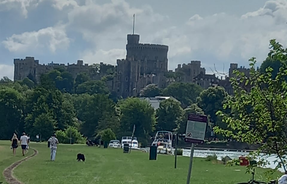
Emerging from a wooded section of the path, I was suddenly confronted with Windsor Castle looming above the scenery. It's an impressive architectural feat, whatever your feelings about its inhabitants.
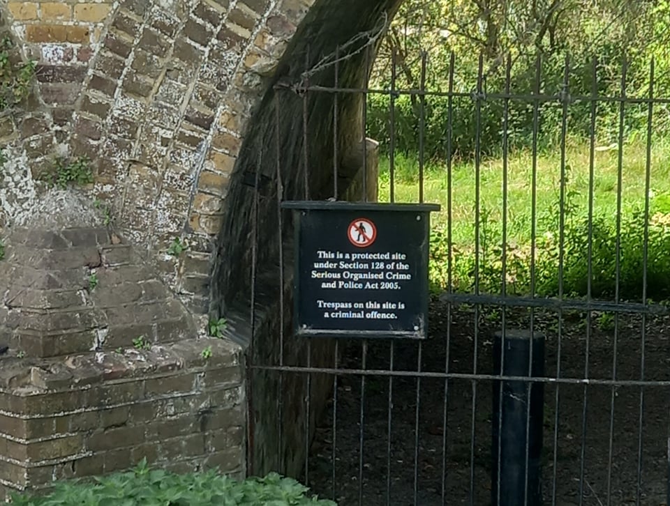
Not wishing to be caught in a tourist trap, I passed through Windsor as quickly as my pack and the heat of the day permitted. The castle continued to dominate the landscape for a couple of miles, both literally and in terms of the security surrounding a royal residence. I've passed many signs warning me off private property, but this was the first one that cited an Act of Parliament.
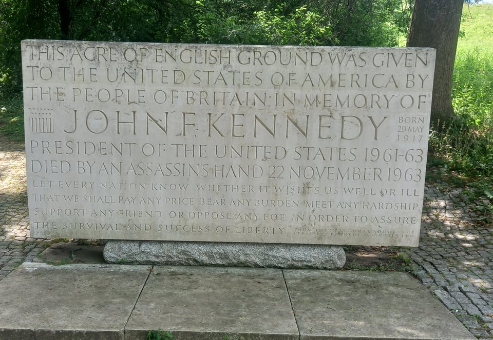
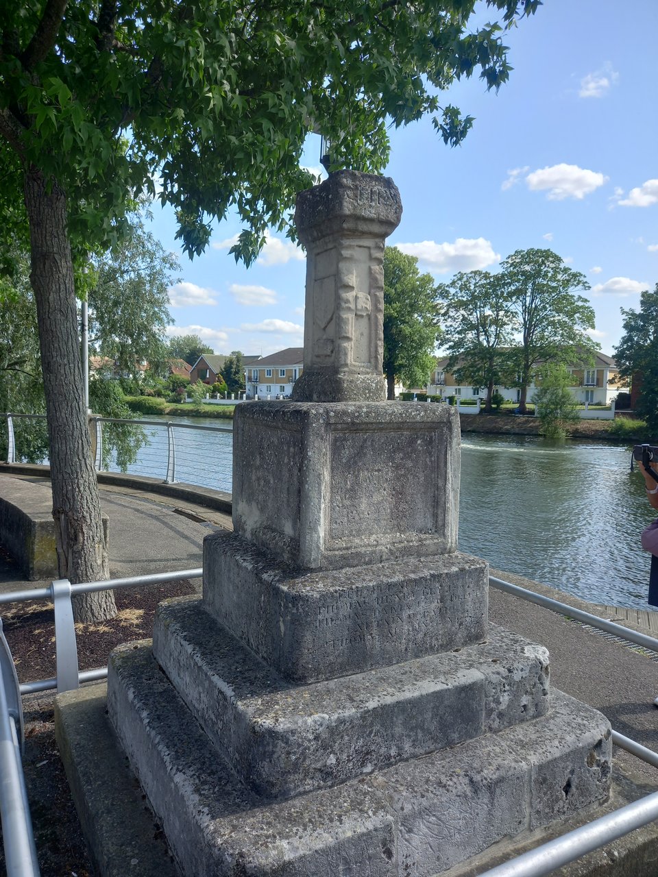
The detour enforced by those signs took me across Victoria Bridge into Datchet, a convenient place to get supplies, and then back across Albert Bridge. (Aww.) After a lunch stop at Old Windsor lock, I came to Runnymede, and discovered that I was arriving on the exact anniversary of Magna Carta.
I took time away from the path to look at a few of the monuments and walk through the acre of land donated to the United States in memory of John F Kennedy, rather fanciful referred to as "American soil".
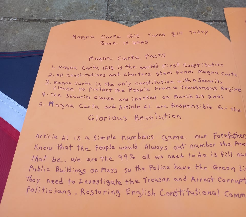
At the American Bar Association monument to the Charter itself, someone was working on what I initially assumed was a school project, until she finished it and I realised it was a birthday card. 810 years young! I suppose that's worth celebrating.
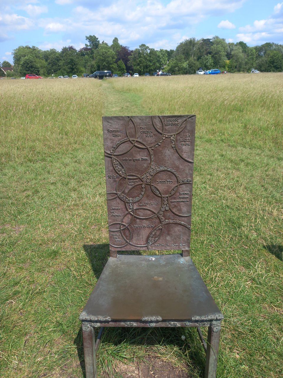
I wanted to feel a sense of history and grandeur, but the day was hot, there was no shade to speak of, and remembering the 800th anniversary celebrations in Lincoln made me fearful of the passage of time. Besides, I had a good deal more ground to cover to reach my campsite, so I paused briefly at the Jurors artwork, skipped all the other attractions, and plodded on.
I refilled my water bottle at Bell Weir lock and then came to a different kind of marker, modern and geographical rather than historical. I passed underneath the M25, the clockwise carriageway on a surprisingly attractive bridge, and found myself by some definitions within London. That saddened me in another way: while I want to reach my goal, I think I'll miss the trail when I leave it.
I trudged through Staines, where a replica stone marks what was once the limit of the City of London's authority, more evidence that I was coming towards an ending.
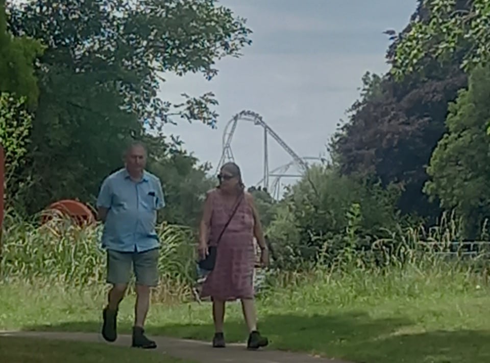
And then, taking my final rest of the day at Penton Hook lock, I realised that what I'd taken for a crane was actually a distant roller coaster - probably Hyperia - at nearby Thorpe Park. Since in another existence I screamed or didn't on the rides there, I was hoping to miss it until I was well rested, but the trail doesn't always give us what we want. So it was exhausted and saddened that I staggered into the campsite reception to pitch up for what would be my final camp of the trail.
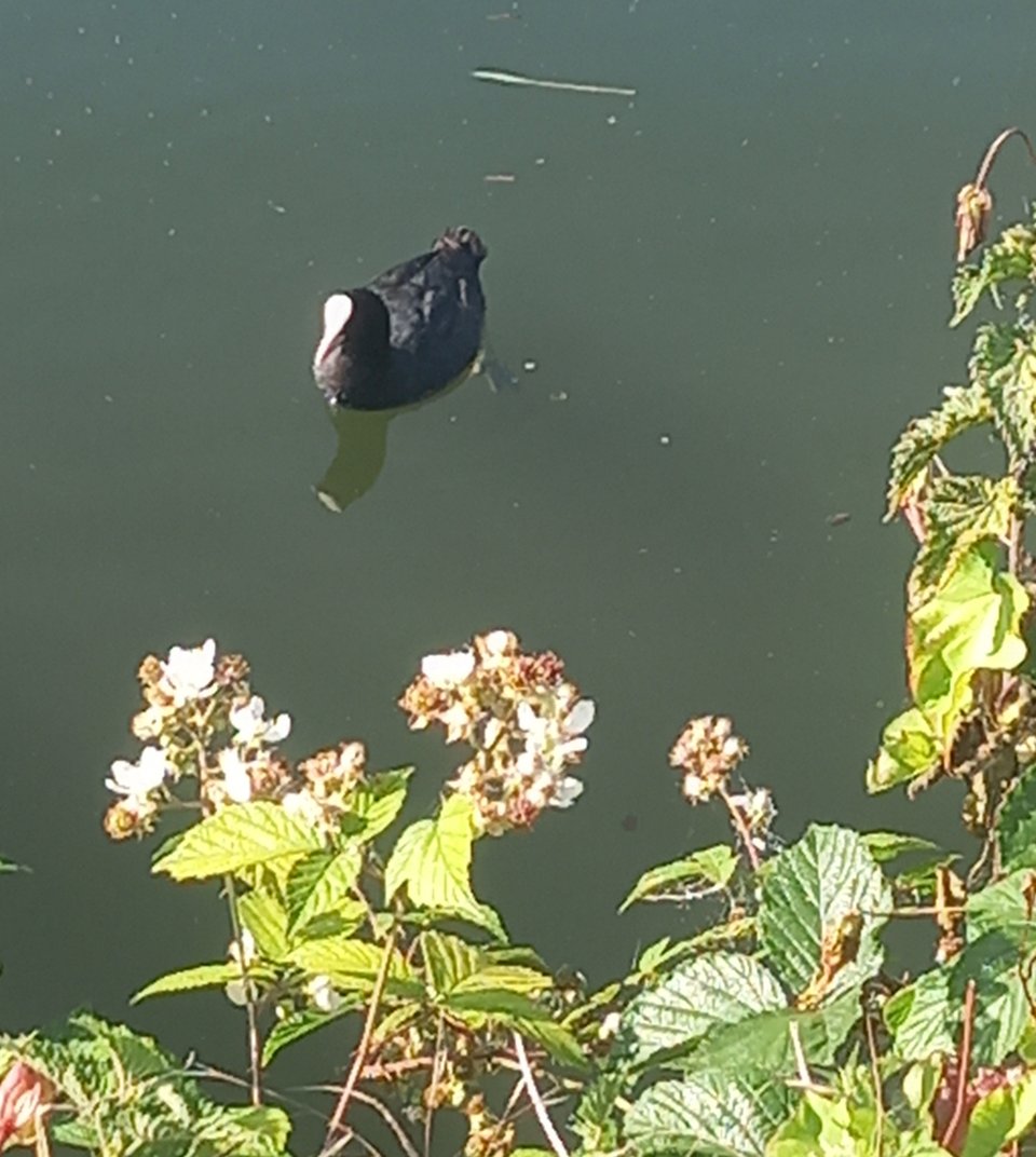
I took a rest and laundry day, partly because I'd run out of clean underwear but partly to put off the moment when I had to pack up my tent for the last time. When the dreaded moment finally arrived, I aired my tent for as long as possible before finally conceding the inevitable. I felt a little mournful as I left the campsite behind me, but the path soon brought new sights to take my mind off it. Even inside the M25, there's space for nature reserves, and I spotted what I'm pretty sure was a coot swimming close to the bank.
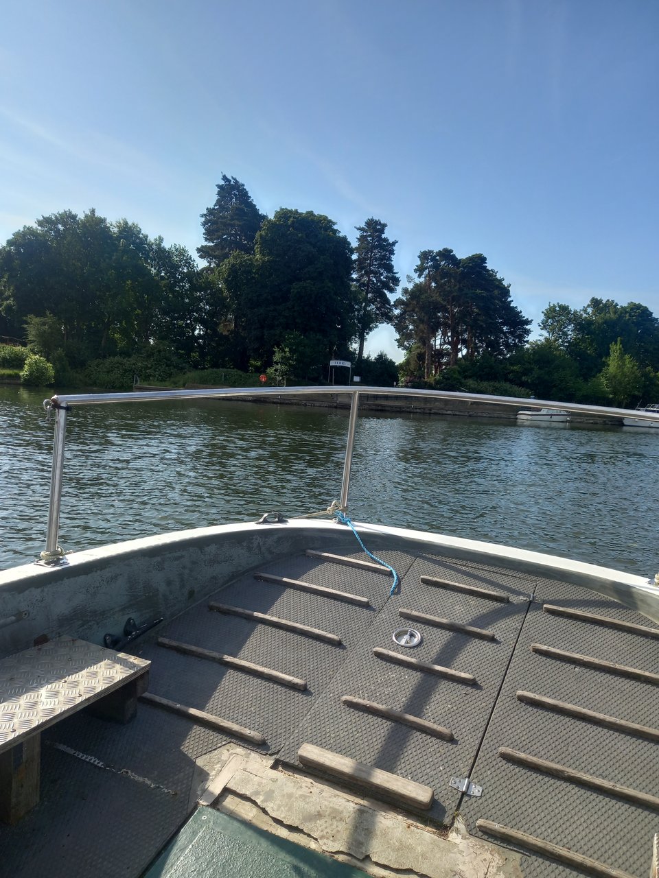
Just downstream of Shepperton lock is the only official ferry crossing of the trail, the Shepperton-to-Weybridge ferry. The guidebook says it's summoned by ringing the bell, but when I hesitated for a moment by the dock, the ferryman saw and approached me. It's a ridiculously brief journey, but still rather exciting to be on the water once again rather than beside or above it.
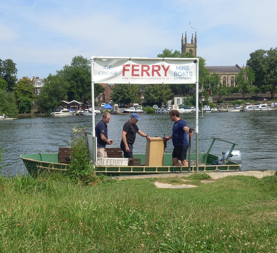
It was shaping up to be another hot day, and I was grateful that the path was mostly shaded through Walton-on-Thames and West Molesey. East Molesey was the site of another ferry crossing, the oldest on the river. I didn't take this one, but I did sit by the bank until it brought some other passengers across.
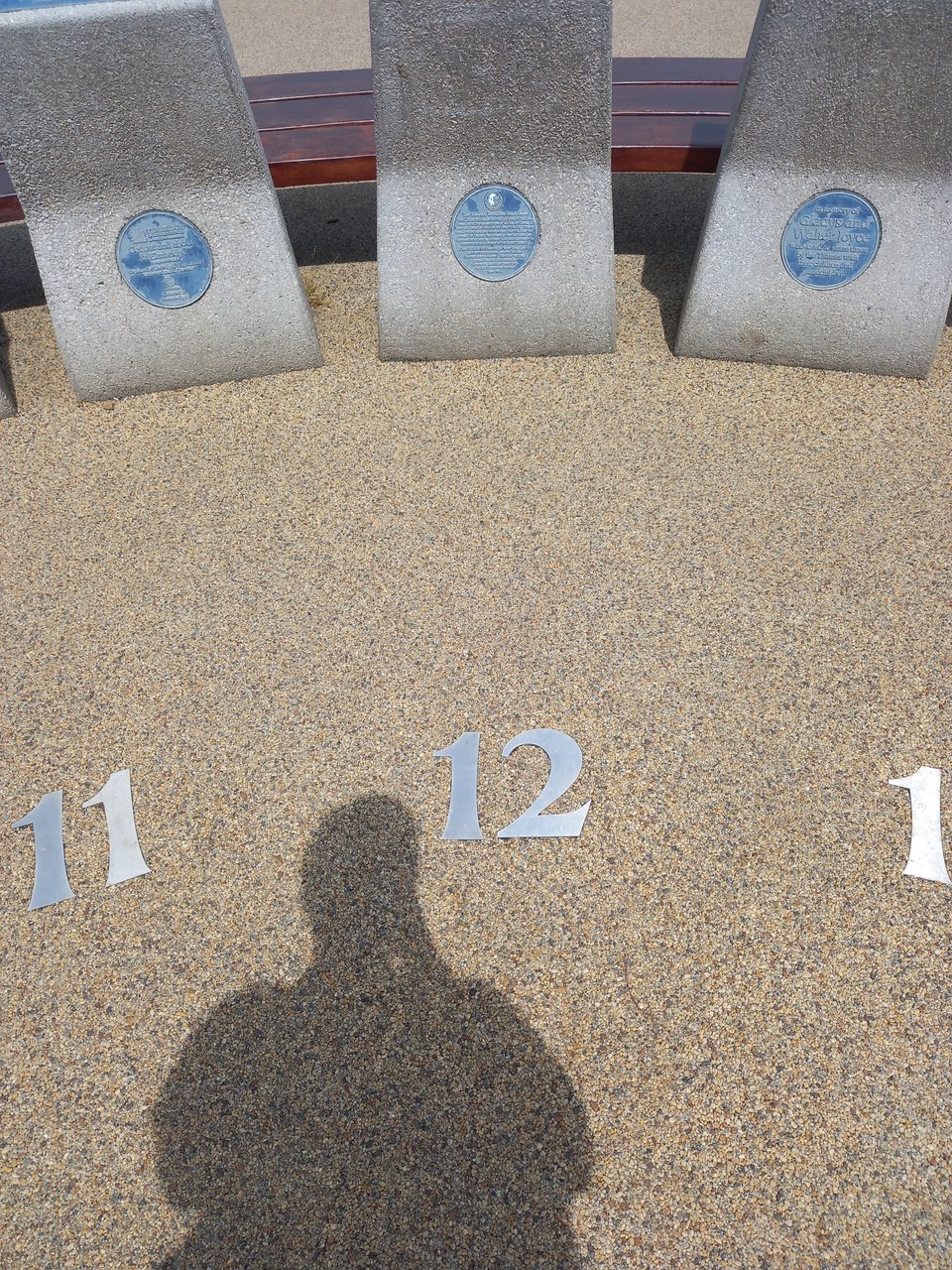
East Molesey had several fascinating sights, like the sundial where you use your own body to cast the shadow. I tried it out, and even allowing for British Summer Time, it wasn't particularly accurate, but it was a cute idea.
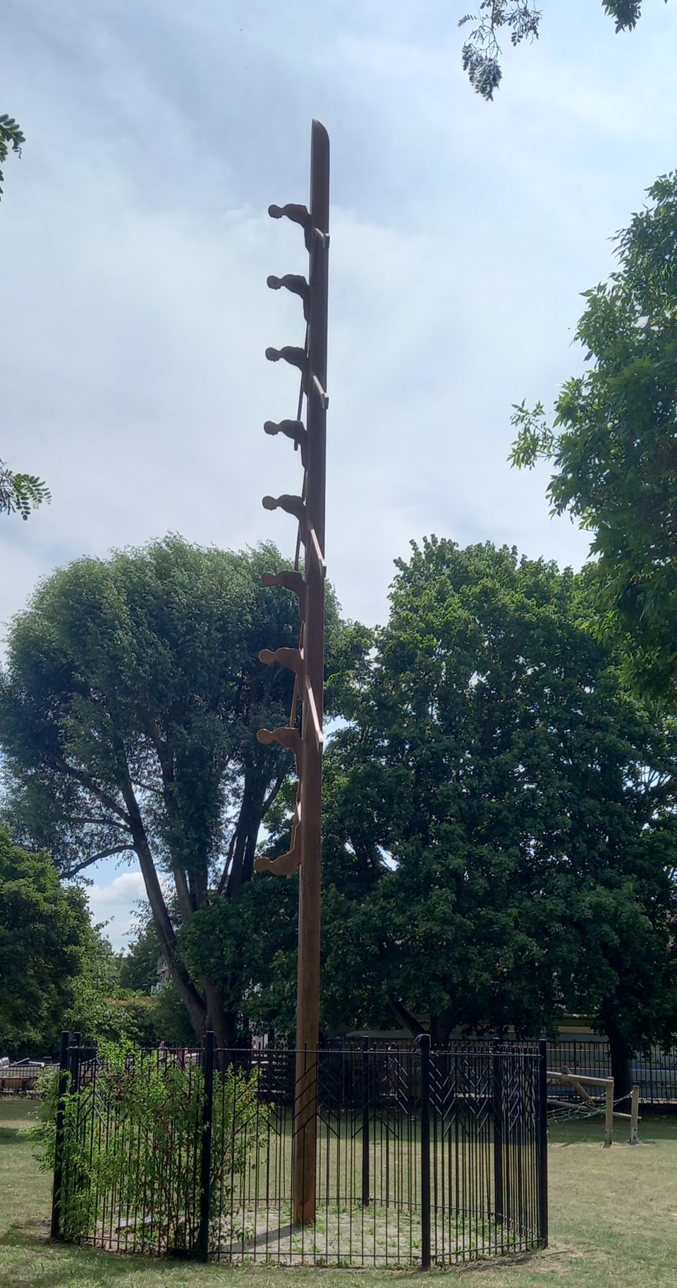
There was also an artwork that puzzled me for a while until I realised it represented a boat and rowers standing on its end.
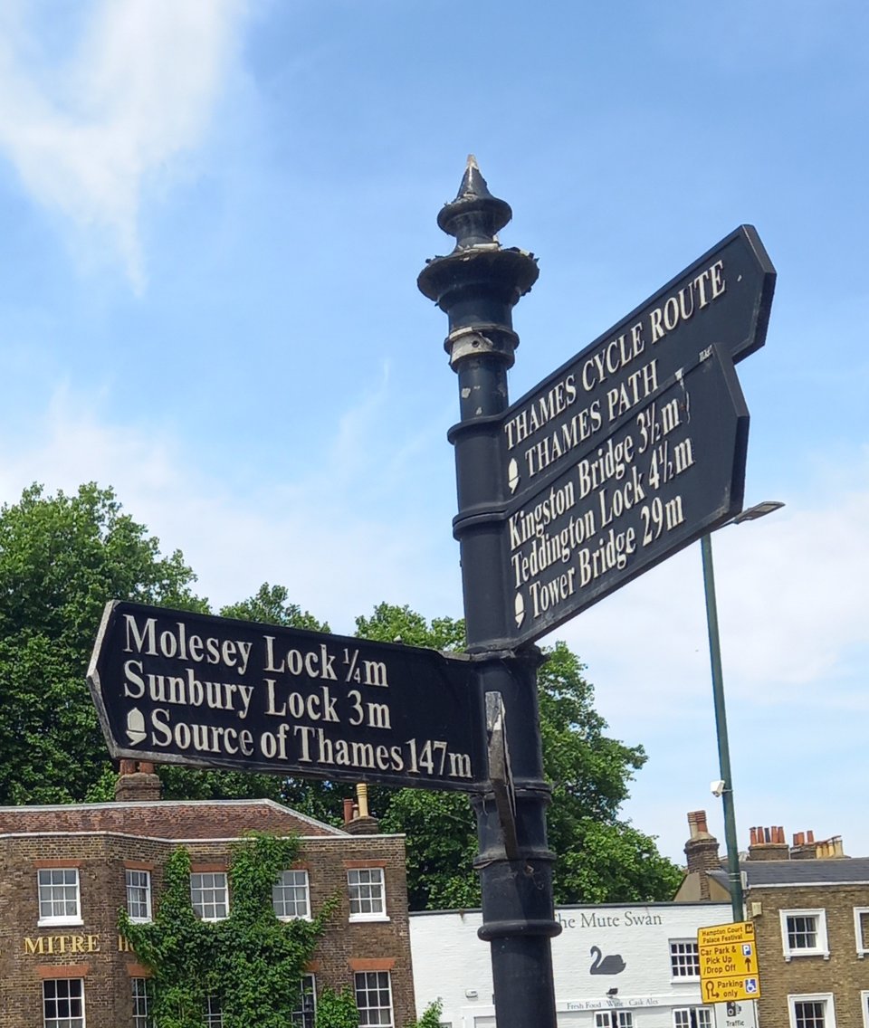
I had my lunch at Molesey lock, trying not to think that this was my last lock lunch. Then I crossed Hampton Court Bridge and came into the Borough of Richmond-upon-Thames, my first official step into London. As if to underline how close I was to the end, the signpost pointing back the way I had come included the distance to the source as well as to the last two locks.
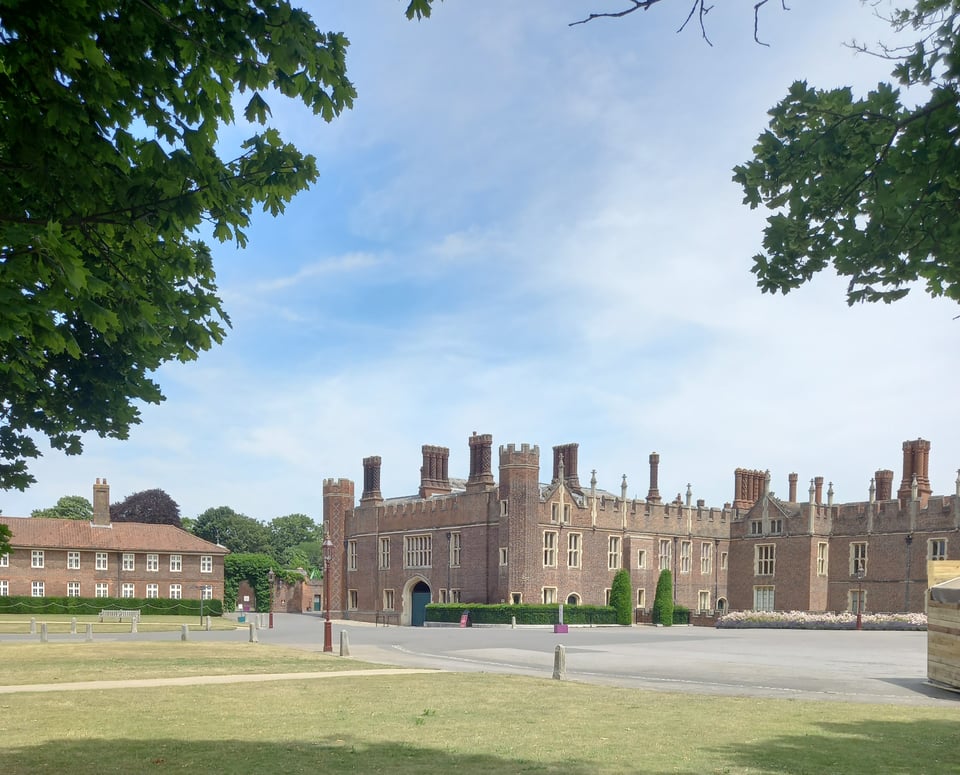
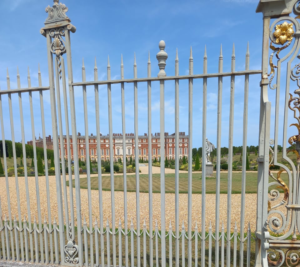
The path passed Hampton Court Palace, its gardens protected from riff-raff unwilling to pay the entry fee by not one but two metal fences, which made getting a photograph nearly impossible.
Then it looped around for several miles with inconsistent shade. My water bottle ran dry and the sun blazed down without pause. The river unrolled in front of me and it was a long and weary way before I finally came to Kingston Bridge. There, I left the trail behind and went in search of somewhere that could sell me bottled water before I made my way to my hotel.
Miles walked: 179
Trail completed: 82%