GovPossible Updates 11/22/2025 - Inspection Mapping
Permitting: Inspection Map
Hello everyone! We've added a powerful visual tool to the permitting module - the Inspection Map!
What's New?
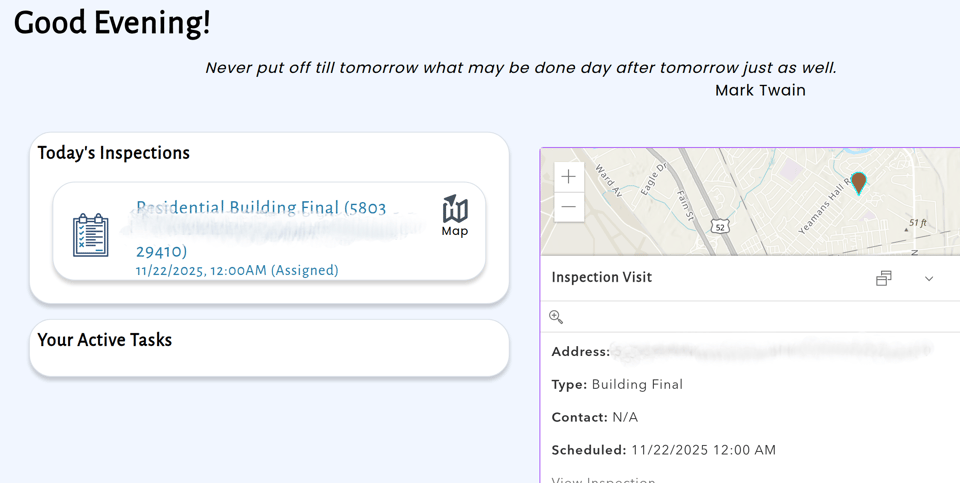
Inspectors can now view their scheduled inspections on an interactive map, making route planning and territory management much easier. Instead of scrolling through lists of addresses, you can see at a glance where your inspections are located and plan the most efficient route for the day.
How It Works
The Inspection Map displays each scheduled inspection as a marker on an interactive map. Each marker represents a property with one or more inspections scheduled, giving you a geographic view of your workload.
What You'll See
When you open the Inspection Map, you get: - Markers for each inspection location - Color coding to indicate inspection status (scheduled, in progress, completed) - Clustering for areas with multiple inspections close together - Property addresses displayed on hover or click - Inspection details available without leaving the map
Interactive Features
The map isn't just for viewing - it's interactive: - Zoom in and out to see different levels of detail - Pan around to explore different areas of your municipality - Click on markers to see inspection details - Access the full inspection record directly from the map