Along the North Channel to Little Current
Latitude: 46 degrees 01.864 N Longitude: 82 degrees 12.424 W
Hi all - I'm writing from Logan Bay on the east side of Clapperton Island in the North Channel. To be truthful this isn't the most picturesque anchorage we've been in but the wind made it seem like a good choice. It's a strong west wind so we had to beat upwind to get here, tacking often. It was an exhilarating sail in the sunshine over blue water with whitecaps and waves but no swell (i.e. no seasickness for me, yay). We thought the wind would die once we got to the island but as Andy said the wind was determined to show us who's boss and kept blowing even as we approached the anchorage. Note to self: low-lying islands, even when thickly forested like this one, do not necessarily block the wind. Fortunately it's quieting down now at 5 p.m.
Since my last post we have entered the North Channel proper and now have a taste for the cruising life and community up here. This part of Lake Huron is more mountainous than the bare low rocks of Georgian Bay, and the sailing is generally smoother because Manitoulin Island provides shelter from the winds and swell of the open water. We immediately notice more boats enjoying what the local guide books proudly call the best freshwater sailing in the world. There is a surprising number of Americans. Most boats fly a large flag off the stern for their home country and a smaller "courtesy" flag if they are away from their home country, so you can recognize the Americans by the telltale Stars and Stripes or by the smaller maple leaf flag fluttering in the rigging. As a rough guess I'd say about 70 percent of the boats are from the US.
Continuing from the last post, here are some daily highlights.
Day 9: Bustard Islands to Beaverstone Bay. This was another open water sail but I must be getting my sea legs because I felt ok! I don't know where the name comes from, but doesn't "beaverstone" sound like a mythical object of great power?
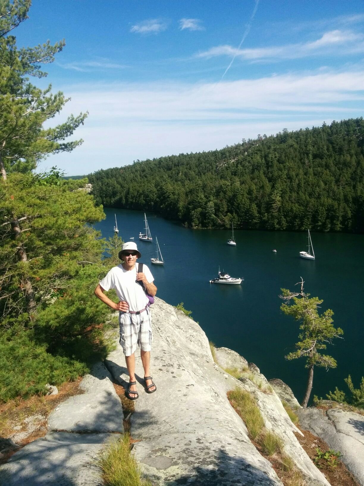
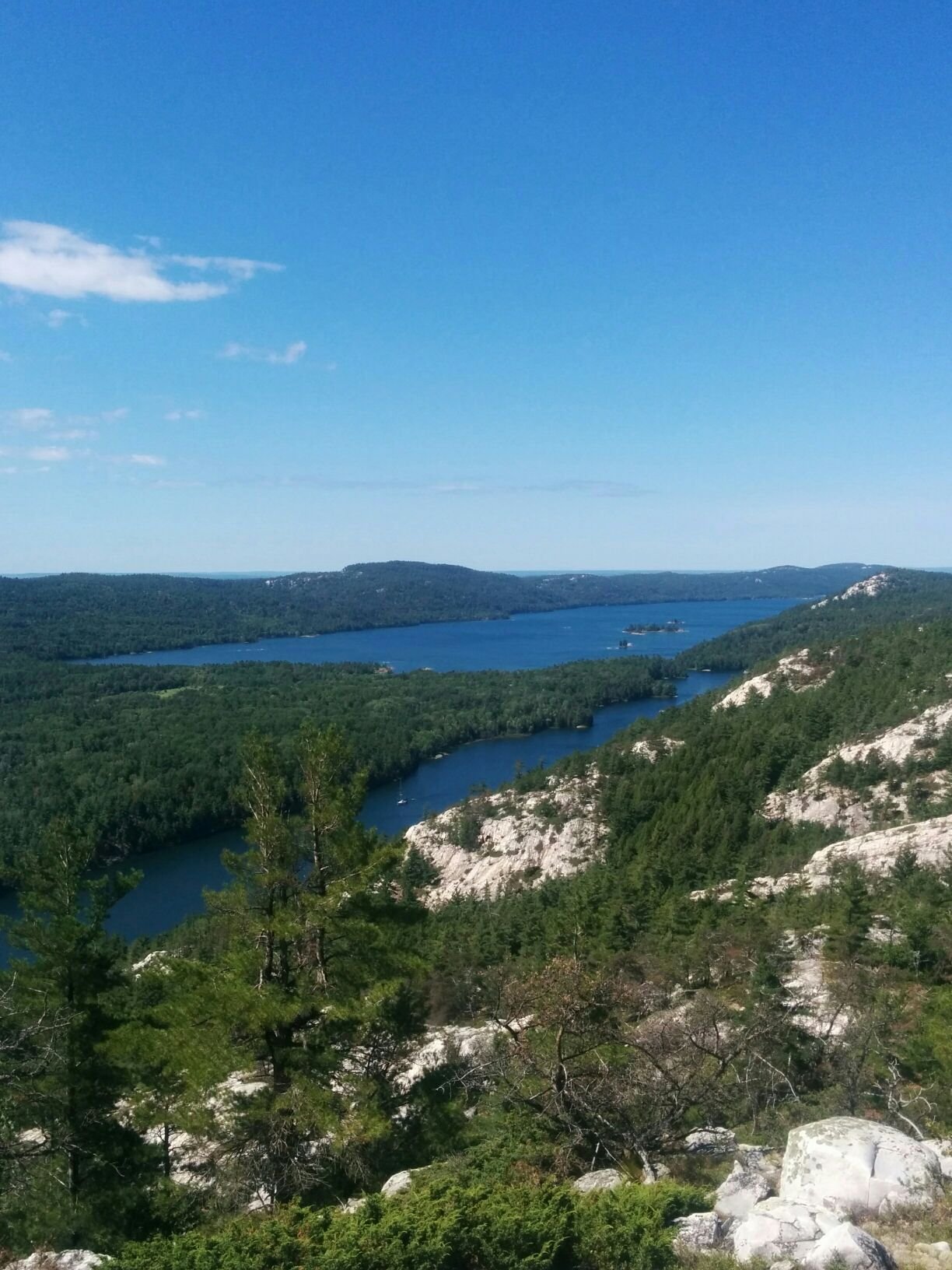
Day 10: To Killarney and overnight in Covered Portage Cove. The scenery is spectacular with the La Cloche hills of quartzite gleaming white in the sun. The tiny town of Killarney was fun to go through. We didn't stop this time but might on the way back. There is a long straight and narrow channel between the town and George Island just off shore, which you motor through dead slow, and admire the docks, cottages, marinas, church, liquor store (30 minute free docking for customers only), fish and chip shop, resort hotel, kayakers, canoes, power boats etc. It was a sunny Sunday and there was a lot of activity. We continued on to Covered Portage Cove which is an amazing anchorage. There's a striking rock face just at the entrance which we ended up anchoring near. The cove is tiny and surrounded by pine-covered hills and rock cliffs. There were about 10 or so boats here. We braved the mosquitoes and hiked up for a view.
Picture: Andy with Covered Portage Cove below
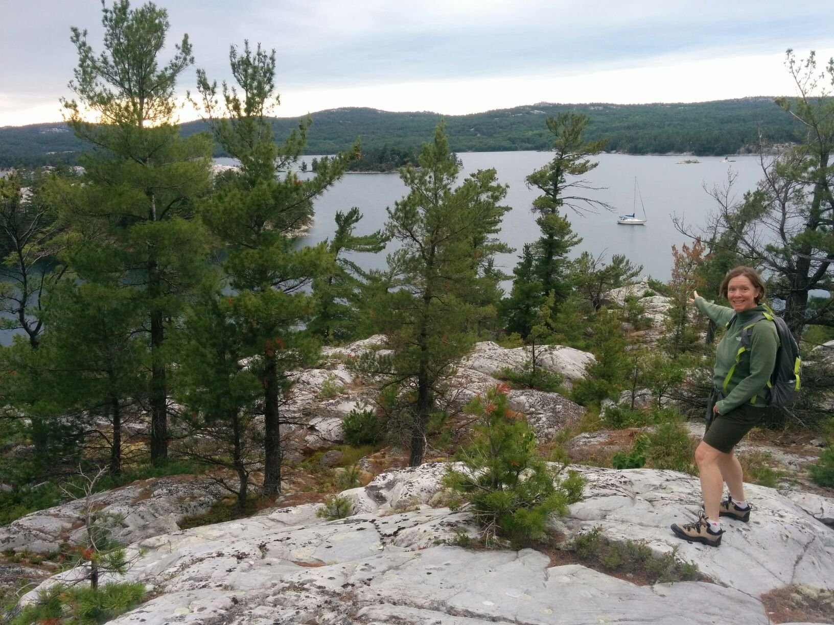
Day 11: To Frazer Bay, Blueberry Island. More rocky cliffs and pine forests. We were around the corner from an astonishing 8 power boats rafted together facing out from shore. It must have been a club outing. They look like a circle of muskox ready to intimidate anyone who approaches. Our first attempt to anchor in front of them failed so we checked the charts and decided to go around the point where we found a lovely spot and were all alone. Hiked up to a rock bluff for a view. The forest is open with exposed clean white quartzite and soft moss-covered rocks that look and feel like round green cushions.
Picture: Boat from bluff above Blueberry Island anchorage
This was the first day we remembered to turn the VHF radio on at 9am for the daily "Cruisers Net" that has been hosted by the same person Roy for 20 or so years, broadcasting out of Little Current. This was super fun for me as I just completed a short course on the use of marine VHF radio and am now qualified to operate the boat radio. The Net is an organized call-in period for all the boats within range to report their boat name and location. The host starts off with the weather, a few news headlines, and some sort of boat-related or local history story, and then invites boats from west to east in the listening range to call in. We listened a while to make sure we understood the protocol, and then Andy reported in.`"Good morning, this is Heartbeat, Heartbeat in Frazer Bay." There are 90 to 100 boats calling in each morning and supposedly this number will continue to grow as the summer season peaks. It's very fun to hear the different boat names. My current favorite is Mossy Paws.
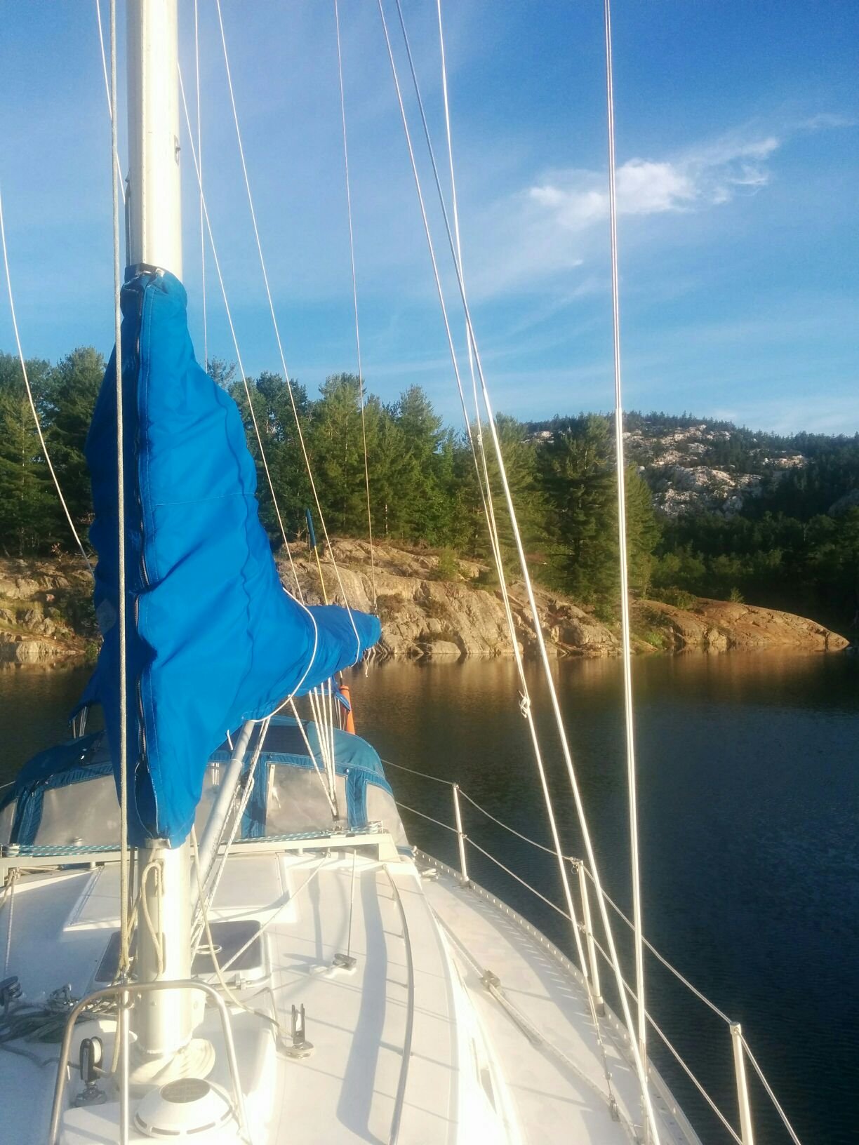
Day 12: The Pool, Bay Fine. Bay Fine is pronounced "Bay Finn" and it comes from the French for Narrow Bay. It is a long fjord-like bay with a very narrow tricky entrance that we motored through. The winds were right for us to sail up the bay which was lovely, about a 2 hour sail. There's a rugged rocky range to the north and a greener more rounded ridge to the south. We made a stately progress up the bay. We have an auto-pilot device, that we call Otto (of course), and when you are on the same tack with no obstacles it is a great way for the helmsperson to take a break. We turned Otto on and enjoyed our lunch with the rocks and cliffs sliding past. At the end of the bay you get to a "mini-fjord" and must motor up that to get to the ending which is called The Pool. It's surrounded on all sides by rocks and hills and according to our Killarney park map, has been a yacht anchorage since 1900. It's a jewel. We worried it would be crowded but it was not and we found a nice spot to anchor.
Picture: HB anchored in The Pool
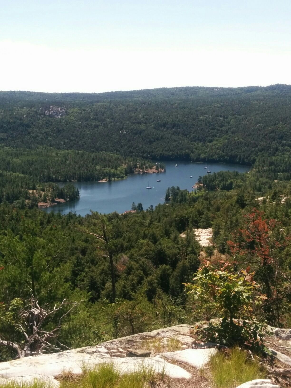
Day 13: No sailing. We stayed at The Pool another night and did a day hike up into the quartzite hills and swam in Topaz Lake which is green and surrounded by white cliffs and should be called Emerald Lake but I suppose there are already enough Emerald Lakes in the world.
Picture: The Pool from the ridge we hiked up.
Picture: Bay Fine and mini-fjord in the foreground. The Pool is not visible in the photo, but is below and to the left.
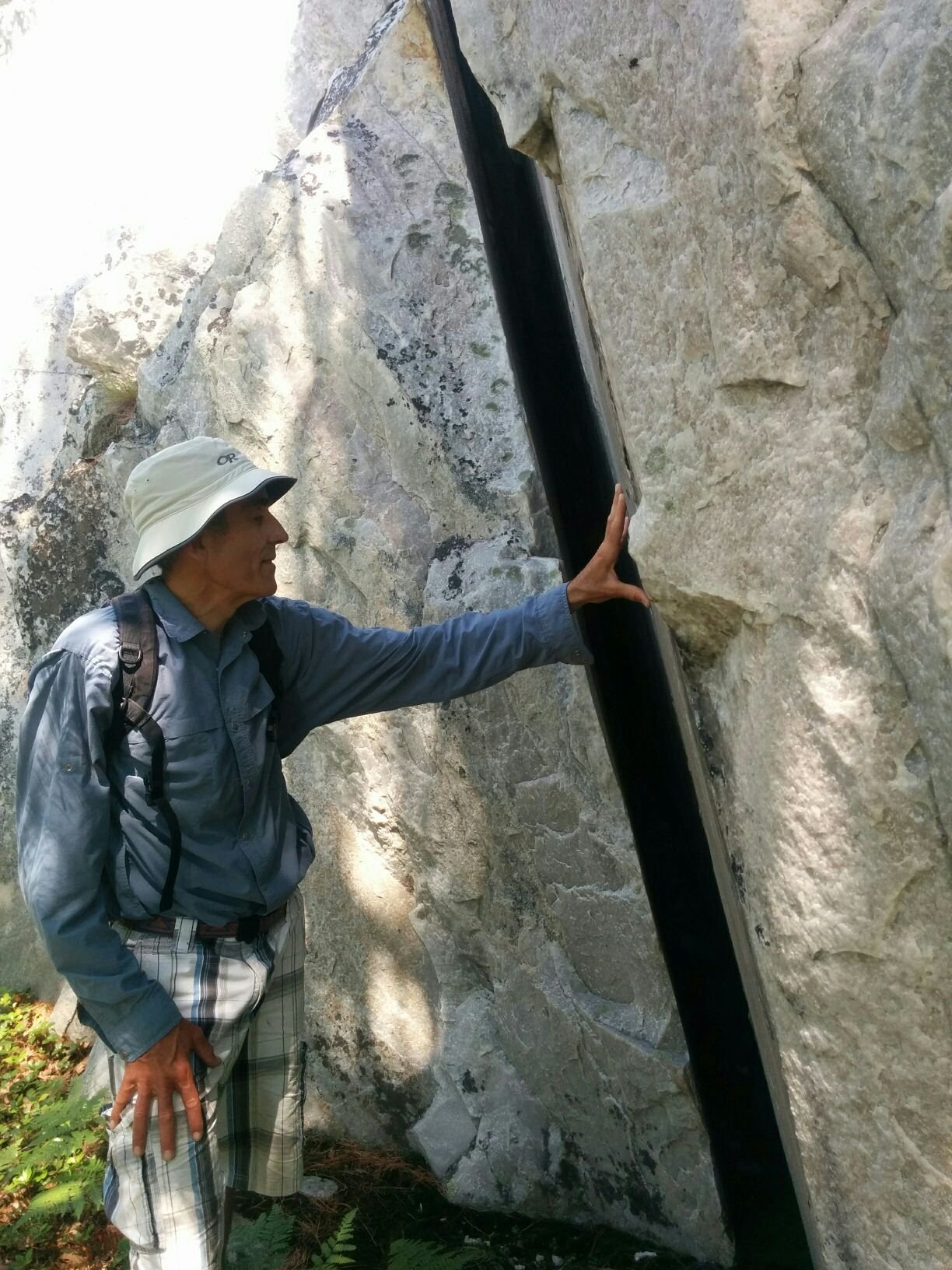
Picture: Interesting fault in block of quartzite
Day 14: Bay Fine to Little Current. Pulled up the anchor to find huge balls of mud and weeds on the line. It took a lot of rinsing later to clean up the anchor locker. We were so lucky with the wind - as well as being able to sail up Bay Fine a few days ago, the winds shifted so that we were also able to sail down the fjord today. As it is so long and narrow it would be nearly impossible to tack against the wind.
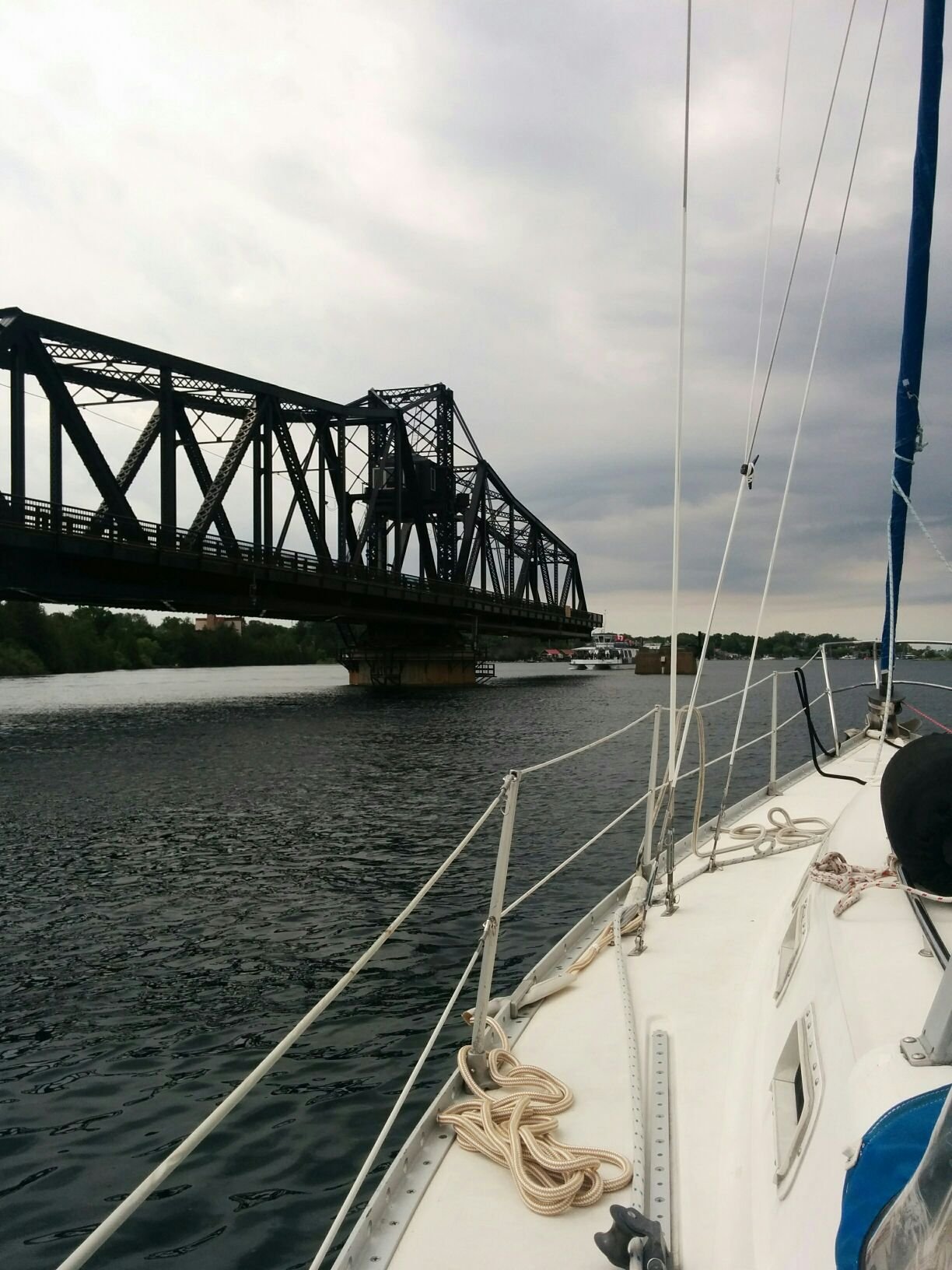
Today's destination is Little Current on Manitoulin Island where we will tie up at a dock for the first time since leaving Parry Sound. First we have to pass through a swing bridge that is too low for most boats to go under, and closed 45 minutes of each hour. On the hour it swings open by swiveling on its centre so that the road bed is now suspended along the middle of the channel, aligned parallel to both shores, and boats can now pass through on either side of it. As it takes time to swing open and shut there's only 5 minutes for boat traffic so you need to time your arrival carefully! We were glad there was only us going through at 2pm as we had to do a few circles while waiting.
PIcture: going through the swing bridge
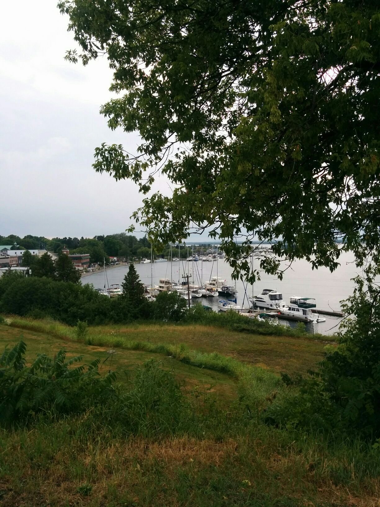
Little Current is well set up for boaters with town docks, water, power, showers, a boardwalk with flowers and picnic tables and trees for shade. We treated ourselves to ice cream cones and walked up the hill to get groceries. There was a dramatic thunderstorm that evening and I watched raindrops pound the water like so many bullets. We stayed overnight - cost is by the length of your boat, $1.75 per foot so just under $80 for our 36-foot boat. It's free for day use - we might stop on our way back.
Picture: Little Current town docks from Turner Park. One of those masts is Heartbeat.
The daily Cruisers Net VHF radio "show" that I mentioned is broadcast at 9am from the Anchor Inn so I went in person to see it. I got to be one of the volunteers who record the boat names and locations in a log book as they are called in. I didn't know how to spell half of the locations but I think the organizers will figure it out. The fellow who does this, Roy Eaton, is clearly much loved and respected by the community.
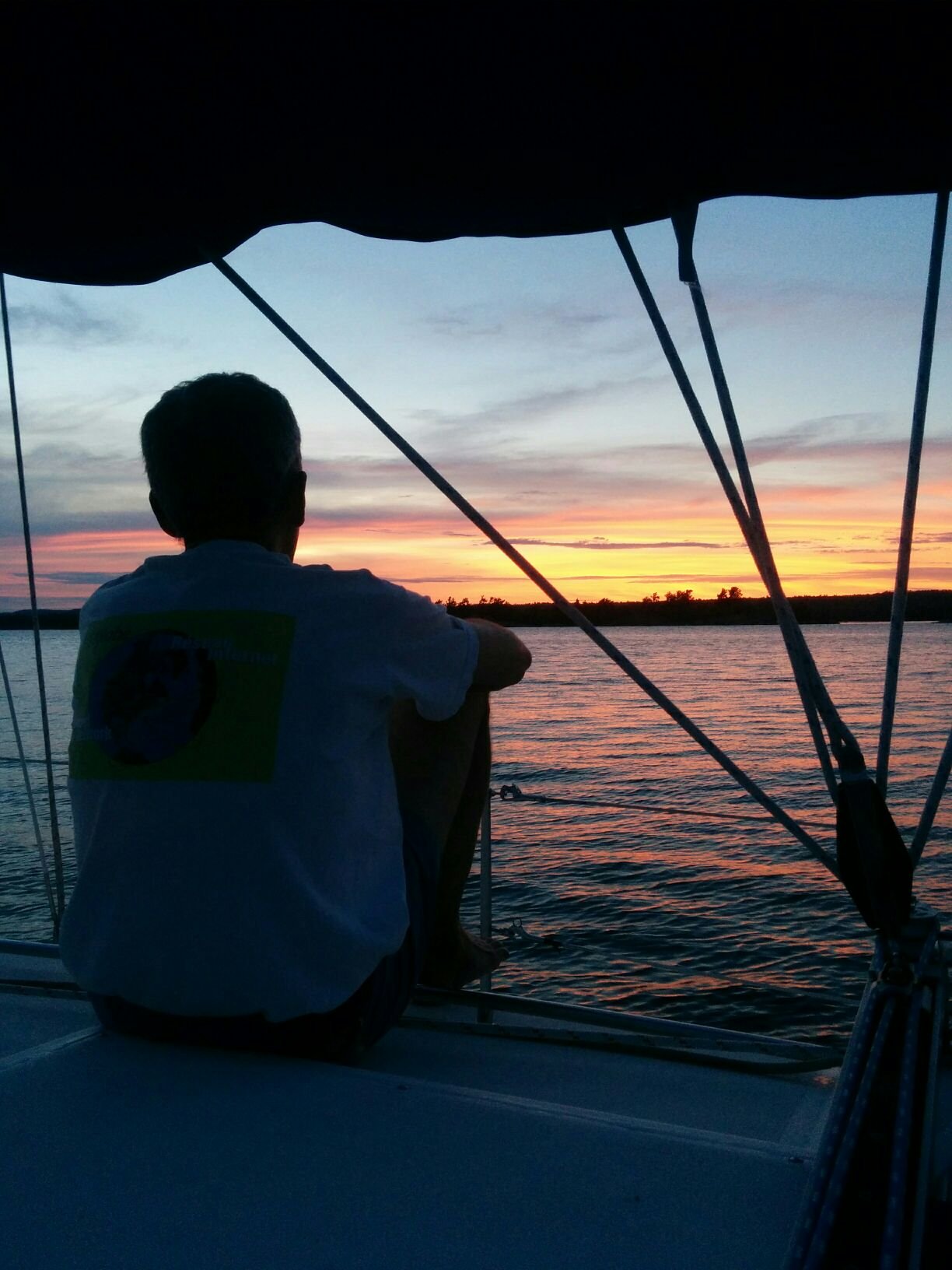
Day 15: Little Current to McTavish Island via the Waubuno Channel. Picture: nice sunset.
Day 16: McTavish to Logan Bay on Clapperton Island
And here we are! We have a few more days pottering around the North Channel before we must turn around and start making our way back.
The heat dome that has been causing the hot muggy weather is due to break tomorrow although we haven't been suffering much since we have wind while sailing and deliciously cool water for swimming in when we stop.
Oh, we got an update on our torn sail from the sail repair guy in Ottawa - apparently it was a "catastrophic failure" and cannot be mended. So, we'll be buying a new genoa sail next winter. But we've been doing fine on the trip so far with the other sails that we have.
Best wishes to all, from Danielle