Day 37: Matsuyama-Kumakōgen
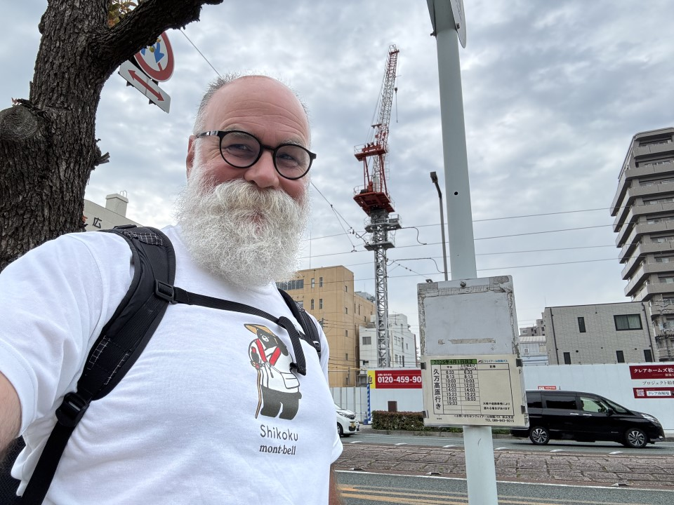
You’re never going to believe this, but I went down to breakfast this morning and ate the same stuff I ate yesterday, just less of it as last night’s Takashimaya sushi feast was pretty dang big… so yup, scattered sushi, coffee, dorayaki, and more juice. Yum. Afterwards, I retrieved all of the cosplay stuff from my room, returned it to reception, and then grabbed my pack and left by the emergency stairs (the elevators are super busy in the morning, so they prop those open for a few hours around breakfast time to make it easier to escape!). It was a short walk to the “South Moat” bus stop - yes, the moat around the castle, woohoo! - and a short wait for the bus to Kumakōgen.
The bus ride was uneventful, but as we got within 15 minutes of Kumakōgen, I noticed that the ticket price had increased beyond the price of a day pass that you could buy online, so I played a fun game of “can I buy a bus pass quickly enough to show it to the driver as I get off the bus?” Answer: yes! We have a winner - the bus driver smiled and laughed at that as he wished me a nice day.
As an aside, there aren’t a lot of guidebooks available that can help you plan this pilgrimage. The one canonically good is is the Shikoku Japan 88 Route Guide published in English by the Buyodo Co. Ltd., but it doesn’t offer any ideas on how to construct a viable walking itinerary. If you want that kind of help, there are two options in English that I’m aware of; there’s an app called Henro Helper that offers 42- and 49-day walking itineraries & there’s a book called 88 Temples In 55 Days written by a German guy who’s very active on the largest Facebook group that’s dedicated to the pilgrimage. I’ve basically done what I could to triangulate a reasonable itinerary using those two guides, but sometimes I really am disappointed in how unreliable or unrealistic they can be. Today was a good example of that; the app says 16.6 km, 740 m elevation gain, but the book says 14 km, 650 m elevation gain for what’s essentially the same itinerary, the one I walked today. And what does my Apple Watch say? 20.1 km, 860 m elevation gain. Go figure - sure, I did do some extra stuff here and there, but anyhow.
As I got close to T44, a tour bus pulled into the parking lot; pilgrims started walking uphill to the temple, and one or two of them became so focused on overtaking me that they forgot to purify themselves before entering the temple, hahaha. The overall feeling I got from the place was a general sense that it was a neglected place; the two urinals in the ancient men’s bathroom had small boxes attached to their flush mechanisms that were plugged into an AC power outlet between them. Um, what? I’m guessing it gets cold there in winter… maybe? Curious.

Now, I know you might be thinking tour groups, ugh, but they’re secretly awesome. Why? Two things: one, the custom appears to be that the calligrapher at the stamp office will always, always interrupt their work on getting all of the tour bus’s occupants’ stamp books done to help you, so they’re not going to hold you up. And two, this also means you’ll get to hear the sutras chanted properly as the guide does that professionally. Finally, as a bonus: without fail, those tour groups have been the friendliest, most polite people. If they aren’t inviting you to join in, they’re doing their best to make you feel welcome - or, in today’s case, a lovely older Japanese woman decided she loved my T-shirt with the pilgrim-bear on it and needed to tell me how cute it was. Cute!!
Leaving the temple, it started to rain for about five seconds before Nature decided that nah, let’s not do that today, shall we? Hey, works for me. There were some scary signboards warning about a dangerous trail ahead and MAYBE YOU SHOULD CONSIDER ALTERNATIVES but not seeing any other option, I kept going. The pass felt short and quick, but I think it’s just that all of this work is improving my ability to climb passes. The allegedly scary bit was on the other side of the pass, and COME ON ALREADY you have got to be kidding me, there’s still plenty of trail left and I don’t even know what you were talking about when you were talking about storm-tossed trees blocking my path or whatever…
The trail down from the pass to the valley was fast and easy; the old town at the base no longer has anywhere to sleep, but back in the day apparently they would have up to 300 people lodging there at busy times of the year. There was a small rest hut there with a large backpack; unusually for the pilgrimage, this bit involves a stretch of a couple k that feeds into a loop, so very like the Shinnen-an luggage storage hut from a couple weeks ago. Me, I’d booked a room at a minshuku that was just a bit further; I wasn’t sure if I was at the right place, so I asked a guy in Japanese if this was the inn; he answered in English (yay) that it was, and would I like to store my backpack in a locker there while I completed the loop ahead? Uh, hell yes, please! He even brought me a cup of water while I repacked everything and got ready to soldier on with my tiny Montbell day pack. Because it had rained earlier, I made sure to put my stamp book in my new dry bag and to take my water (because steep trail ahead) and a rain jacket, but I did forget my incense and candles, dagnabbit. Anyhow: all of the guidebooks warned about an infamously steep bit coming up just around the corner, but honestly it just didn’t seem that bad, at least not compared to, say, Switzerland or California. (The tallest mountain in Shikoku is 1,982 m; California is 4,419 m, and Switzerland is 4,634 m. The mountains here are beautiful, but on the whole the hiking has been moderate. As an example, the notoriously difficult walk from T11 to T12 is 11.5 km with 445 m of elevation gain, but walking up San Gorgonio near Palm Springs is 28 km with 1,676 of elevation gain.)
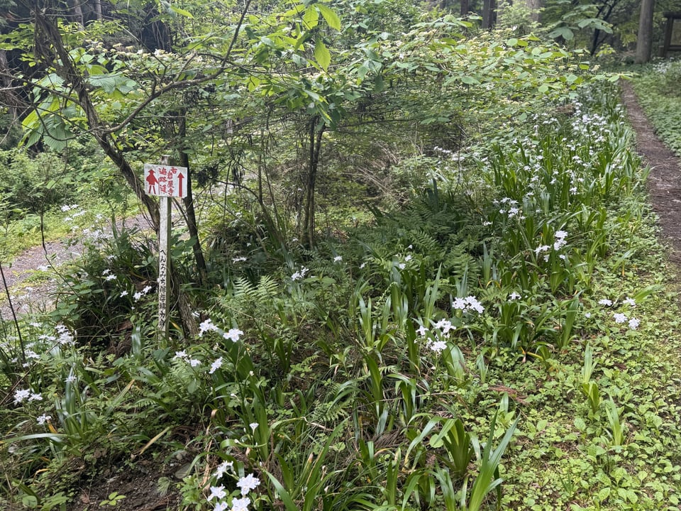
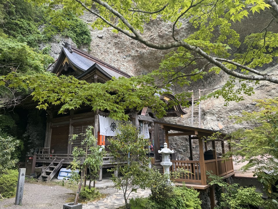
It was still overcast so there weren’t any spectacular views to be had, but it was a well constructed, well-used trail along the ridge until it eventually made a very steep descent down to Iwaya-ji, T45, a temple that’s built halfway up a steep mountain amongst a lot of really cool-looking rocks. Frustratingly, there are a couple of interesting side quests above the temple that require you to get keys or permission to visit them, meaning you’d have to go all the way down to the temple, and then back up again - yeah, that’s a no from me, sorry. One of the side quests is a visit to 36 stone statues, each of which has a small trash can (not used as a trash can, but rather as a place to store special name slips you can purchase at the temple office) and a flag next to it; I did put down my pack and try to get up to just one of those, but whoa, difficult - steep, with cables attached to rock faces and slippery trails. There really isn’t a way I could do that safely, especially as my left hand isn’t quite up to the task of gripping things tightly at the moment. It was fun to see what one of them would be like - so: maybe next time?
I could occasionally hear the temple bell being struck down below; I started to hear voices, some of them European, and eventually I made it down to the temple. There’s no wonder it’s considered one of the most beautiful on the trail; not only is in a spectacular location, but it’s got a bunch of bonus features. Scary giant wooden ladder that goes up the side of the mountain to a niche with a statue in it? Yup, did that. Dark cave with very dim lighting with a statue in that too? Sure, why not? A locked gate that takes you to a steep slippery incline with chains and rope you can grab onto to haul yourself up to a special ascetic training spot? Yeah no, not going to do that either today, thanks. There were an impressive number of pilgrims there today, mostly elderly Japanese who had made the long, arduous walk up from the parking lot far below - that walk would be hard for young people, much less the aged; I was impressed. I got my stamp and headed down.
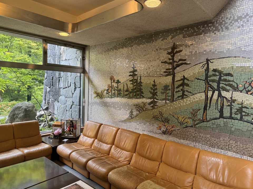
At the base, there were some souvenir stalls - a rarity - and then it was another few k on pleasant riverside trails, slightly uphill, to a very, very dated looking hot springs resort hotel that I believe was built by the Japanese government in the 1970s: Furuiwaya. I was getting really hungry - I got off one bus stop too late to get to a convenience store, so all I had was a stale red-bean doughnut and some “easy-to-drink yokan” - something like a energy gel shot, but Japanese - with me, but mostly I just wanted to see what the inside of the place looked like in 2025. They had a bag of spicy shrimp crackers for about $1, which hit the spot - and oh man, that hotel is not looking good but wow, classic in a very Bulgarian holiday camp kind of way. I mean, honestly, if this were in Palm Springs, you’d happily spend $30 on a cocktail there:
At this point, I was almost around the loop; it was a short uphill walk on a paved road (no traffic, just an access road for a water treatment plant) and then boom, I was back at the iris patch at the base of the steep part I’d managed earlier. So just a few more k and I was back at my inn; the friendly owner checked me into my room, offered the large, warm bathroom to get cleaned up (yes, thanks!), and then I just lay down and relaxed for a while. Today was tiring, but it felt good.
Dinner was a better-than average spread; only four guests tonight, a Japanese, an Australian, and an Irishwoman, so we chatted for a bit and I gave them what advice I could for hiking the Kumano Kodo. Interestingly, the two Westerners had never been to Japan before this week - it was wild (to me) that they started with such an obscure part of the country, but also ballsy of them. Respect!
And now I’m well fed, back in my room, and typing this newsletter. I’ll be asleep shortly, I’m sure.
Random notes: So many Westerners today! I wound up chatting with a couple of them who’d been walking together for many weeks, having accidentally met on the first day of the pilgrimage. One of them was headed to a Buddhist meditation center in the USA after he was finished with the pilgrimage, even. Wild stuff.
There are no shops or convenience stores along the trail tomorrow - glad I have a secret stash of emergency snacks because I’ll definitely be needing that. Thankfully, it’s a relatively easy day: just one pass, then a long, gradual road walk to get to what looks like a Buddhist pilgrims’ hostel with amazing food. It’ll probably rain, but it’s fine, I’m prepared.
My Dad helpfully suggested a couple of things I can do about the achy thumb - today was better than yesterday and I’m confident it’ll keep improving. I switched to a different pair of trail gloves that’re better cushioned & that’s already helping. The trickiest thing is just not using it so much - it’s hard not to use my dominant hand!
The Salomon shoes continue to be right on the edge of acceptable, mercifully. I will not mourn their passing when I recycle them after I get home (they’re already starting to wear out after 400 miles), but they were a good temporary fix. Really looking forward to my Oboz, though. And I should probably investigate cushier insoles for those…
Add a comment: