City & County 01: Memories of the High Sierra
Memories of the High Sierra
February 4, 2019
Above Sonora Pass in the High Sierra, sometime in the early 2000's.
An occasional newsletter about exploring the connections between urban, rural, and remote places. Mostly images with some words here and there, detailing the connections between cities, edgelands, and the wild fringe, as well as the roads and trails that transmit the walker between town and mountain.
///
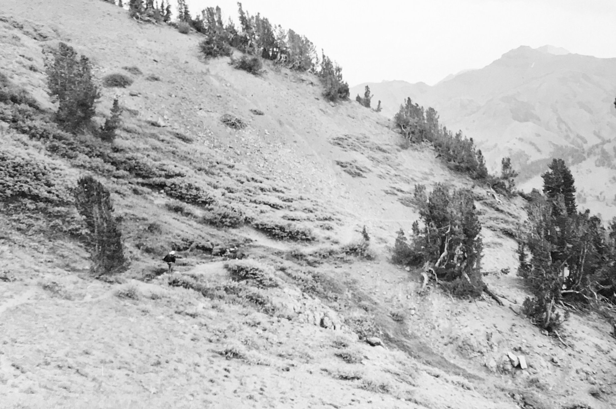
Last June, I found the two black and white photographic prints in this newsletter when I was home in Northern California, visiting my parents. The prints document the last time I hiked above Sonora Pass in the High Sierra, with my father and our now-deceased border collie, Annie, in the early 2000s. The trail up Sonora Peak is a great day hike: it is a two hour drive east from the town of Sonora, up the winding, narrow Highway 108. There is the most minimal of a trailhead and at the smallest cut of a pull-out; it is easy to miss if you aren’t looking. After crossing a drainage ditch and scraping through some low, prickly brush, the path becomes steep. The elevation, near 10,000 feet to start, compounds the challenge of managing the incline without a warm-up. Depending on time of year and weather conditions the previous winter, there might be patches of snow lingering in the shadows: the Pass is typically closed from mid-October until late May, crushed under snowpack that melts throughout the summer, eventually running down into the Stanislaus River and the reservoirs that provide much of the water for the Central Valley’s agriculture and the Bay Area’s cities. After ascending past scattered, gnarled pines contorted by a lifetime of extremes--cold, wind, snow and the always-present possibility of drought--the trail pushes over a ridge and turns even steeper as it rises toward Sonora Peak, for the last push disappearing into a rock-scramble from cairn to cairn above treeline. My father, as is his habit, packed sushi and beer to the summit, where we huddled out of the wind behind a low rock wall, eating and taking in the view before descending sharp gravel constantly sliding under foot.
///

Descending Sonora Peak (11,464 feet) in the High Sierra, off Highway 108. Sometime in the early 2000’s.
There is a timelessness to these scenes that I was not consciously intending to capture. I do not see these photographs and necessarily know when they was taken. Today when metadata timestamps and geotags embed a digital image with the specific time and precise location of a photograph, when social media posts or emails and text messages sent in anticipation can highlight who-what-where-when an event took place, I appreciate the ambiguity of memory to stir these thoughts in 2019.
///