Glaciers, Gertrude, and Going South- Week 7 in NZ
It’s been a while, and a lot has happened!
Ally leaving was a huge bummer. It had been refreshing and quite special sharing such a beautiful place with someone from home and it had been a month and a half since I had last been on my own without any plan to meet up with someone else; It was solo adventure time, seemingly indefinitely.
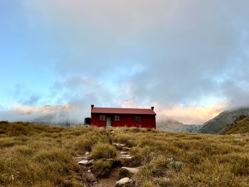
Weeks prior, I had managed to score a booking at Brewster Hut, a hut 3,300' up a mountain in Haast Pass. It's one of the most sought after huts for an overnight because not only does it have sweeping mountain and valley views, but it also has a glacier that you can hike up to. Right up to. As in touch it. Anywhere else in NZ you have to either helicopter onto glaciers in order to touch them, or do some serious mountaineering.
The hike to the hut, like almost every other mountain hike here, was straight up. It's a short hike, 2.25 miles, but the grade is painfully steep (3,300’ up kind of steep).
In the parking lot I met a very nice girl named Elizabeth, also from the States, who was staying in the hut as well. We chose to do the hike together, which worked out very well in terms safety, good company, and pacing myself. She was definitely slower than I was, and keeping her pace allowed me to not come out too hot and burn all my energy on the first part of the climb. I have a tendency to do that, and it's made past hikes a lot more difficult and type 2 fun than they needed to be.
The trail starts with a river crossing, which is super dangerous and impossible when it's raining or has been raining. The water rises quickly and becomes murky and rapid. Luckily the weather had been AMAZING and it was nothing more than a crystal clear, ankle deep walk. It then becomes steep forest, with lots of roots and trees to pull up on and when clambering up the hillside.
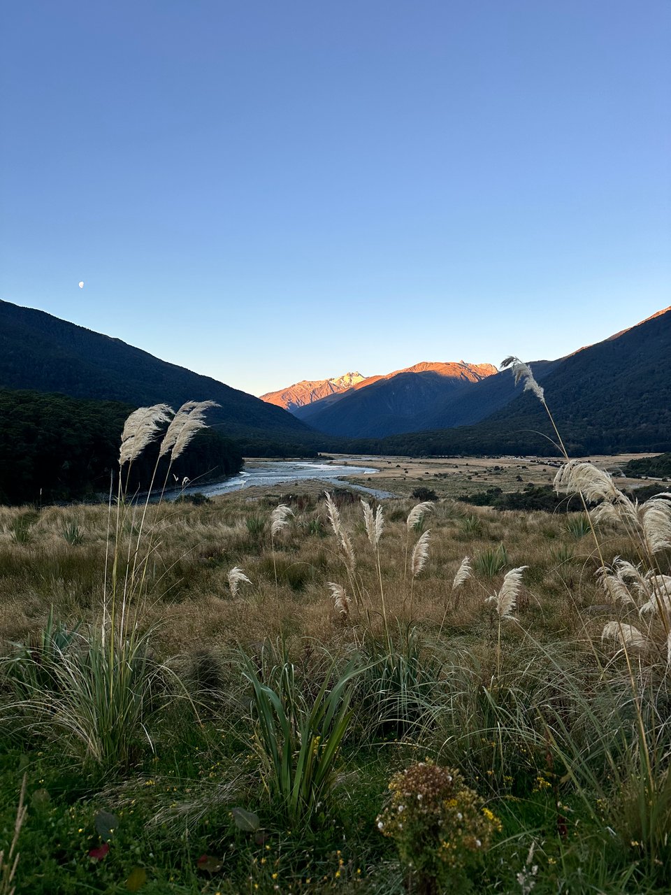
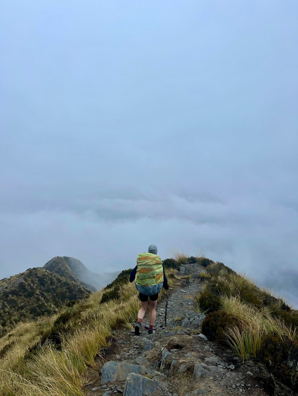
Elizabeth and I talked and slowly made our way through the forest, up and over said roots and rocks, and then emerged to the alpine ridge line section. Once out of the forest, we had sweeping views of the valley below, the mountains range in the distance, and there was Mount Brewster, right in front of us.
At the hut, the sleeping room had 4 bunks, a top and bottom that fit 4 people each, and a top and bottom that fit 2 people each. We were earlier than the other hut goers, so we got first dibs! The bottom bunk with 2 spots was our choice, so we didn't have to be surrounded by others in the night. My anxiety about accidentally touching others when I sleep would make it so I'd get no sleep otherwise.
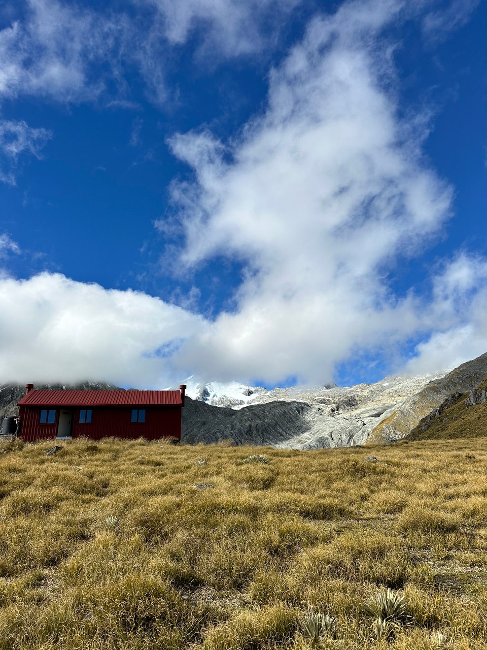
Once we chose our beds, off to the glacier we went! The hike up was another 1.5 miles and 1,700' of gain, but the views the entire way were astounding. It did require a tad bit of rock scrambling and walking on large slabs of steep rock, which made me so grateful the weather was perfect and sunny. I'd have zero interest in trying to do the trail if it were even remotely wet or cold. That would be remarkably dangerous, and if I've gained anything from NZ, it's much more self preservation when hiking and the lack of desire to do any hike that could be sketchy or have precarious bits, especially when I'm alone.
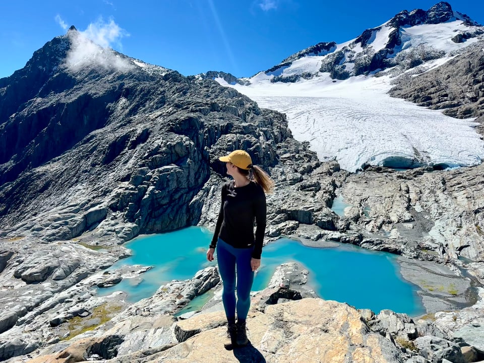
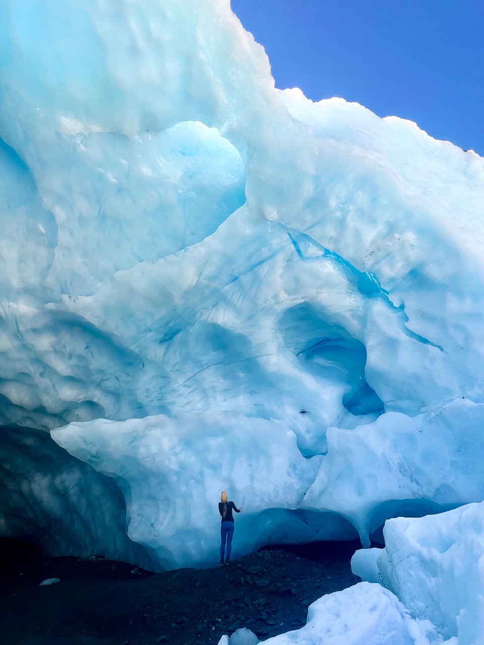
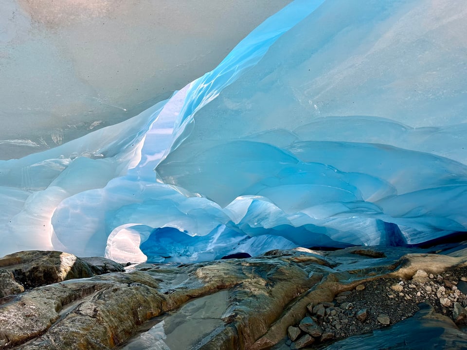
The front of the glacier was unlike anything I've ever seen. In Argentina, though absolutely mesmerizing, the front of the glacier I saw was too far in the distance to see the details. Here, I was close enough to touch the front of this one - and I did... sorry mom and dad. Being so close, I could see stratification across the whole face, a beautiful display of the accumulation and compacting of snow and ice over time. It also looked so smooth compared to the glacier I'd walked on in Chile, and so, of course, I had to go see if it was. Unlike the jagged part of Grey Glacier I was on in Chile, this glacier face felt exactly as an ice cube does, slick and oh-so smooth.
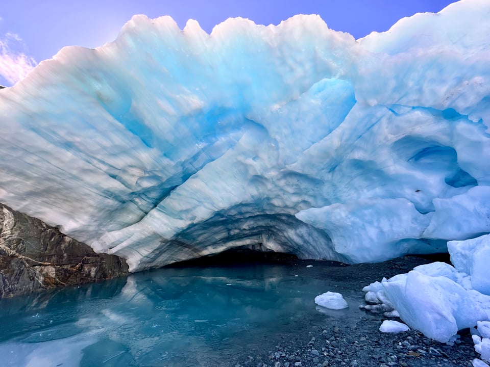
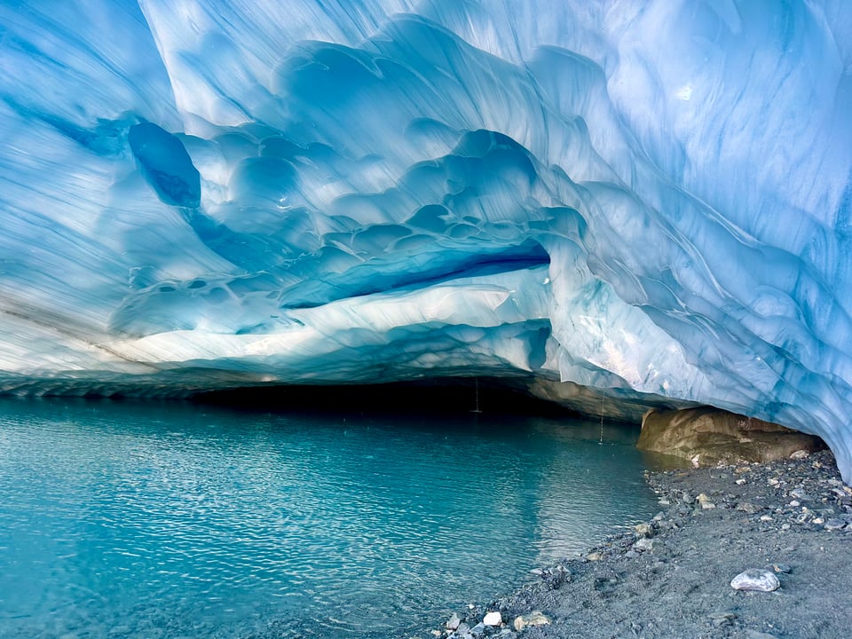
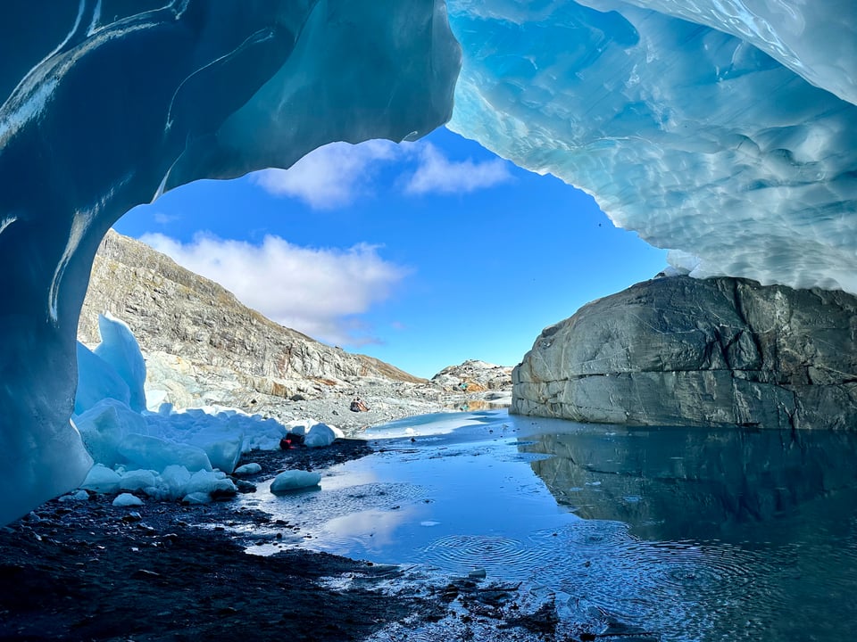
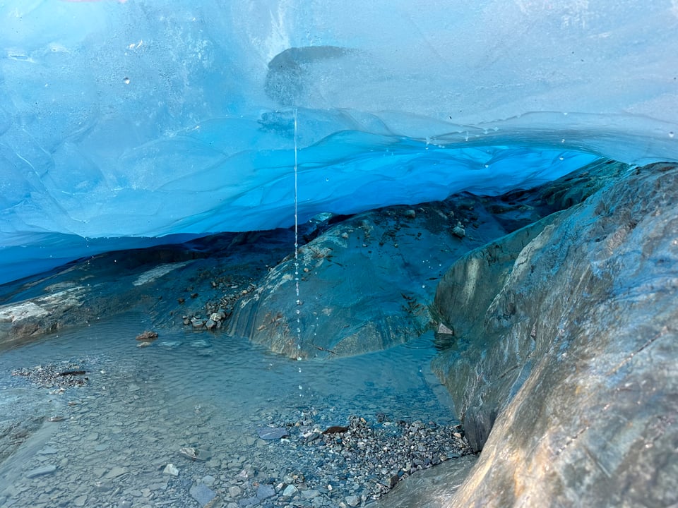
There was the sound of running water running all around, and you could see it dripping from the ceiling of the cave that is front and center on the face as well as pouring out from breaks in the ice and running out from where the glacier meets the ground. All this water met at a small river coming from the cave and running down the rocks to the bright blue glacial lakes below.
We explored around the entire face of the glacier, seeing so many small caves and tunnels, all the most raw blue in color under the shining sun.
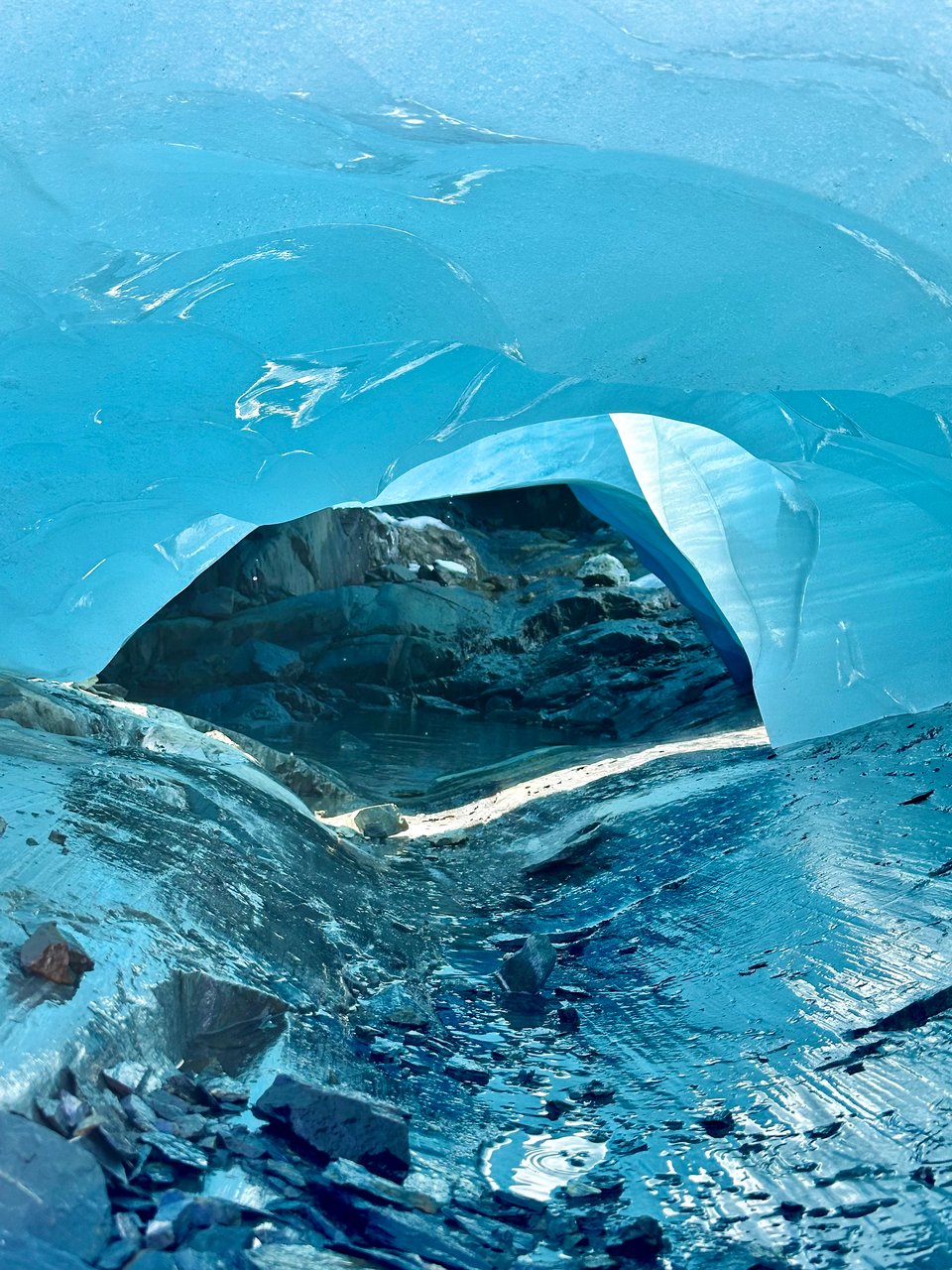
My favorite little cave drew me in with the sound of a stream of pouring water interrupted at regular intervals with a "gulp" of sorts. I crouched down outside the mouth of the cave to look and there was, in fact, a steady stream of water coming through a hole in the ceiling where a pool of water had collected. Every few seconds an air bubble would "glub" its way from the hole through the pool of water and stop the steam of water for a moment while it caught its breath.
On our way back around that part of the face 10 minutes later, the stream of water was gone, as were the silly noises. Elizabeth commented how special it was that we had just gotten to see in real time the evolution of the glacier and a true unique moment in time.
Before leaving the area, we decided to be real brave and take a plunge in the blue glacial pools. Cold water is not my friend, and likely never will be, but getting my entire body, head and all, into such pristine water was not just a once in a lifetime experience, but also was immensely grounding. It was mind numbing and exhilarating all at the same time, and very few things have felt as good as resetting my body like that and then soaking in the NZ sun to dry off.
Back at the hut, we met our other hutmates, shared some tea and snacks as we took in the view, and played cards (I'm teaching everyone in the world Cambio this year it seems).
In the morning the weather was less than ideal. It wasn't raining necessarily, but it was definitely wet and that had me worried about the river crossing. We got our butts in gear and left early, just in case. I’d learned not to try to wait out weather… it doesn’t seem to often work in my favor.
Elizabeth and I, and a girl we'd befriended, Trinity, hiked down together, which took longer than the ascent it felt! Hiking down such steep, rooted trails is scary and takes a ton of concentration, and by the end we were all spent. The river was just fine for crossing, thank goodness and we got back to our cars, said our goodbyes, and went our separate ways.
This connecting for a short time is something I've thought about a lot on this trip, and the other trips I've been on this year; you meet and connect with people, learning about and from them, and you share amazing, once in a lifetime experiences together. You feel bonded to them, and they've now become a part of your life and part of an unforgettable experience. But then you inevitably part ways, perhaps becoming friends on social media to stay “connected,” but likely you'll never see them again. Then you’re off to start the cycle anew; It’s beautiful, but also somewhat sad, the constant connection and then loss.
With that, I know that I am so lucky; There are so many humans I've had amazing conversations and connections with, that I wonder where they are and how they are, and I am forever grateful to have established even short, sweet connections like that. They make life and traveling so beautiful.
I disgress…
Having booked one night on the 45 mile Kepler track, another Great Walk, for 3 days later, I needed to get my butt to Te Anau. I planned to also do a hike, Gertrude's Saddle, prior to Kepler because it had come highly recommended* and I don't know what else to do to fill my time other than hiking.
*someone had told me that it was the best view in NZ, which is a lofty statement to make.
After a night of camping by the lake, I drove the 3 hours to Gertrude Saddle trailhead, worried that I was starting my hike too late.
Gertrude Saddle is another hike that requires good weather, and there were signs everywhere warning you to not do it if there was any sign of bad weather or any sign of ice. Lucky for me, there was neither- it was sunny and cloudless!
I'm embarrassed to admit that I got lost .5 miles in because I couldn't find the orange trail marker after crossing a dry riverbed. I ended up at a dead end, in the bushes, turned around, and righted myself.
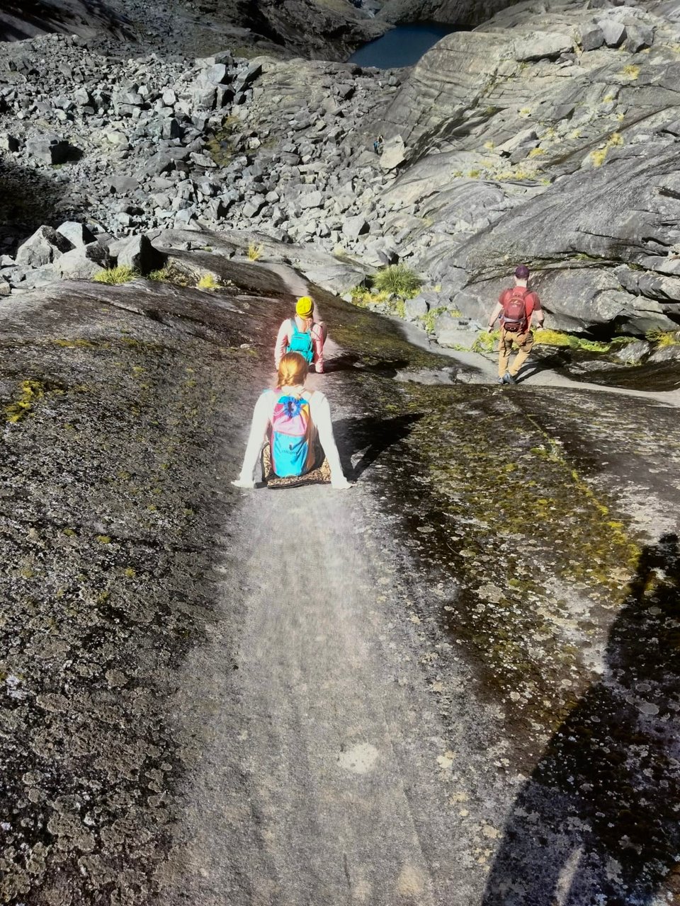
The rest of the walk was quite straightforward, and quite up. Unsurprisingly. You essentially go up a mountain face, which starts as scree and rocks, and then turns into large steeply sloped slabs of granite. My sticky rubber-soled shoes made the slabs no issue to walk up, but the small bit of water running all across and down sure did. I became increasingly thankful to have started "late" as the sun slowly started to peek over the mountain, warming up the track and drying up the water. The people I met who were coming down said I was lucky as well, as it had been pretty hairy coming up and down prior to the sun coming out.
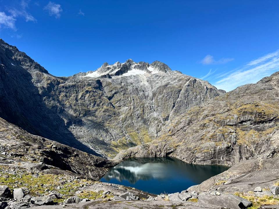
I was less lucky when my poor legs were so tired from the intense incline that I chose to "bear crawl" up the steep slab, which inverted my backpack just enough for my phone to slip out of its pocket and start cascading down the granite toward a lake. Knowing my phone wasn't worth my safety, I watched it as it slid and bounced down and down, praying it would stop and waiting to see where it landed before going to get it. It stopped well before the lake, thank goodness, and in a very safe spot to walk to.
Mid-way through the slab there was the cable section, which was very Half Dome-like, but the cables were much less necessary as the granite was quite sticky and there were no drop offs.
At the end of the last section, a guy at the top responded to a woman in his group asking "is this the top?" with "pretty much!"
To which I asked, "pretty much or actually?" because my little legs were real tired and I was ready for the view.
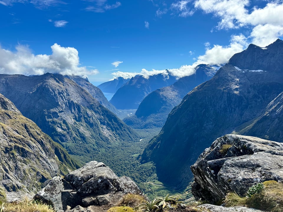
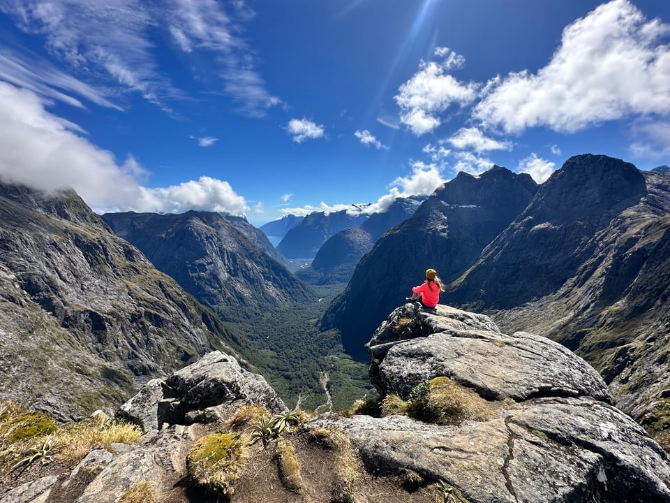
It was actually the top, and my goodness... the view was exceptional. On each side there were large mountain peaks and in front stretched the entire valley leading to Milford Sound and then Milford Sound itself. Because it was clear and sunny, so you could see all the way to the ocean through the sound. Behind was another mountain peak, and the alpine lake that my phone ventured down toward. The almost 360° view was absolutely one of the best I've seen in NZ, though I'm not sure if it's the best in my opinion.
While enjoying the view and my snack, I chatted with the "pretty much" guy and his friends. We really hit it off and chose to walk down together after. I was grateful for their company, as down steep slabs of granite is somewhat anxiety inducing. I ended up adopting the "crab walk" method which was not only quite fun, but also felt much more stable. There's almost no way to fall when you've got your hands and feet on the ground already.
Once down, they invited me to their Airbnb to park and sleep, which was a godsend because camping out that way was minimal, sand fly ridden, and/or expensive. They even let me use the shower! We had a laughter-filled evening out at dinner, then breakfast and great conversation over coffee in the morning, and parted ways. Once again, I reflected on how fortunate I am and continue to be. People's friendliness and generosity on every trip I've been on this year has been really touching. It's been a powerful point of continued reflection for me, about how I carry myself, as well as how I want to also show up for others in whatever ways I can.
Unfortunately for me, the weather was getting bad. Again. So, I had to make the heartbreaking decision to cancel backpacking Kepler; Backpacking in the rain pretty much never sounds fun and it didn't seem worth it- the views would all be covered by rain clouds, and I’d be wet and cold.
That meant coming up with an alternative plan, and I landed on driving the southern most bits of the South Island instead. I had intended to not do this part of the island because the internet and many blog posts say is something you should only do if you have extra time and don't know what to do with it.
But I was finding myself with some extra time and I didn't know what to do with it, so south to Invercargill I went.
Invercargill isn't known for much, except that it's the gateway to Bluff, which will take you to Stewart Island, the best place for animals and birds in NZ.
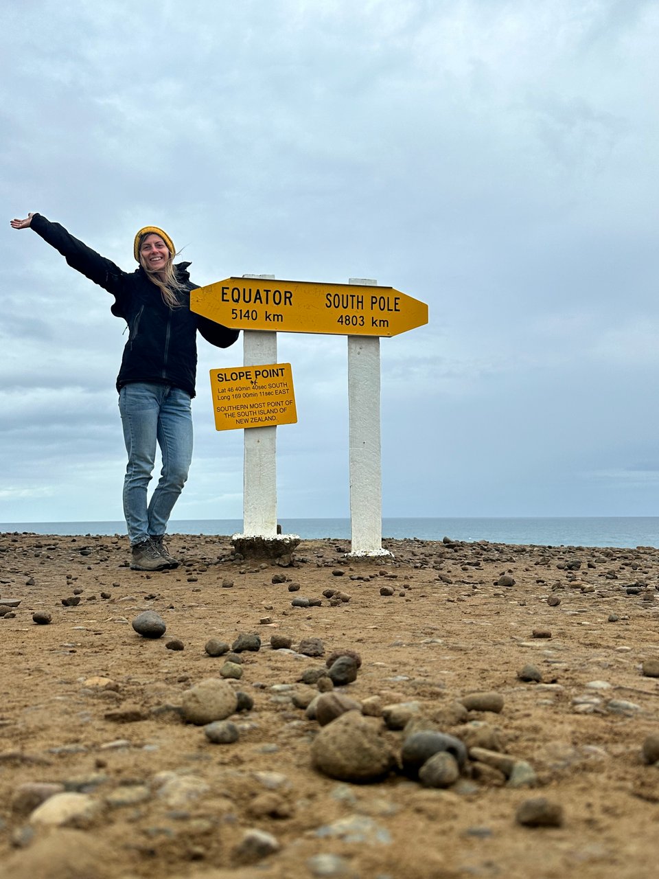
I went on an estuary walk to break up the driving and get some movement in, and saw tons of massive black swans. On it the weather very quickly changed from sunny and nice to windy as all heck and stormy. I raced the storm to my car, barely making it, and spent the rest of the day driving through the rain to small view points or points of interest, the most notable being Slope Point, the most southern part of mainland NZ.
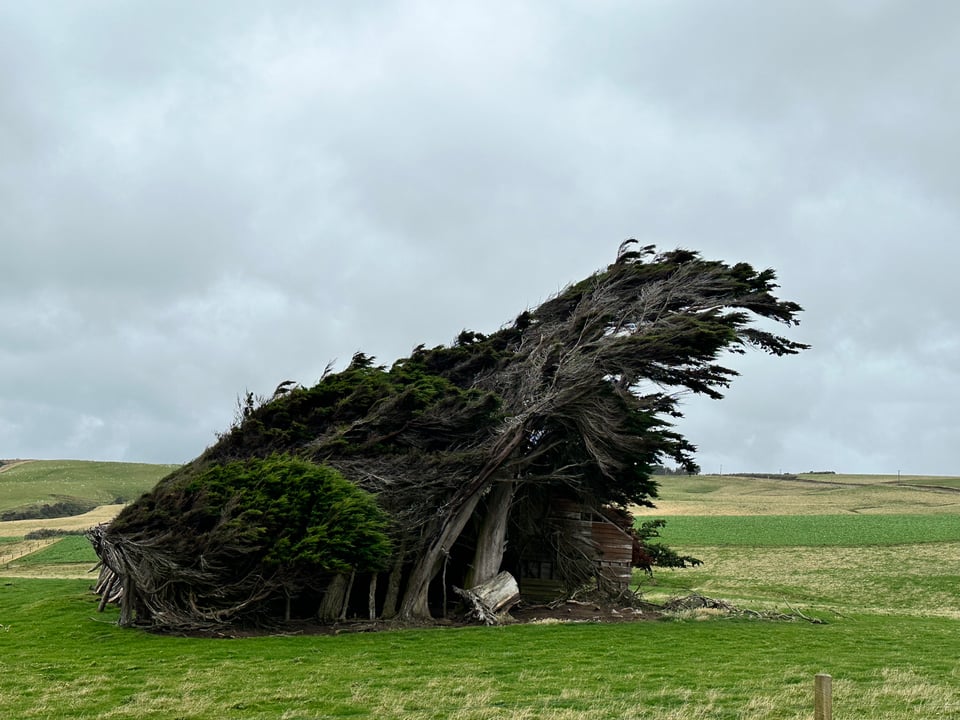
The drive was mostly green hills with livestock, which didn't do much for me after coming from the mountain.
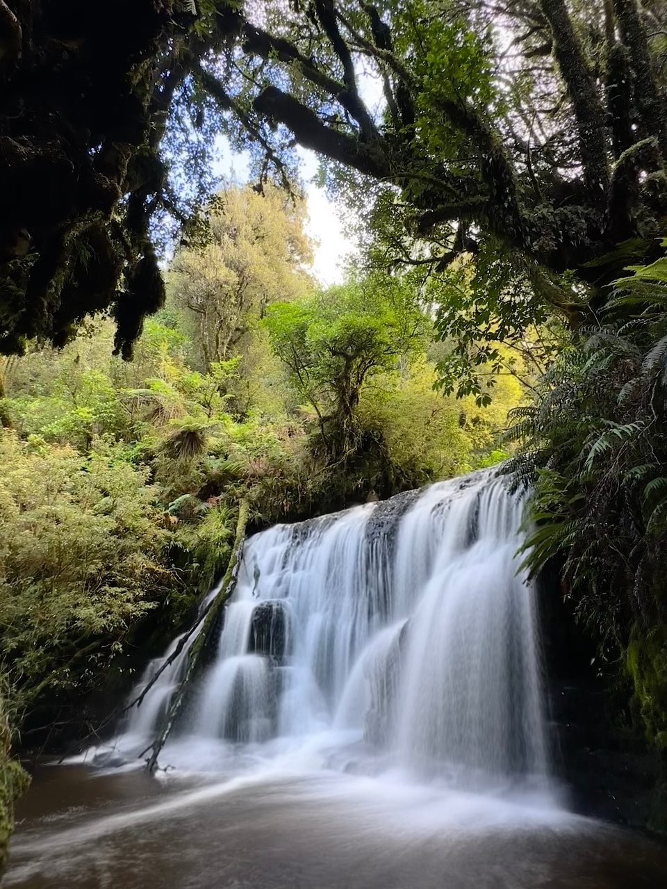
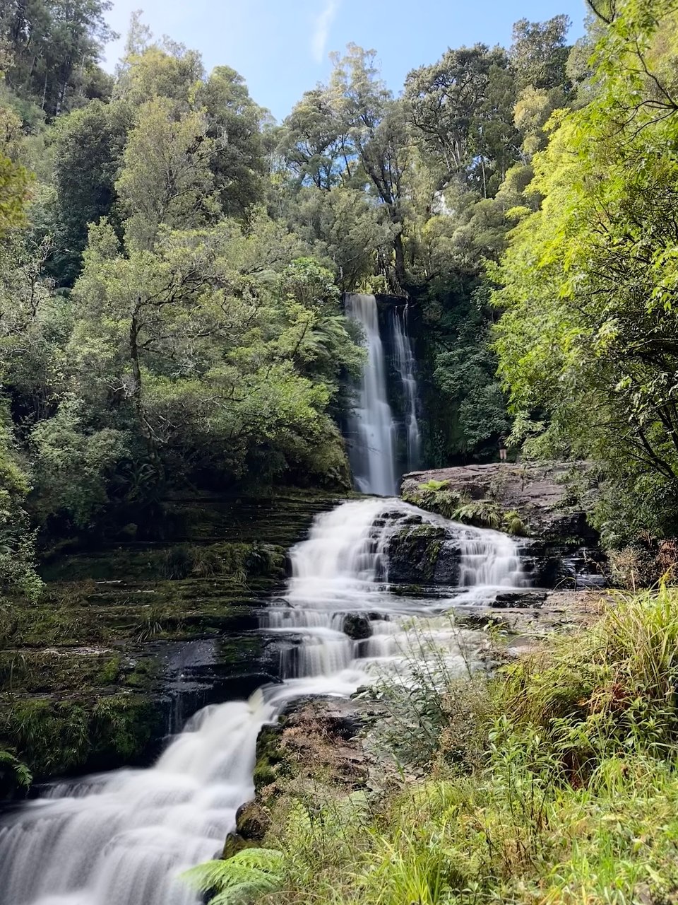
The next day was more driving broken up by a few waterfall hikes through the jungle that hadn't been cut down to farm cattle or sheep. The waterfalls were all beautiful, especially post-rain; I just love how much more full and powerful they are after a storm.
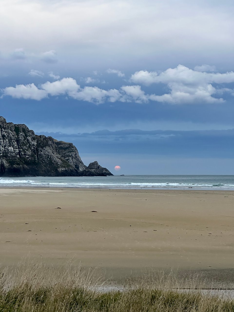
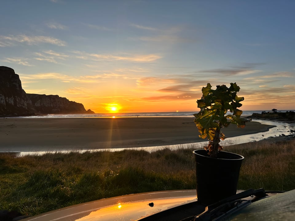
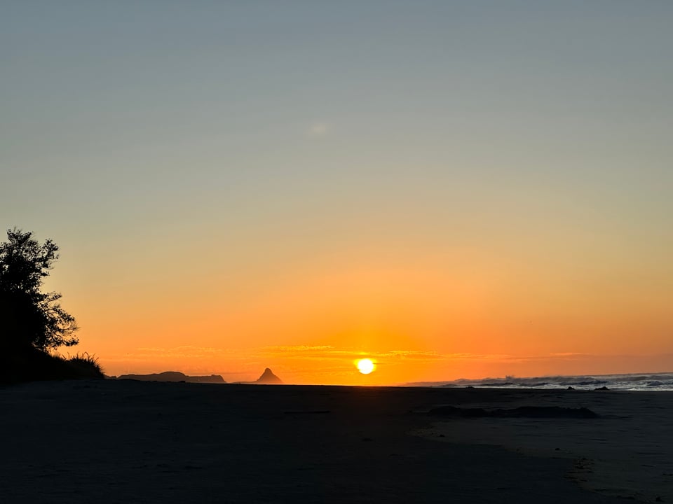
I ended up at a pretty stellar beach campsite that provided spectacular views of the moonrise and the sunrise in the morning.
Less spectacular in the morning was trying to get out of my camping spot. It had rained overnight and I was on a grassy hill. I backed down off of it and got myself stuck in some mud. The man in the area next to me was very helpful in directing me and giving me a minor push to get out, bless his heart.
Not too long after, on my drive I came upon another cow road black that required herding! Never in my life could I have predicted how much cow herding I'd be doing on this trip. Unfortunately for my little van, the cows had also defecated all over the road and it ended up all in my tires and on the underside of my already very dirty car.
The rest of the day was similar to the ones prior, with some stops at scenic spots or walks, and lots of driving.
I snagged another great beach campsite, which I don't much prefer over the mountains, but they do provide a great, more consistent setting for decent sunrises and sunsets!
March 26th was my final day of my southern road trip, and honestly I was real ready to be done. Not only had the weather been uncooperative and demoralizing, but I understood completely why people don't often do the southern route; compared to the rest of the island it's not majestic and grand in its scenery. It’s beautiful in its own way, don’t get me wrong, but the green hills and constant beaches were much less my speed; I was going into serious mountain withdrawals. By this point, I was also really struggling with a lack of movement and was feeling relatively uncomfortable in my body, and to top it off, I was getting a bit lonely.
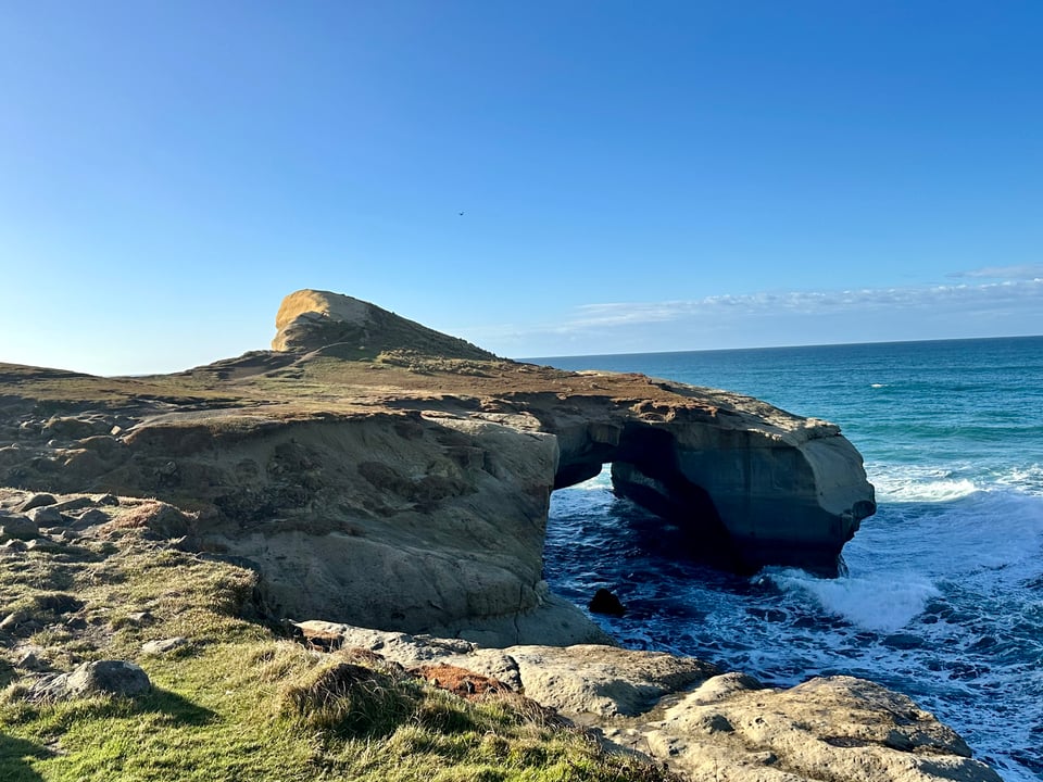
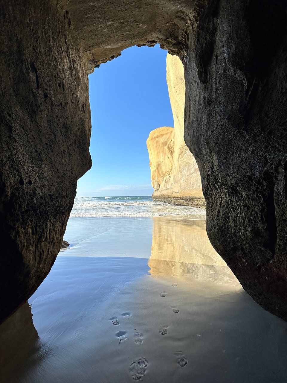
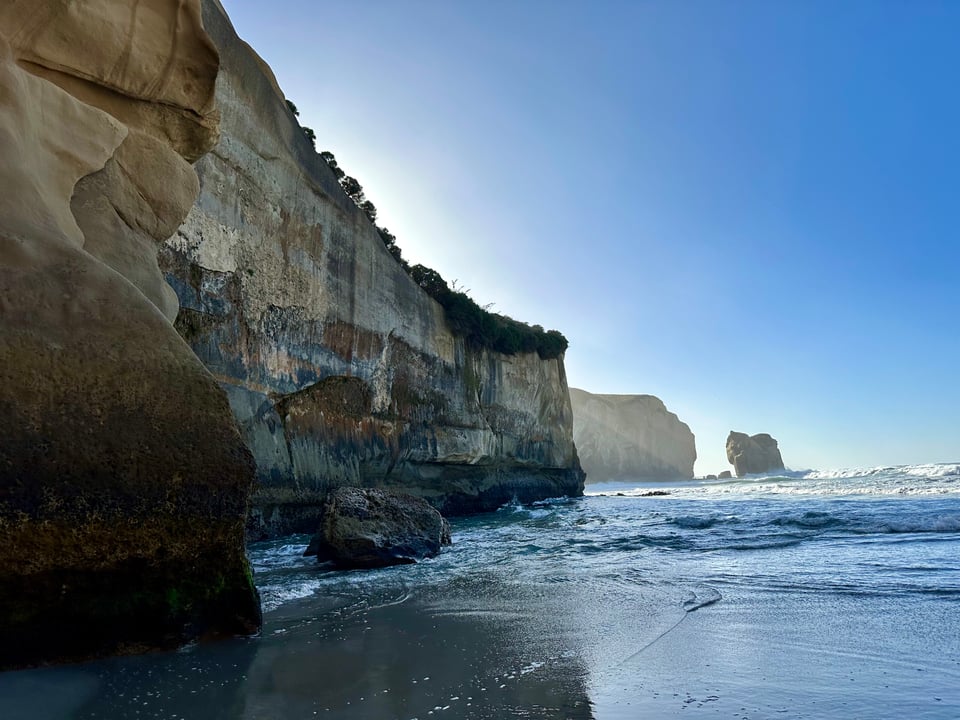
I did one last walk, a seaside tunnel walk to try to shake some of these struggles. It looked so much like home, which shouldn't surprise me anymore. NZ is just California on the other side of the Pacific. The walk had great ocean views and neat rock features, and it felt really good to get some sunshine among all the sporadic bad weather that had been happening.
Post-walk, I headed into Dunedin, a seaside college town that hadn't been particularly hyped up by anyone I knew that had been there, but it was the last bit of this loop I'd committed to. It's also where things got worse, but then they, thank goodness, got a whole lot better.