Showing Ally the South - Week 6 in NZ
Strap in for another lengthy one.
Back on the South Island, I was reunited with my van! Oh how I'd missed her so much in our week-long separation. It's remarkable how quickly one can become attached to a thing, though I guess it's my current home so it makes a bit of sense.
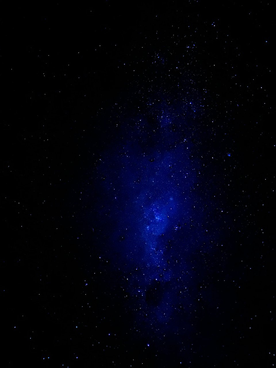
I got back to Pierre's so late at night that I didn't bother to find somewhere to camp; I just slept in my car in his apartment parking area, which is very frowned upon. You're not supposed to self-contained freedom camp just anywhere. The stars were so amazing that evening, so even though I was quite tired, I stayed up to watch them for a little. That's one thing I know I'll miss so dearly when I leave, the ability to so easily see the Milky Way.
The next day, as I made my way to Queenstown so I could pick up Ally the following day, she realized she'd accidentally booked that night at a hostel even though she hadn’t arrived. She she called and they said I could take it! Oh goody, I had a real bed and a shower to look forward to!
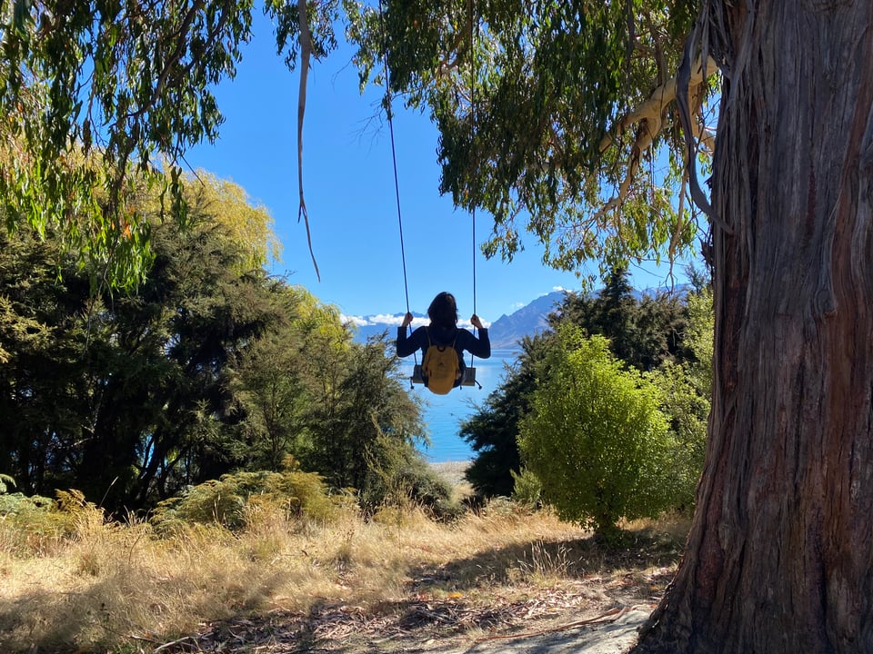
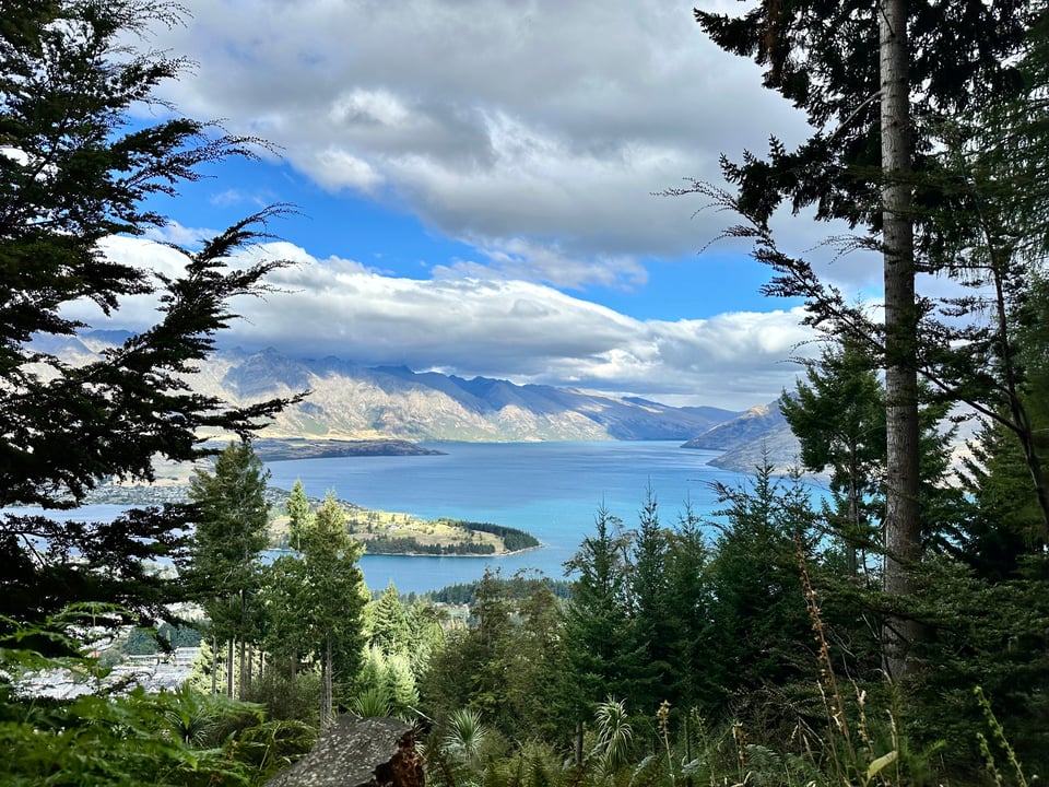
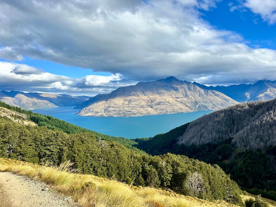
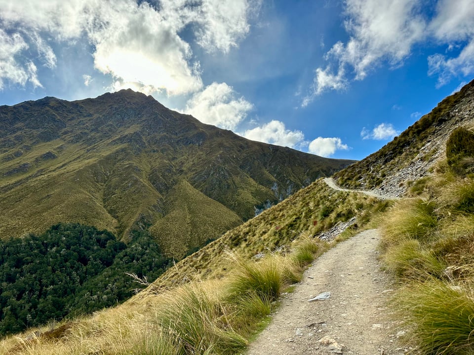
With that in mind, I set off to do the main Queenstown hike to the top of Ben Lomond, which has 360° views of the area. It conveniently leaves from in the town and you can hike up a multitude of ways or take a gondola to a midway point and then hike the rest. Never one to shy away from an extra hiking opportunity, I chose the Tiki Trail, which goes through the forest underneath and beside the gondola. Unfortunately, because it was by the gondola, parking was a total nightmare and I wasted 40 minutes of rather precious daylight trying to find a spot and then making sure that where I was parking wasn't going to result in a massive fine.
Once on the trail, I hustled to make sure I had enough daylight to complete the hike. It was 4:30 and sunset was at 8, which, according to the signs saying it took 5-6 hours was absolutely not enough time. By now you should know I don't trust the signs one bit, but I also didn't want to be overconfident and get myself in a pickle, so I decided that no matter how far I was at 6:30, I needed to turn around.
There was one great viewpoint during the walk, but it was primarily just up up up through the forest, with the occasional downhill mountain biker flying past down a separate, much steeper downhill biking path that sometimes crossed the trail. I thought of Nick a lot and how much he'd love it here.
At the gondola top out there were quite a lot of people and not really a better view than I had had from the trail. I was a bit surprised, but with no time to waste, onward and upward we went.
A woman who works at the gondola said the best view was 20 minutes past the gondola, which I was skeptical of, but also hoping was the truth, as it was 5:15 and it was seeming more and more as though I likely wouldn't make it to the top.
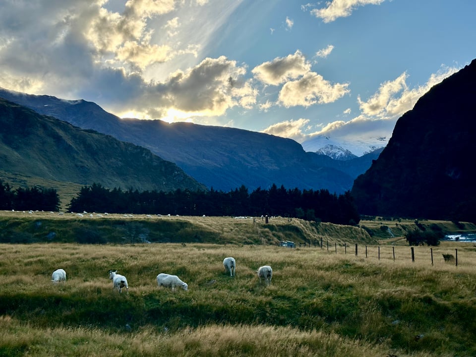
The view was amazing, with the lake down below and forested hills. Those aren't super common here, as much of the land is farmland or alpine and the “alpine" here seems to be grassy and not the forested type I'm used to at home.
As I got higher and higher, I could see the saddle that meant 1.5 km more to the summit. Even getting to the saddle would feel like a win, but then I came upon a sign that said 1.5 km to the saddle. I looked at my watch. 6:15. I realized it wasn't going to happen. I stood there, trying to figure out what to do, and then convinced myself I'd get to the saddle regardless of the time and just do some trail running down to make up for it. I started off, rounded a corner, and got blasted with icy cold wind. Though I had layers in my backpack, that immediately killed any and all motivation I had and I promptly turned around to make my way back to the car and to the hostel.
The woman there had slight issue with me taking Ally's bed, but let it happen. That ended up being a total blessing because then I used all the hostel facilities the next two days and no one batted an eye, as they'd seen me there as a paying visitor already.
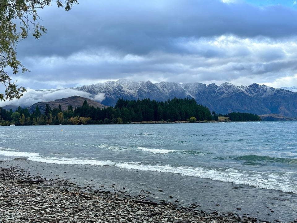
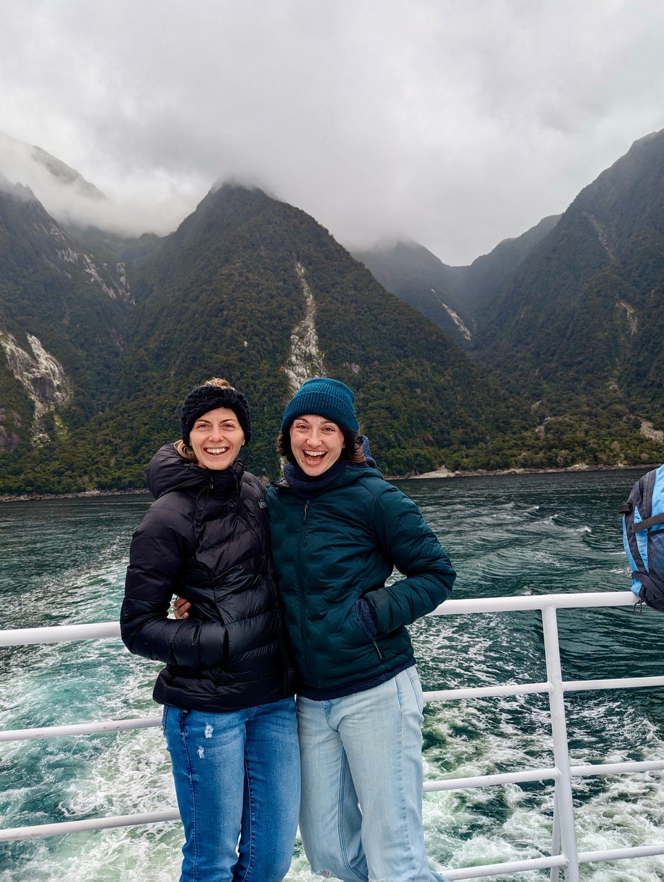
The next morning I woke up to snow on the mountains, which was VERY exciting! Mountains are always a little prettier with some snow dusting, and Ally absolutely deserved to show up in Queenstown with it at its best. I snagged her from the airport and we set off to do a little day hike.
Our day hike included some beautiful forest, a nice little waterfall, a lot of stunning but inedible mushrooms, and a great view at the top, overlooking the mountains and a lake. It was so nice to be moving my body multiple days in a row again and to get to show Ally some of the beauty of the south island!
When we returned to Queenstown we stopped by Ferg’s, a bakery/gelato spot/burger joint, that always has a massive crowd/ line. We had to see what the fuss was about. We got a pie, a New Zealand staple, for a dinner appetizer and then some additional savory treats for our long day tour to Milford Sound the next day.
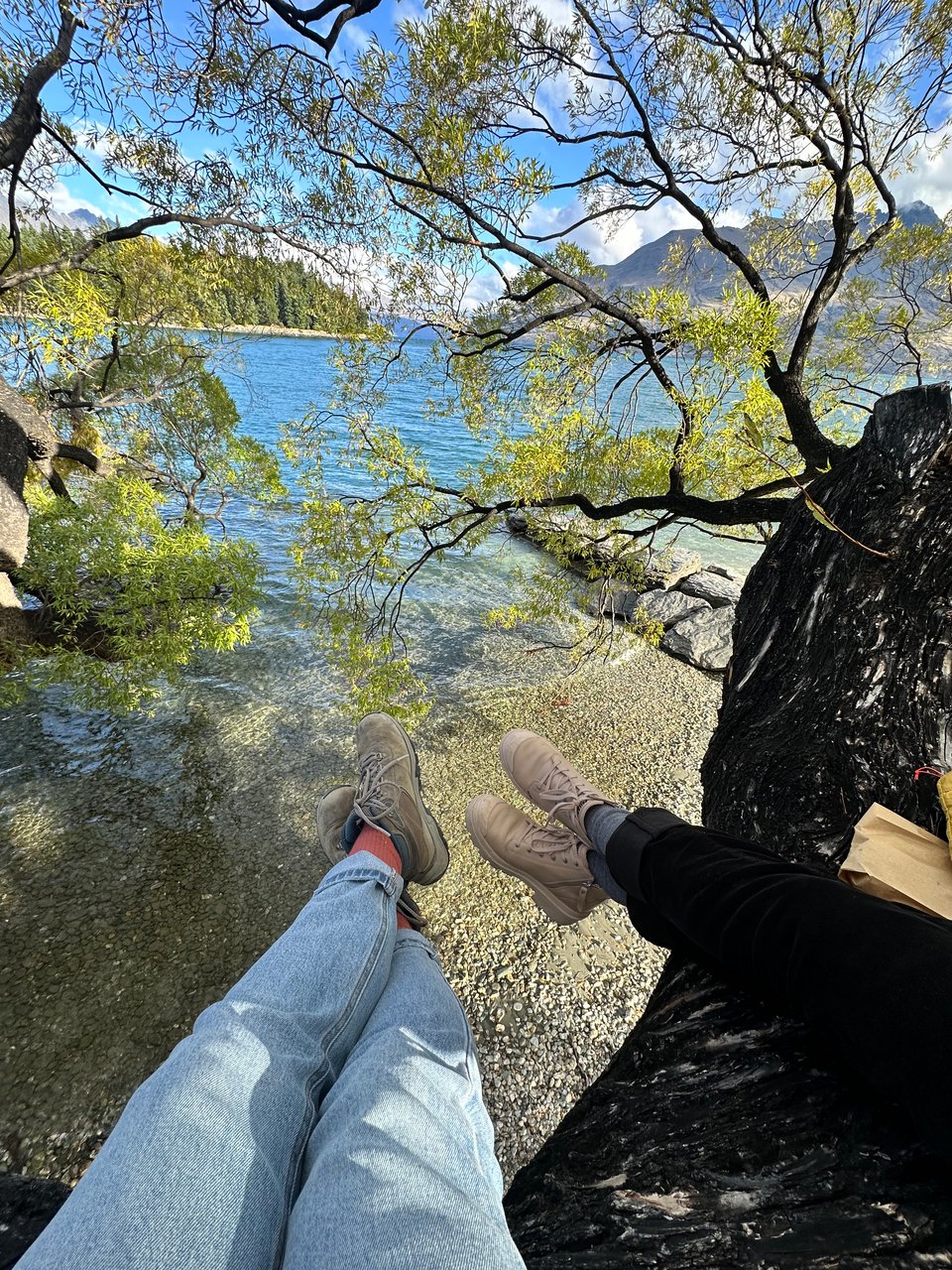
Hungry and not able to wait until we got back to the hostel because the smell was too good, we found a killer climbing tree on the lake to enjoy our pie packed with meat and vegetables and gravy. The crust was impeccable, so flaky and well laminated; I understood the hype.
That night, Ally taught me cribbage, which became a staple in our evenings. I managed to sneak sleeping in my car in the hostel parking lot instead of driving out of town to a campground, which was such a blessing because we had a 5:30 am start the next day.
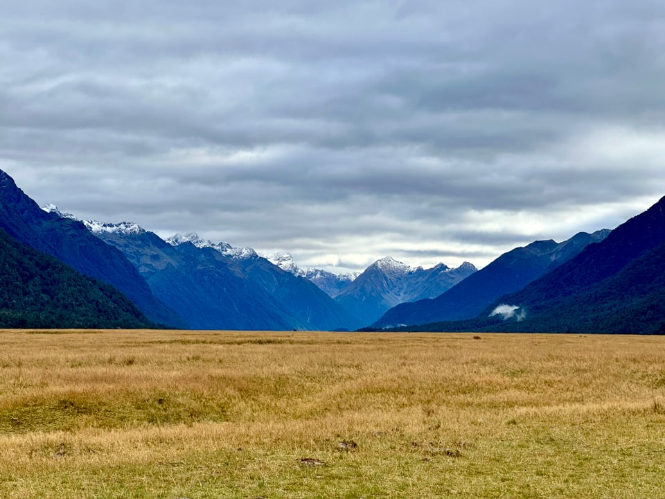
In the early morning, after a small breakfast and some coffee, not nearly as rested as I’d have liked, we walked in the dark to meet our tour bus and make the 4 hour journey to Milford Sound. Ally, lucky duck, slept a fair amount of the drive. I did not. Initially this was frustrating, but once the landscape changed from farmland to forest and mountains, I was happy to be awake.
Roland, our bus driver, spouted facts at us every few minutes, and eventually I had to wonder if he was just talking to keep himself awake and how it must feel to talk with little to no response for 4 hours. Then I remembered that’s what a normal day at work with preteens looks like, and felt some major empathy. I feel guilty, but much like my students, I don’t remember a lot of what he said because I was too tired to log any of it.
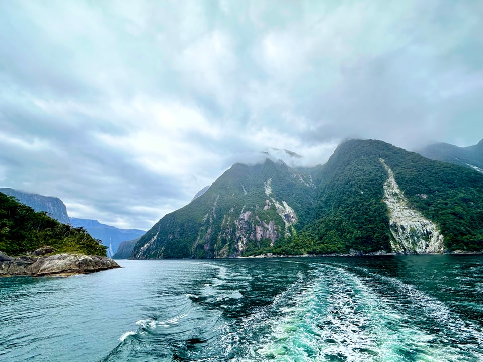
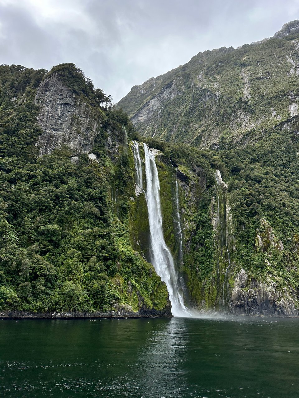
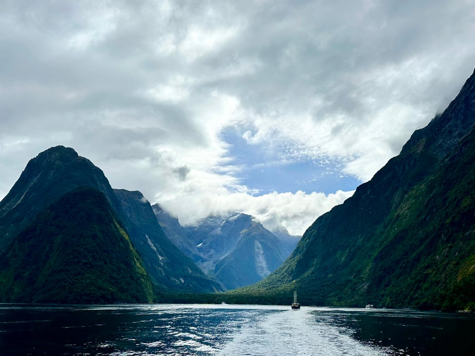
Everyone says that Milford Sound is best when it is raining because waterfalls spring up everywhere. It had rained that morning, but was not raining when we got there, as one can see from the photos. Thank goodness for that, as I didn’t want to spend the day on a boat in the rain. I’ll take a lack of waterfalls over staying dry and somewhat warm any day. We boarded our boat, already in awe of the visible towering cliffs and peaks jutting out of the water. Just like on the Routeburn track and most other valleys here, this area was formed by glaciers, which means it is a U-shaped valley with steep cliff walls. Because it is a glacial valley, Milford Sound is incorrectly named; it is a fjord, not a sound, a fact that Roland told us and then also our boat tour guide.
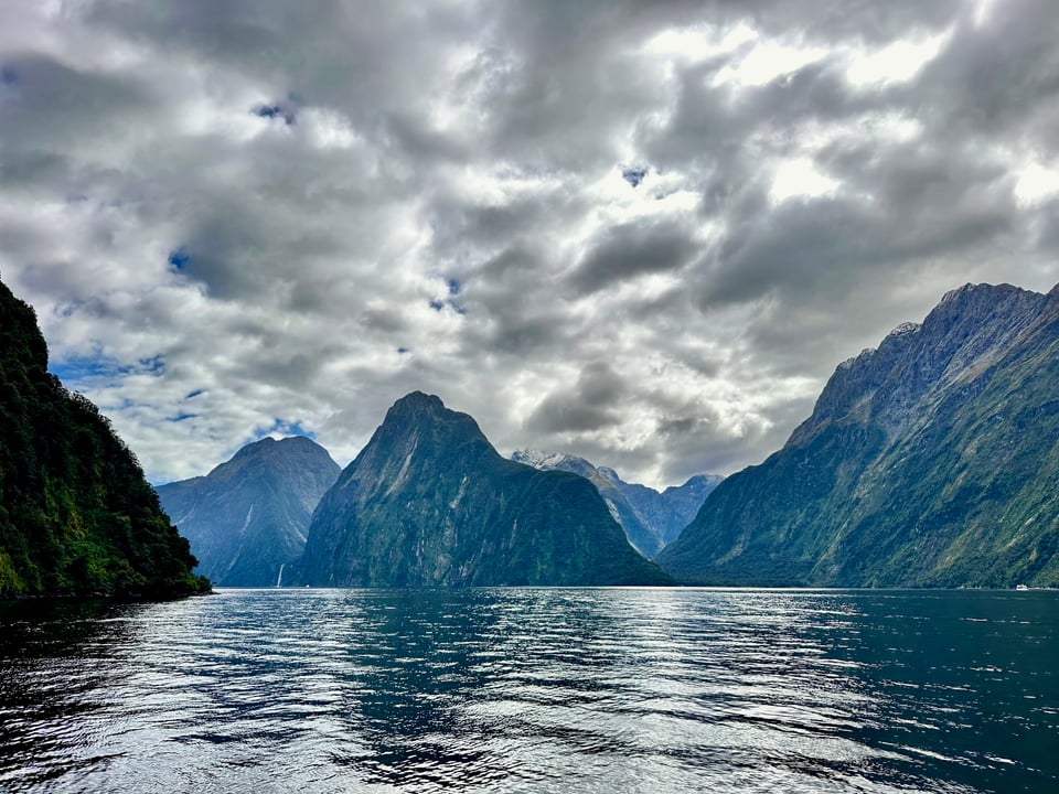
Leaving the dock, we saw our first waterfall, which is one of only a few permanent ones in Milford; The seemingly immeasurable number of other ones come and go based on the rain.
On the boat we drove through the sound toward the ocean. The boat guide, much like Roland, said, facts every couple minutes. He taught us that the top layer of water in the sound is freshwater and the reason it is such a dark color is because it is rainwater that goes down through the trees on the cliff faces and is therefore full of tannins. The water underneath that, the salt water, is the same bright and beautiful blue you see in the rest of New Zealand.
We drove up to some waterfalls, with the captain putting the nose right underneath and allowing those who wanted it to get a little wet. I opted out of that one, though was real tempted for a second when the boat guide let us know this was “the wettest water in the whole world.” What a privilege that would be, to get to say I got wet from the wettest water (this guide was a goof and having too much fun with his job. We loved it).
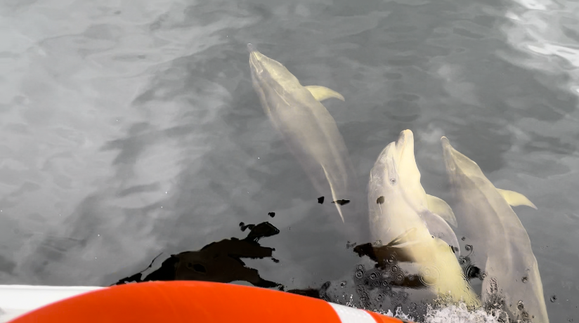
The highlight of the boat trip was being lucky enough to come upon a pod of dolphins that played and swam alongside the boat. They’re such a joy to watch, as they’re so fully of joy themselves.
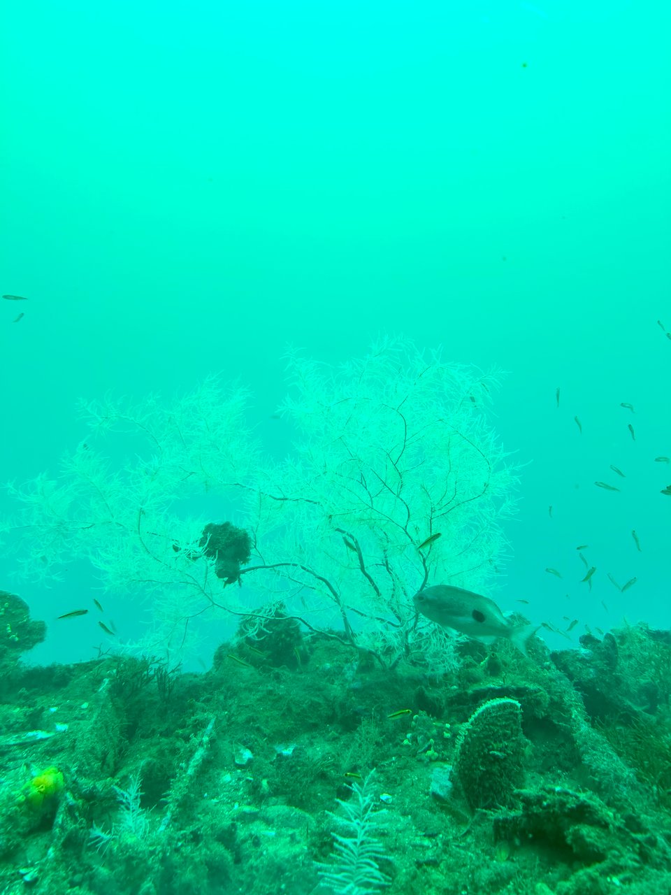
Post-tour through the sound they dropped us off at the world’s only underwater observatory so that we could learn some more about the underwater wildlife and see it for ourselves. Because of the dark top layer of water, underwater plants and animals that usually live much deeper in the ocean thrive there in much shallower water. The most notable of these underwater creatures is black coral, which is actually white, they just were always finding the skeleton washing up on shore and that is black.
David, our observatory guide also told us that the sound is incorrectly named, and is actually a fjord. It seems New Zealand really loves to make sure we all know they made a mistake, and they know it.
I also learned that David, who is from the UK, spent 6 summers working in Santa Rosa, the first 6 summers I lived there, in fact. The world is small!
Four and a half hours later we were back in Queenstown and I introduced Ally to Patagonia Chocolates, the best ice cream in the whole world. That’s saying a lot, because I’ve had ice cream literally all over the world. The cows here are raised and treated really well, and it shows in the dairy, which is very high quality and VERY expensive.
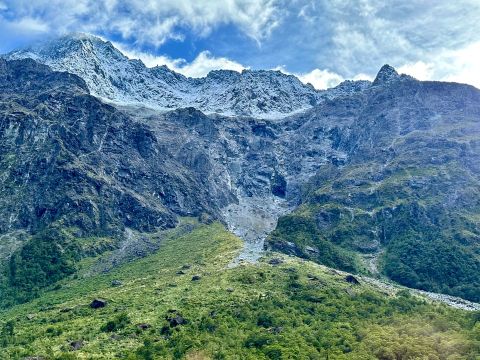
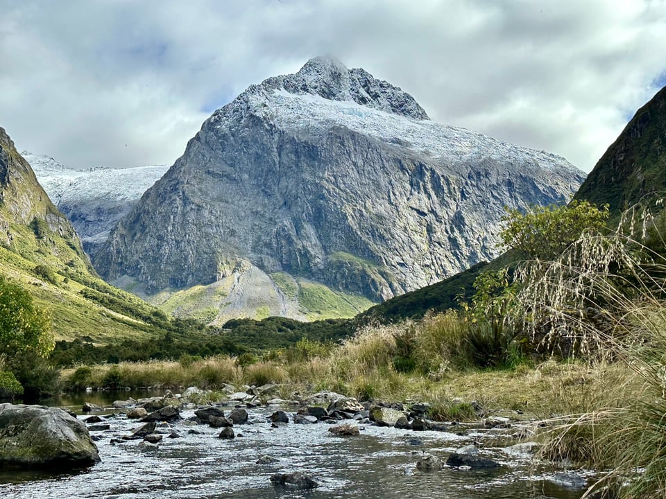
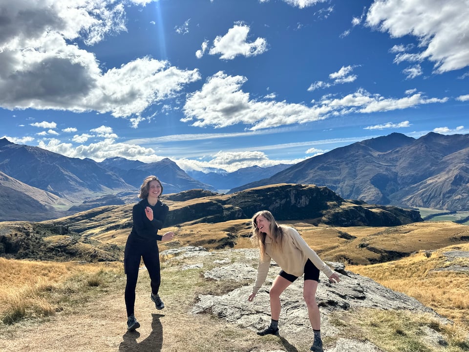
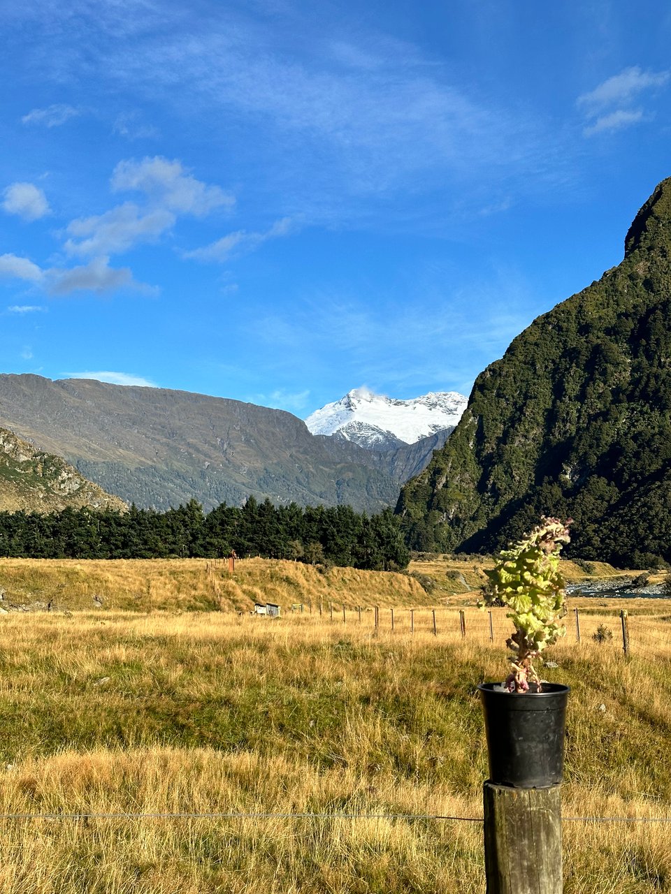
The next day we ventured toward Wanaka, one of my absolute favorite places here. It’s always sunny and the lakeside town is clean, walkable, and just so darn cute. Wanaka wasn’t our stop though, I was taking Ally out past Wanaka to Mt Aspiring National Park so we could hike to Rob Roy glacier -not to be confused with Roy’s peak, the site of the worst hike of my life.
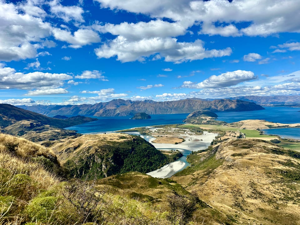
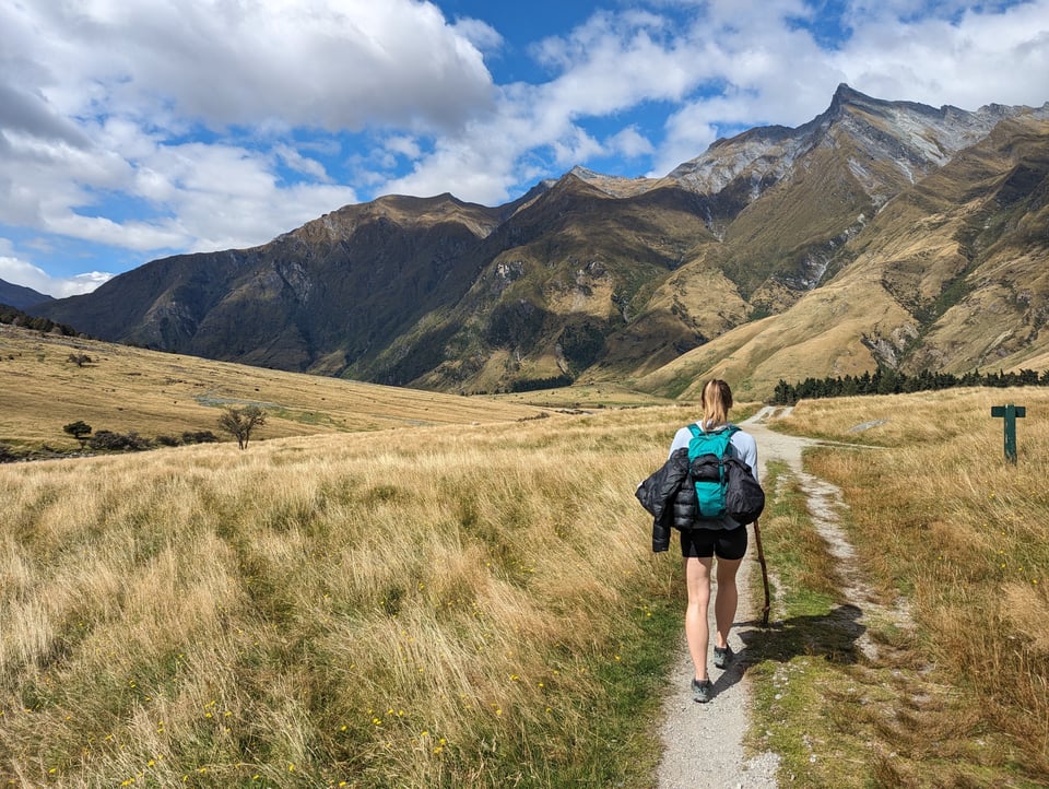
Along the way we stopped and did a hike at Diamond Lake and Rocky Mountains, during which Ally got her first view of Mt Aspiring. Watching her be so excited by the snow capped peak made me even more excited! I love the mountains, and I love sharing them and being in them with others even more! I loved this hike because it had very similar views to Roy’s Peak, but was significantly shorter and easier. There was zero suffering and just a lot of enjoyment of the 360° views!
After that good driving break, we got back in the car to go to Raspberry Car Park, our campground for the night and starting point for the glacier walk the next day. I put the location into my maps app, and it said 20 miles, great! I hit “start” and it said my estimated arrival was in 2 hours. Uhm… how?
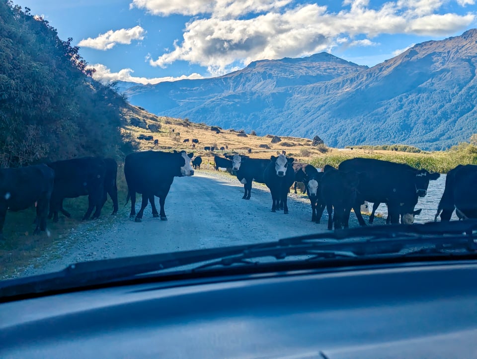
We figured out how quite quickly, as the road abruptly changed from pavement to the most washboarded road I’ve ever encountered. In my Subaru at home, this would be no issue, but in my 2005 Mazda mini van… slight issue. The car rattled and bounced much like a wooden roller coaster, and Ally and I screamed, laughed, and were genuinely concerned. “I can’t do this for 2 hours” I commented, and she responded with the knowledge that if you go fast enough, the car will supposedly glide over the bumps more easily. Apprehensive, I chose to drive on the grass alongside the road, which worked until it disappeared and I was forced back onto the road from hell. Mustering up some courage, and refusing to subject Ally, myself, and my poor car to this for any longer, I picked up speed. Surprisingly, it made the drive bearable, smooth even. This was how we continued, Ally cheering me on, until we came around the corner and were met with a herd of cows in the road. We said hello, told them how great and cute they were, and then slowly herded them off so we could get through. I definitely didn’t ever expect to herd cows in NZ, but now we’d done it twice!
We picked up speed again, and other than a few small river crossings, overall has a relatively “smooth” rest of the journey. Once at Raspberry Car Park, Ally seemed to have the same “I am ruined for campsites now” experience that I had when Will and I camped at Mt Cook.
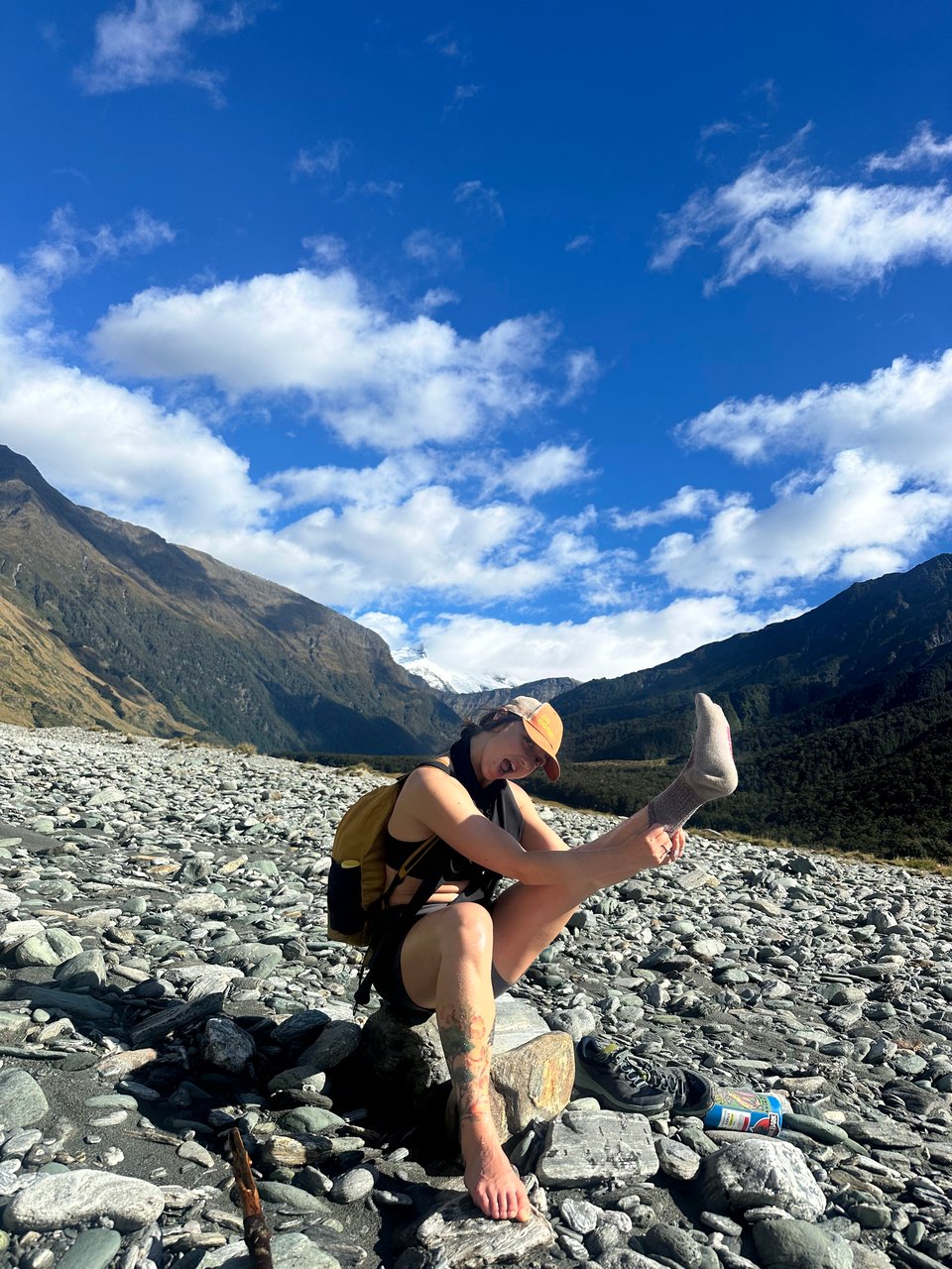
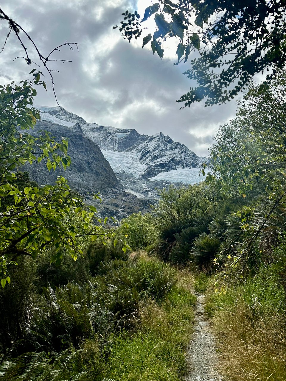
I’m glacier walk day we set out very excited! A man in the parking lot the previous evening had told us the river crossing we had to do because the trail bridge was closed was an easy one, and we were thrilled for a little added adventure to our hike. Once at the river, the water was so clear and it seemed straightforward enough, but then we realized we couldn’t actually tell how deep it was. We spent way too long wandering the river bank to find the ideal spot, eventually just committing and realizing it wasn’t actually that deep at all. It sure was cold though.. once across, we weren’t anywhere near the trail though and had to scramble up a grassy hill, squeeze through a fence, and pull ourselves through a forest to the trail. Finally, we were on our way!
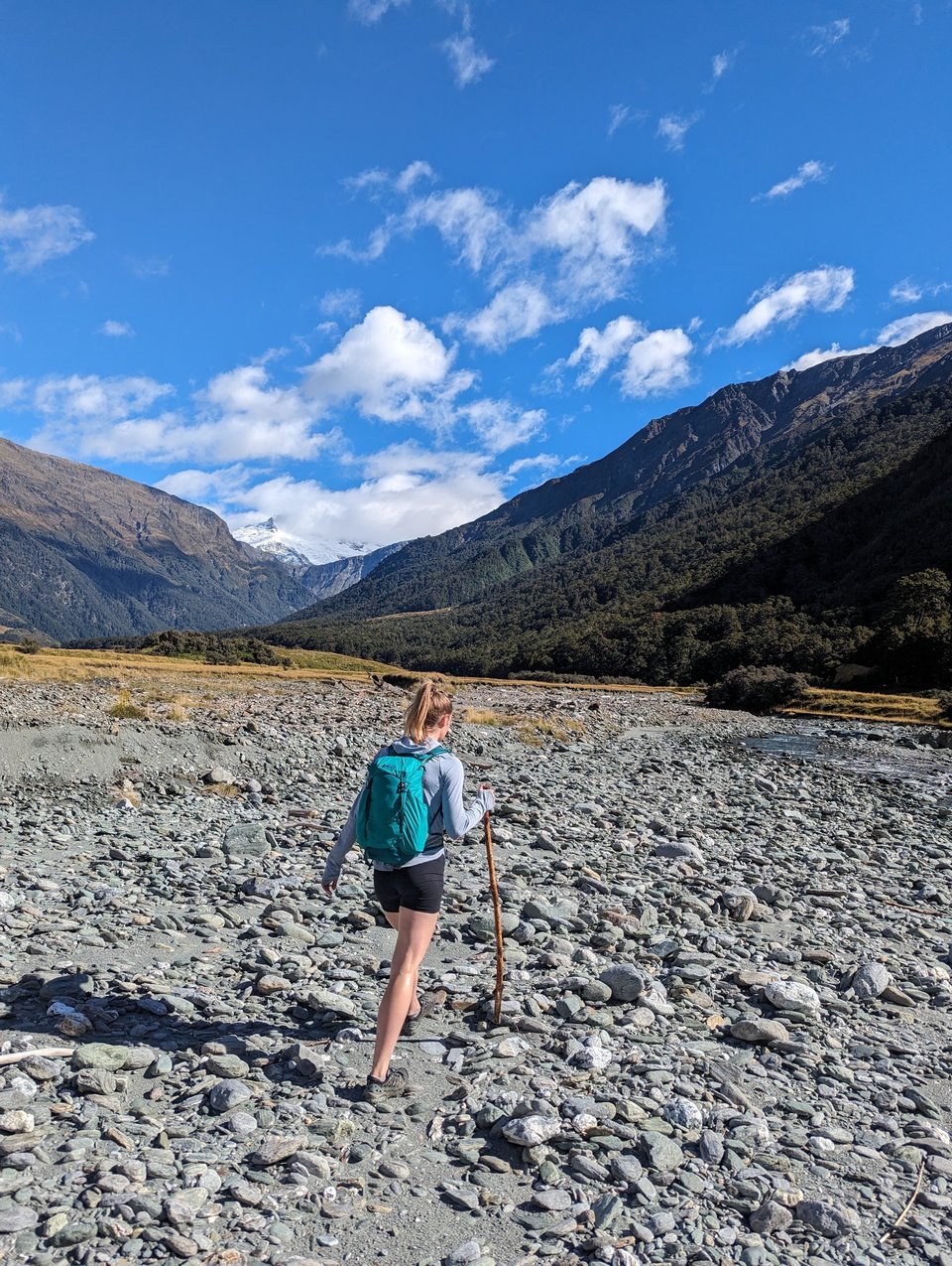
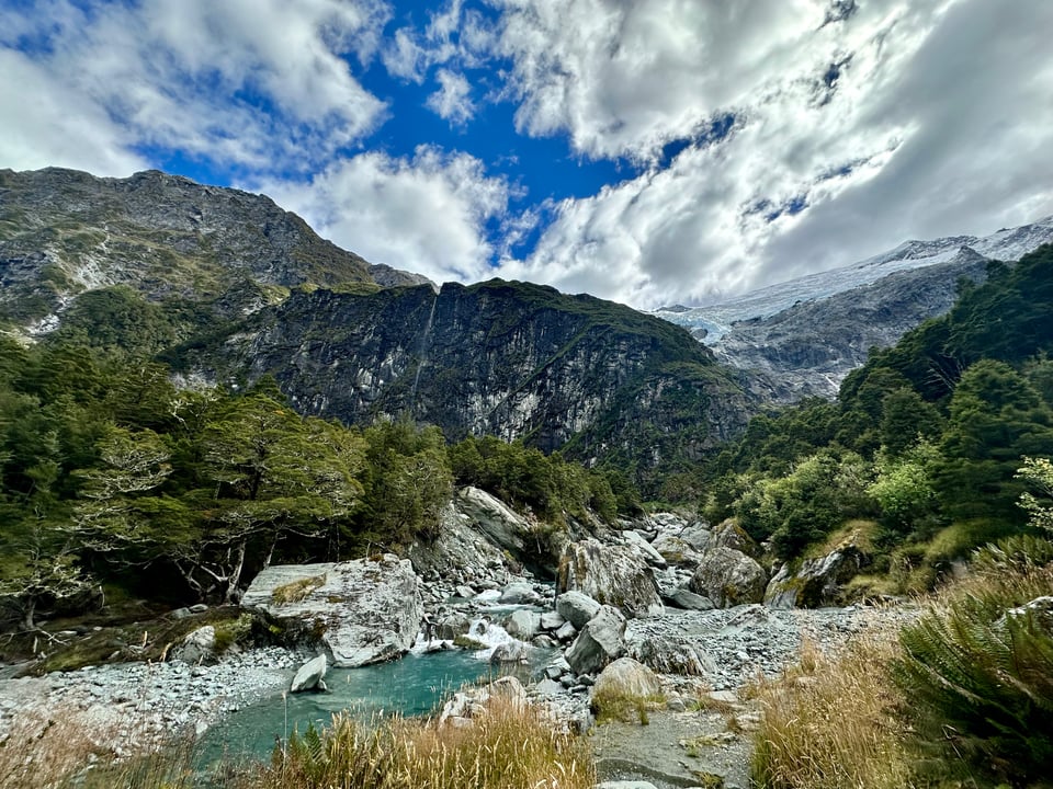
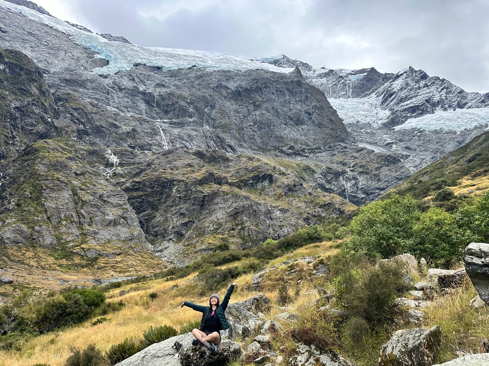
The hike was beautiful, through a forest, and not overly difficult, which was refreshing. I do love some good fitness hikes, but they get really hard on the body eventually. The views at the end were reminiscent of the hanging glaciers I’d seen in Patagonia, and it was great to share the awe with Ally over some snacks and maté. The size of the glaciers, and the many waterfalls coming out from them is pretty mesmerizing; It is easy to sit and just watch them evolve and flow for hours. We closed out our time on the mountain with a small offering, some burning of palo santo, and a song honoring the nature. It all felt very fitting, as it was our last big adventure together as well.
The way back was much easier, since we didn’t have to figure out how to cross the river. We’d met some people on the trail who informed us that the bridge was closed because it normally can hold 10 people and the DoC can’t guarantee that capacity right now, but one at a time is perfectly safe. We did that, lived to tell the tail, and made our way back to Wanaka on the road from hell. At least we knew what to expect this time.
The following day was our last day together, and it was quiet, easy, and bittersweet. We went on a nice lakeside walk, said our goodbyes and “I love you’s” and then she was gone and I was alone once again.