SAGTA: Map Downloader - new improved version!
Good afternoon
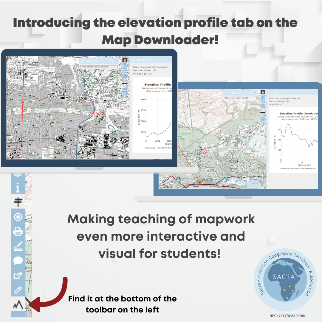
We are SUPER excited to let you know that the new elevation profile tab on the Map Downloader is active and that you can now draw a cross section of any place on any topographic map. This is quite revolutionary for teachers to have access to in a classroom and will most definitely make cross sections more interactive and real for the students. Please go and test it for yourself on the SAGTA website under Map Downloader! :) For a very limited time, Map Downloader Lite will also have access to this feature.
If you have any queries or comments, please email Ineke at help@sagta.org.za.
Don't miss what's next. Subscribe to SAGTA newsletter: