Geomorphology Association of Ireland Summer 2023 newsletter
Summer newsletter of the Geomorphology Association of Ireland
Introduction
Dear Members,
The Geomorphology Association of Ireland (GAI) was officially relaunched in May as an inclusive organisation supporting not just geomorphologists working and living in Ireland, but also the Irish diaspora scattered around the world who are making contributions to the field. We want to create a welcoming network of like-minded researchers and practitioners passionate about the Irish landscape.
Membership is now available via the website and we encourage you all to join! Benefits include:
i) Access to the new GAI listserv (this will supersede the existing IGGy listserv at the end of September 2023).
ii) GAI newsletter, which highlights new geomorphology research from around Ireland.
iii) Eligibility for GAI funding awards.
iv) Discounted attendance rates for GAI workshops and conferences.
v) The community of the larger GAI research network!
vi) Access to online recordings of invited seminars.
vii) Access to teaching materials for undergraduate field, lab and lecture courses.
viii) Community resources such as online weekly writing sessions.
ix) Up to date notifications from the International Association of Geomorphology.
GAI webpage: https://www.irishgeomorphology.ie/
Twitter/X: https://twitter.com/IGeomorphology
Did you know?
The GSI are hosting the 35th International Geographical Congress during August 2024 in Dublin! The call for sessions is open until Saturday 9 September 2023 and here at GAI we are encouraging everyone to get involved! Feel free to contact us to discuss your session ideas or find collaborators for sessions and/or field trips. Let's work together to make the best representation of Irish physical geography that we can! For more information, see: https://igc2024dublin.org/call-for-sessions/
Recent events
International Field School
A successful 2023 US-Ireland Coastal Boulders and Waves Field School was held in June. This was a collaboration between the Universities of Notre Dame, TCD, DCU and UCD. We had 9 undergraduates, 1 PhD and 8 Professors attend. We saw a lot of boulders but sadly not too many waves due to the high pressure cell that had stalled over Ireland, bringing the beautiful field conditions. Everyone had some good food and geomorphological experiences both at Kylemore and on Inishmaan. We had a great group of participants that continually impressed with their range of skills and knowledge. Everyone came away with more than they arrived, and it was a lot of fun as well. Below our some images of students hard at work, flying drones, measuring surface roughness and boulders.

Fluvial geomorphology training for LAWPRO
In late June, geomorphologists from cbec eco-engineering (Drs Peter Downs, Hamish Moir, and Colm Casserly) and from University College Dublin (Dr Jonathan Turner) provided a two-day introductory course on process-based geomorphology to approximately 15 LAWPRO staff involved in catchment assessments.
Day one consisted of a series of short presentations covering the fundamentals of fluvial geomorphology and the role and practices of fluvial geomorphology in river restoration. The final session introduced the attendees to River ReST, a recently developed national-level decision support screening tool developed for the EPA, that is intended to guide users towards rapidly identifying the ‘right measure in the right place’ for appropriate, sustainable, and effective river restoration. The tool utilises readily-available datasets to estimate an ‘Index of Recovery’ (IoR) based on reach-scale ‘geomorphic process intensity’ (a remotely derived estimate combining sediment transport, supply, and storage potentials) and the level of channel modification indicated by the Morphological Quality Index (MQI). The resulting IoR is subsequently filtered through an expert scoring system to identify suitable restoration measures.
Day two of the short course involved a field trip to the River Mattock (Co. Meath/Louth border) to complete a reconnaissance sheet of observations directed at identifying river channel adjustment. A variation on this approach will be developed as a validation tool for River ReST in the coming months. The River ReST tool will be presented at the Scientific Advances in River Restoration conference at Liverpool University in September 2023.
For more information, contact Colm Casserly at c.casserly@cbecoeng.co.uk.

Engaging the Public: The ACCOMPLISH Project Increasing Coastal Landslide Reporting through Citizen Science
By Isabel Hahn (3rd year UG student at DCU and Research Assistant with the ACCOMPLISH Project)
Established in 2022 by researchers from Dublin City University and Trinity College Dublin, the ACCOMPLISH project is funded by the Geological Survey of Ireland (2022-SC-012). Its primary objective is to enhance the reporting of coastal landslides through public participation and engagement. The project website features an online app for convenient landslide reporting by project volunteers.
Volunteers from Dublin, Wicklow, and Wexford actively contribute to the project by reporting landslides during their coastal walks. Given Ireland's vulnerable coastline and the impact of climate change, including sea level rise, coastal erosion, and rainfall-induced landslides, improved reporting is crucial to effective planning and management of our vulnerable coastline. This data will increase our ability to manage and protect our coastlines.
By actively engaging in the ACCOMPLISH project, volunteers are making a positive contribution to our collective coastal management efforts.
Email: accomplish.project@gmail.com
Website: https://www.accomplishproject.ie/
Twitter: @ACCOMPLISH_Pr
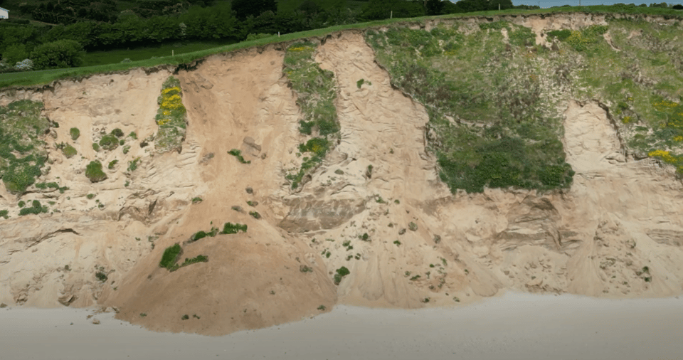
Image: Drone footage of a landslide from Wexford (Credit: ACCOMPLISH project).
Dr Eugene Farrell (University of Galway) travels to USA for experimental research
In May 2023 Dr Eugene Farrell travelled to the Salton Sea and Palm Springs in California to participate in USA NSF funded field experiments led by Prof Douglas Sherman (University of Alabama, USA) to test the potentially paradoxical or enigmatic role of granular electrification in modifying wind-blown sand transport rates from those associated with wind forcing alone. Granular electrification, in this case, refers to the development of electrical charges in sand grains caused by the separation of particles from one another, their collisions during transport, or as a product of the friction of the wind blowing across them. The resulting electrification can enhance or suppress transport rates according to the polarity of charged grains and the surface electrical field. At each site the team collected data for shear velocity, sand transport rate, sand grain size, sand moisture content, strength of the near-surface electrical field, charge-to-mass ratio of saltating sand, strength of the charge at the sand surface, and air temperature and humidity.
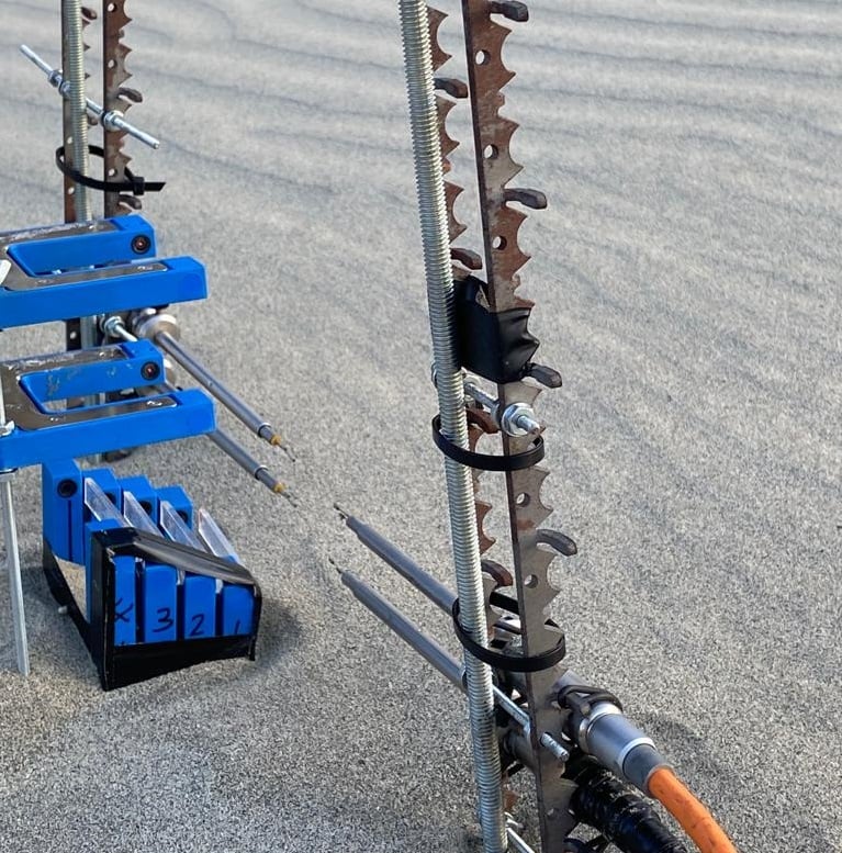 Image: Stacks of Wenglor laser counters and thermal anemometers (Credit: E.Farrell).
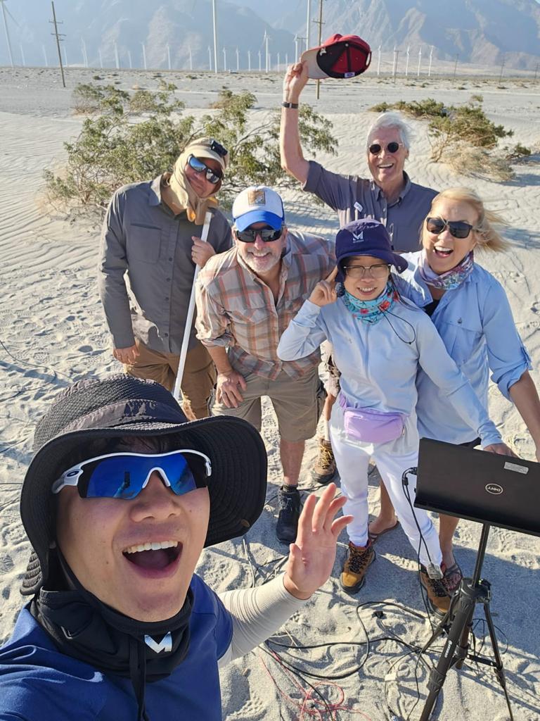 Team picture: Left to right: Mr Jinsu Bae (PhD student, University of Alabama); Dr Eric Parteli (Universität Duisburg-Essen, Germany); Dr Eugene Farrell; Dr Douglas Sherman; Dr Pei Zhang (New Mexico State University); Mrs Diane Sherman. Not pictured: Dr Bailiang Li (Xi'an Jiaotong-Liverpool University, China); Prof Jean Ellis (University of South Carolina, USA).
54th Annual Conference of Irish Geographers
UCD's School of Geography hosted this year's CIG during 16-19 May in Wexford town.
In a departure from the usual academic setting this year's conference was held in Wexford town, creating opportunities for greater engagement with local communities. The 'Climate, landscape and community: building a resilience across Wexford' forum started things off by introducing community members to research projects happening in the local area. Two geomorphology projects SloWaters (slowaters.wordpress.com) and ACCOMPLISH (www.accomplishproject.ie) were featured.
Physical geography was well represented with sessions on coastal nature-based solutions for adaptation to climate change; peatlands; applications of AI, machine learning and remote sensing technologies; and restoring and enhancing river corridors. Our congratulations to Trinity College PhD candidate Abbie Nugent who won the PECN annual poster competition for her research on modelling barrier island evolution.
Coastal geomorphologists were in their element with two field trips during the conference. A trip to the Raven Point dune restoration project (pictured) was led by Dr Kevin Lynch (NUIG) and Alan Lauder from the INSULAR project. More info here: https://www.coillte.ie/wp-content/uploads/2023/01/Raven-Info-Jan-2023_A4-web.pdf.
Prof Iris Moeller (TCD), Karin Dubsky (Coastwatch), Jim Hurley & Mick Berry (local experts) led the second field trip to Bannow Island Beach & Kilmore Quay to learn about Blue Carbon Habitats and impacts of climate change. It was brilliant to see local collaborative projects being shared with researchers across Ireland.
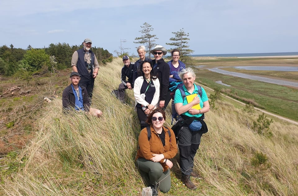 Image: Field trip attendees at Raven Point (Credit: K.Lynch, University of Galway).
Feature article: Release of the Irish Shelf Seabed Geomorphological Map (v2023)
Contact: Riccardo Arosio (rarosio@ucc.ie)
The Marine Geoscience group at UCC has created the Irish Shelf Seabed Geomorphological Map (v2023), which is the first high-resolution (up to 10 m/ pixel) geomorphological map of the entire Irish continental shelf, down to a depth of 200 metres below sea level (Arosio et al., submitted).
This large-scale mapping exercise took advantage of the vast INFOMAR multibeam echosounder dataset, and used a protocol of semi-automated mapping techniques to accurately and rapidly extract seabed features. All previous mapping efforts and existing literature on the Irish shallow shelf geomorphology have been collated and integrated in the map, re-delineating features using the machine-assisted techniques and critically evaluating the previous interpretations. An internationally standardised terminology and classification scheme for geomorphology was adapted from the collaboration between Mareano-INFOMAR-Maremap and Geoscience Australia (MIM-GA), aligning the Irish Shelf Seabed Geomorphological Map (v2023) to other international geomorphological work. Details on the scheme can be found in Dove et al. (2020) and Nanson et al. (2023). The map includes both newly identified and re-assessed seabed morphological and geomorphological units (e.g. channels, drumlins, dunes etc.) and the different types of substrate (e.g. bedrock, unconsolidated or consolidated superficial deposits) that have been mapped to represent the dominant composition of the top two metres of the seafloor. Classification and attributes for each feature are contained within the attribute table accompanying each vector file of the map. The ISSGM (v2023) includes three additional attributes not existing in the MIM-GA scheme, which are applied to further describe geomorphic units (Arosio et al., submitted). Map shapefiles have been uploaded to the Irish Marine Data Centre and can be found at: https://data.marine.ie/geonetwork/srv/eng/catalog.search#/metadata/ie.marine.data:dataset.5120
At a national level, this detailed geomorphological digital map is intended primarily as a resource to better inform multiple offshore activities and management of the marine environment on the Irish continental shelf. The information contained is of importance to a range of stakeholders connected to offshore fisheries, aquaculture, renewable energy (wind, wave and tidal power), seabed cables for communications and power, dredging and the aggregate industry. The map also acts as a baseline for future studies in marine geomorphology, as it identifies gaps in the knowledge and highlights areas of contentious interpretation that require further work.
 References:
Arosio, R., Wheeler, A.J., Sacchetti, F., Guinan, J., Benetti, S., O’Keeffe, E., Van Landeghem, K.J.J., Conti, L.A., Furey, T., and A. Lim. The geomorphology of Ireland’s continental shelf, Journal of Maps, (submitted)
Dove, D., Nanson, R., Bjarnadóttir, L.R., Guinan, J., Gafeira, J., Post, A., Dolan, M.F.J., Stewart, H.A., Arosio, R., Scott, G., 2020. A two-part seabed geomorphology classification scheme (v.2); Part 1: morphology features glossary. Zenodo. https://doi.org/10.5281/ZENODO.4075248
Nanson, R., Arosio, R., Gafeira, J., McNeil, M., Dove, D., Bjarnadóttir, L., Dolan, M., Guinan, J., Post, A., Webb, J., Nichol, S., 2023. A two-part seabed geomorphology classification scheme; Part 2: Geomorphology classification framework and glossary (Version 1.0). Zenodo. https://doi.org/10.5281/zenodo.7804019
Member profiles
Juliet Rounce

Hi! I’m Juliet Rounce and I’m a coastal geomorphologist currently working on my PhD in the Trinity Coastal Research Group (Supervisor: Iris Möller) within the Department of Geography at Trinity College Dublin.
My research investigates the spatial variation of carbon storage in managed and unmanaged saltmarshes, to increase our understanding of within-marsh controls on soil organic carbon content (SOC) and the resulting feedbacks (sedimentary, hydrological, geomorphological, ecological). Field campaigns for the collection of sediment samples alongside location-specific environmental data aim to help constrain uncertainties around scaled-up carbon accumulation estimates per unit area saltmarsh for regional, national and international inventories.
Prior to this position, I developed my interest in coastal morphodynamics at the University of Plymouth in England. My undergraduate thesis investigated spatial and temporal variation in sediment characteristics on a high-energy beach, taking advantage of long-term coastal monitoring data in the region. Continuing my studies in Plymouth, I completed an MSc in Applied Marine Science. My master’s research focused on examining the erosional and depositional behaviour of cohesive sediments across various aquatic environments. My research interests include coastal morphological change, sediment properties and hydrodynamics in relation to coastal management.
To learn more about Juliet’s work, contact her at rouncej@tcd.ie or connect on linkedin (https://www.linkedin.com/in/juliet-rounce-44a702159).
Prof. Iris Moeller
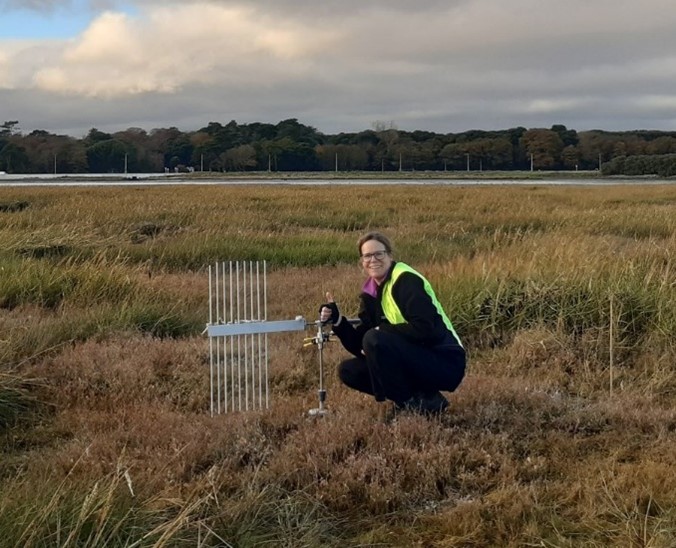 Hi! I am Iris Möller and I came over to Ireland in the autumn of 2019 after spending over 20 years at the Cambridge Coastal Research Unit, Fitzwilliam College, and the Department of Geography at the University of Cambridge. I became Head of Discipline of Geography at Trinity in January 2020. As coastal geomorphologist, I am particularly interested in how physical and biological processes interact at the coast, particularly in the intertidal zone. Over the past years, I have worked in multiple teams of researchers from within and beyond Geography to develop integrative solutions for a coastal environment in which people are protected from flooding and erosion whilst also taking advantage of the many benefits healthy ecosystems have for humans. The monitoring and understanding of long-term coastal morphodynamics forms a key component of my work, as does how we use these insights to adapt to a changed environmental future through climate change, sea-level rise, and altered storm frequency/severity.
Since September 2021, as the Covid-19 pandemic eased and with the great help of a research assistant (Kevin O’Leary) and two PhD students (Abbie Nugent and Juliet Rounce), we have begun sampling and surveying on North Bull Island and in the Rogerstown Estuary at Turvey Nature Reserve. The aim is to better understand the processes which shape and change the coastal geomorphology in these locations, particularly how a changing climate (e.g. storm events) will manifest itself and how carbon storage is affected by bio-physical process linkages and controls.
On North Bull Island, our research has thus far been focussing on two key areas of the island: the back barrier saltmarshes north and south of the Causeway Road, and the northern tip of the island. Alongside water level loggers, we have installed a Surface Elevation Table (SET) station and accretion markers on each marsh, which is used to record the relative change in elevation of the saltmarsh annually (see photo) and Abbie Nugent is monitoring beach and dune change alongside modelling the future of the island in different climate scenarios.
At Turvey Nature Reserve, an inland area of the Rogerstown estuary, Juliet Rounce has been studying the local-scale distribution of soil organic carbon in unmanaged and managed saltmarshes. To develop an understanding of within-marsh controls on soil organic carbon content (SOC) and the resulting feedbacks (sedimentary, hydrological, geomorphological, ecological), sediment samples are being collected, alongside location-specific data on elevation, inundation, biomass and accretion rates. This will aid quantification of the impact of several key factors (e.g. drainage, topography, biomass and accretion) on carbon accumulation. An ongoing data set of tidal level since May 2022 and recent field studies have been undertaken to collect relative elevation change data.
I am also building more coastal teaching into our undergraduate and postgraduate teaching programmes at Trinity and have developed our capacity for drone surveys to better visualise the changes in the landscape through high-resolution imaging. Most of all I look forward to plenty of collaboration across Ireland in the coastal geomorphology space and beyond, so we can collectively continue to build capacity.
To learn more about Iris’s work, contact her at moelleri@tcd.ie and see her profile here: https://www.tcd.ie/Geography/people/staff/irismoeller/
Recent publications
Here are a some examples of recent publications from GAI members. We'd love to showcase your work so if you have a publication to add to the next edition, please email us at iGeomorphology@gmail.com
Archer, R. E., J. C. Ely, T. J. Heaton, F. E. G. Butcher, A. L. C. Hughes and C. D. Clark "Assessing ice sheet models against the landform record: The Likelihood of Accordant Lineations Analysis (LALA) tool." Earth Surface Processes and Landforms n/a(n/a).
Arosio, R., B. Hobley, A. J. Wheeler, F. Sacchetti, L. A. Conti, T. Furey and A. Lim (2023). "Fully convolutional neural networks applied to large-scale marine morphology mapping." Frontiers in Marine Science.
Ballantyne, C. K. and J. B. Murton (2022). Great Britain and Ireland. Periglacial Landscapes of Europe. M. Oliva, D. Nývlt and J. M. Fernández-Fernández. Cham, Springer International Publishing: 325-363.
Beamish, David and White, James, On the Accurate Mapping of Peat (Raised Bogs) and the Estimation of Soil Bulk Density Using Airborne Radiometric Data. Available at SSRN: https://ssrn.com/abstract=4535860 or http://dx.doi.org/10.2139/ssrn.4535860
Cruz, Charmaine; O'Connell, Jerome; McGuinness, Kevin; Martin, James; Perrin, Philip; Connolly, John (2023) Assessing the effectiveness of UAV data to accurately map coastal dune habitats". European Journal of Remote Sensing. 56 (1) https://doi.org/10.1080/22797254.2023.2191870
Grottoli, E., M. Biausque, D. W. T. Jackson and J. A. G. Cooper "Long-term drivers of shoreline change over two centuries on a headland-embayment beach." Earth Surface Processes and Landforms n/a(n/a).
Hayes, E., S. Higgins, D. Mullan and J. Geris (2023). "High-resolution assessment of riverbank erosion and stabilization techniques with associated water quality implications." International Journal of River Basin Management: 1-15.
Ingle, Ruchita; Habib, Wahaj; Connolly, John, McCorry, Mark, Barry, Stephen and Saunders, Matthew (2023). Upscaling methane fluxes from peatlands across a drainage gradient in Ireland using PlanetScope imagery and machine learning tools. Nature Scientific Reports. 13:11997, https://doi.org/10.1038/s41598-023-38470-6
Ingle, Ruchita; Bhatnagar, Saheba; Ghosh, Bidisha; Gill, Laurence; regan, Shane; Connolly, John; Saunders, Matthew (2023). Development of Hybrid Models to Estimate Gross Primary Productivity at a Near-Natural Peatland Using Sentinel 2 Data and a Light Use Efficiency Model. Remote Sensing, 15 (6), 1673 https://doi.org/10.3390/rs15061673
Islam, M.T., Bradley, A.V., Sowter, A., Andersen, R., Marshall, C., Long, M., Bourke, M.C., Connolly, J., Large D.J. (2022) Potential use of APSIS-InSAR measures of the range of vertical surface motion to improve hazard assessment of peat landslides. Mires and Peat, 28, 21, 19pp. (Online: http://www.mires-and-peat.net/pages/volumes/map28/map2821.php); doi: 10.19189/MaP.2021.OMB.StA.2356
Knight, L., C. M. Boston and H. Lovell (2023). "Glacial geomorphology in the Wicklow Mountains, Ireland." Journal of Maps 19(1): 2132885.
de Smeth, K., Comer, J. & Murphy, C. (2023) Hydrometric data rescue and extension of river flow records: Method development and application to catchments modified by arterial drainage. Geoscience Data Journal, 00, 1–21. Available from: https://doi.org/10.1002/gdj3.206
Summers, G., A. Lim and A. J. Wheeler (2023). "Multi resolution appraisal of Cork Harbour estuary: An object based image analysis approach." Geomorphology 439: 108851.
UNEP (2022). Global Peatlands Assessment – The State of the World’s Peatlands: Evidence for action toward the conservation, restoration, and sustainable management of peatlands. Main Report. Global Peatlands Initiative. United Nations Environment Programme, Nairobi (Co-ordinating Lead Author for Chapter 2). https://www.unep.org/resources/global-peatlands-assessment-2022
Vandaele, R., S. L. Dance and V. Ojha (2023). "Calibrated river-level estimation from river cameras using convolutional neural networks." Environmental Data Science 2: e11.
Zhao, M. and F. O’Loughlin (2023). "Mapping Irish Water Bodies: Comparison of Platforms, Indices and Water Body Type." Remote Sensing 15(14): 3677.
Fun from the field!
ACCOMPLISH Project Fieldwork Surveys Uncover Coastal Landslides in Ireland
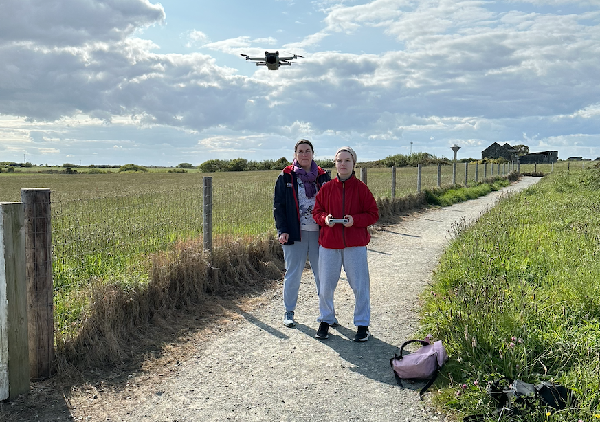
During the month of May, the ACCOMPLISH Project made significant progress mapping and monitoring coastal landslides in Ireland. Katherine Molloy and Isabel Hahn are 3rd year undergraduate students studying Climate and Environmental Sustainability at DCU. In May they embarked on an extensive fieldwork expedition along the coastlines of Dublin, Wicklow, and Wexford. Equipped with a DJI Mavic 3 Mini, they captured aerial video footage of the coastline. They discovered multiple significant landslides along the coastline during the surveys. The field data collected will act as a baseline survey of landslides on the Dublin, Wicklow and Wexford coasts against which future reports can be compared.
 (Credit: ACCOMPLISH project)
Website of the Project: https://www.accomplishproject.ie/
Email: accomplish.project@gmail.com
Get in touch
To join the GAI or contribute to the newsletter please contact the GAI committee: iGeomorphology@gmail.com
We welcome submissions for all sections of the newsletter, including job advertisements and grant and conference announcements. Don’t forget you can also email the GAI community any time using the listserv, or by emailing us to send out on your behalf. We'd love to hear from you!
Best wishes to everyone for a fabulous coming Autumn and Winter, 'til next time!
Kate de Smeth (Newsletter Editor), on behalf of the GAI Committee.